
We’re at the peak of summer, with average highs around 99 degrees, counting down the days until our next good rain chance or that first cold front finally pushes this humid, stagnant air out.
Unfortunately, that won’t happen anytime soon, as the upper-level high-pressure system, or heat dome, remains parked over the Four Corners region in the desert Southwest and will continue to influence the weather across the Lone Star State for at least the next week or so.
After the past few days of triple-digit heat, high temperatures on Friday will be a degree or two lower, with highs in the upper 90s. However, humidity will remain high and make those temperatures feel more like 102 to 106 degrees.
The morning will start off cloudy and muggy, but sunshine will take over by around 11 a.m. Winds will remain light out of the south at 5 to 12 mph. We will have only the slimmest of chances for a few coastal showers east of Interstate 35 during the peak heat of the day.
The heat dome will shift north a bit over the weekend, and this will open the door for afternoon and evening coastal showers and thunderstorms, with only a 10% to 20% rain chance expected for areas along and east of Interstate 35. Temperatures will hover around 100 degrees.
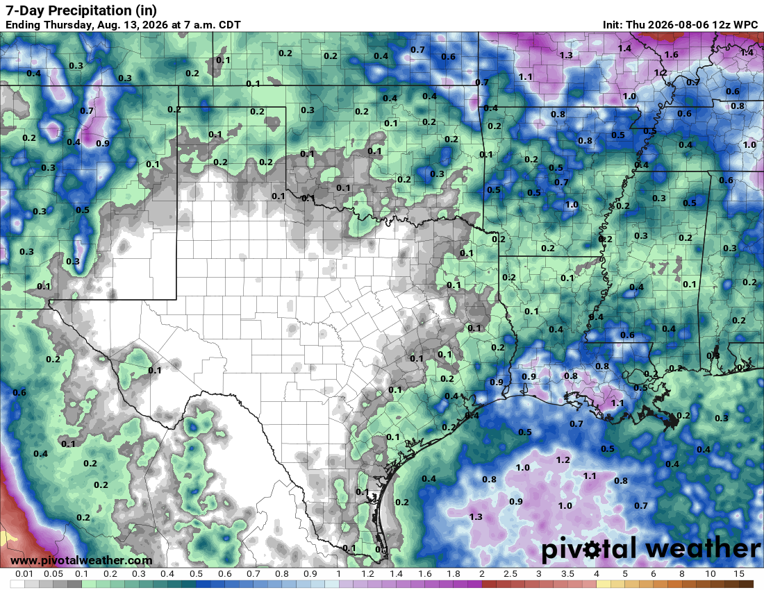
While the Southwest and southern Plains remain under the grip of a heat dome, leaving Central Texas stuck in a “rain desert,” many other parts of the country will see a healthy dose of summer rainfall.
A weakening cold front stretching from the Great Lakes through the Mississippi Valley and into the Central and Southern Plains will gradually lose strength on Friday. Even as the front fades, abundant moisture will fuel rounds of showers and thunderstorms from the Northeast and Great Lakes southward through the Southeast, the Mississippi River Valley, and into parts of the central and southern Plains through Saturday.
In Texas, the best rain chance for the next seven days will be east of I-35 and in the most northern part of the Texas panhandle.