
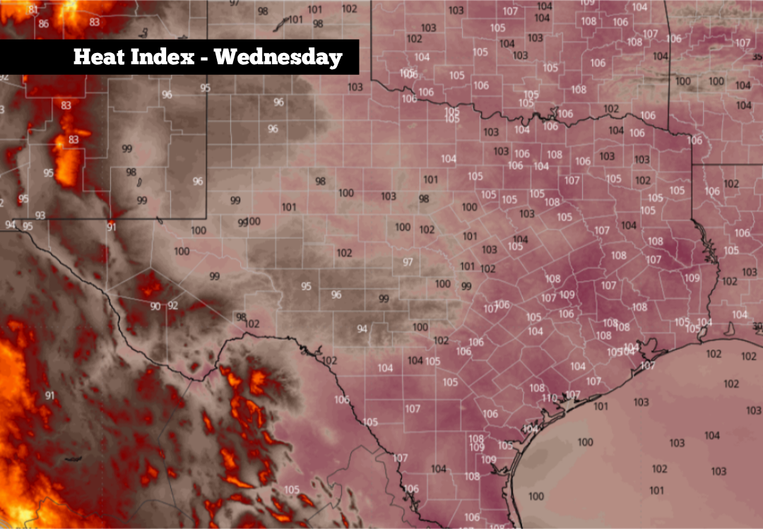
On average, early to mid-August is the hottest part of the year in South-Central Texas, and that will hold true during the upcoming week.
An upper-level area of high pressure temporarily shifted west over the weekend, which brought slightly cooler temperatures to South Texas. But now, high-pressure is expected to move back over the state in the coming days, resulting in increasing heat and humidity.
This change will bring some of the hottest temperatures of the year, as well as dangerous heat index values, to San Antonio this week. Rain chances will also be quite slim as high pressure strengthens during the middle of the week. Here’s a breakdown of what to expect.
Mostly cloudy skies are expected early Monday morning, with mild temperatures hovering in the upper 70s to near 80 degrees through 9 a.m. Skies will turn sunnier by the middle of the day, sending temperatures to around 90 degrees by noon.
Afternoon high temperatures are expected to top out at around 96 degrees by 4 p.m., which is near the climate-average for Aug. 10. However, as atmospheric moisture moves in from the Gulf, humidity levels will also surge. You can expect very muggy conditions and heat index values rising up to 105 degrees.
A few isolated showers and thunderstorms are likely to form near the Texas coast, especially from Victoria to Galveston and Houston. Rain chances in San Antonio will be much lower, at only around a 10% chance.
As high pressure draws closer during the middle of the week, temps will rise by a few degrees. On Tuesday, San Antonio can expect highs to reach 98 degrees, but with “feels like” temperatures up to 106 degrees possible.
The hottest temps of the week will arrive Wednesday through Friday, when high temperatures are expected to reach near 100 degrees each day. Very muggy conditions will also continue, causing “feels like” temps to reach 107 to 109 degrees.
If you have to spend significant periods of time outdoors this week, be sure to follow heat-safety guidelines. Drink plenty of water throughout the day, wear loose and light-colored clothing, and take frequent breaks in air-conditioned spaces. Heat exhaustion or heat stroke can happen very quickly if the proper precautions are not taken.
Low temperatures also will not offer much of a reprieve from the heat, falling only into the upper 70s to near 80 degrees each morning.
Long-range weather models are showing that high heat is expected to continue through next weekend and into the following week. According to the Climate Prediction Center’s outlook, San Antonio has a 90% chance of near or above-average temperatures during the week of Aug. 16-22.
Dry conditions are also expected, as the ECMWF ensemble weather model projects well-below average precipitation through the end of August. However, the model does suggest a shift in the weather pattern by September, as near- to slightly above-average rainfall could return.