
South Texas will be under a moderate to major heat risk to public health on Tuesday, according to the National Weather Service.
National Weather Service
The light at the end of the tunnel of peak summer heat is just days away, but San Antonio still has some serious heat to get through first. For now, a classic summer heat dome will continue to dominate the Texas weather pattern.

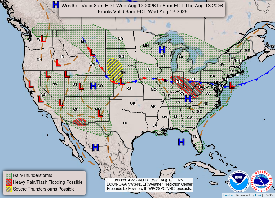
A ridge of high atmospheric pressure is slowly shifting east from the desert Southwest and is expected to settle over the northern Gulf Coast later this week. That setup could bring a chance at triple-digit temperatures, dry weather and plenty of humidity to South Texas.
Article continues below this ad
High atmospheric pressure will dominate our weather pattern in Texas through the work week.
Weather Prediction Center
On average, peak daytime temperatures this time of year hover around 97 degrees before gradually easing back into the middle 90s and settling on an average high of 94 degrees by Aug. 31.
But San Antonio’s August temperatures this year have been anything but normal.
Tuesday forecast
Tuesday will likely be a degree or two hotter than it was over the weekend as the upper ridge of high pressure begins shifting to the southeast.
Article continues below this ad
“This in turn really shuts off our diurnal rain and storm chances that we have had occur over the past several days, meaning Tuesday will likely be dry for many across the area,” meteorologists at the National Weather Service wrote in their daily forecast bulletin for South Texas. “That said, Tuesday`s dew points will need to be monitored closely as we could hit advisory criteria for areas along and east of the Interstate 35 and Interstate 37 corridors.”
More triple-digit heat could add to our low tally (so far) of 100-degree days in San Antonio this year.
Pivotal
Dew point temperatures, which correspond to how saturated the air is with moisture, can be a good indicator of how muggy the air will be. If a dew point is above 65 degrees, you can count on uncomfortably humid air, but dew points in Austin this week will be mostly between 70 and 77 degrees.
Forecast highs on Tuesday afternoon will range from 98 to 100 degrees, but with the higher humidity, the air will “feel” more like 104 degrees or hotter.
Article continues below this ad
Wednesday forecast
By Wednesday, the heat dome will be over Texas, bringing a slight increase in temperatures, with highs around 100 to 102 degrees. These higher temperatures, combined with the humidity, may produce heat index values that meet the weather service’s heat advisory criteria. The alerts are typically triggered when heat index values reach 108 degrees or higher. This could easily happen in areas along and east of Interstate 35 on Wednesday.
Thursday and Friday forecast
The hot and dry weather will stick around throughout the rest of the week, however. Humidity values may be a little lower with dew points in the 60s during the afternoon Thursday. Also, high temperatures will dip back into the middle to upper 90s, which would keep most of South Texas outside the heat advisory criteria.
Article continues below this ad
Hottest month ever in U.S.?
The contiguous United States, or the lower 48 states, experienced its hottest month on record in July, according to the National Oceanic and Atmospheric Administration.
The average temperature last month was 76.9 degrees, more than 3 degrees above the 20th-century average. It was the warmest July — and the warmest month overall — in the 132 years of records, edging out previous July records set in 2012 and during the Dust Bowl in 1936 by roughly 0.1 to 0.2 degree.
Article continues below this ad
While it was certainly hotter during the day, the biggest factor for the excessive heat was the average overnight minimum temperature, which stayed nearly 4 degrees above normal and beat the previous record, set in July 2022, by 0.7 degree.