
Without a doubt, the main story this weekend will be the intense heat across Texas. Triple-digit temperatures are expected state-wide, with parts of Texas potentially nearing the 110-degree mark both Saturday and Sunday afternoons.
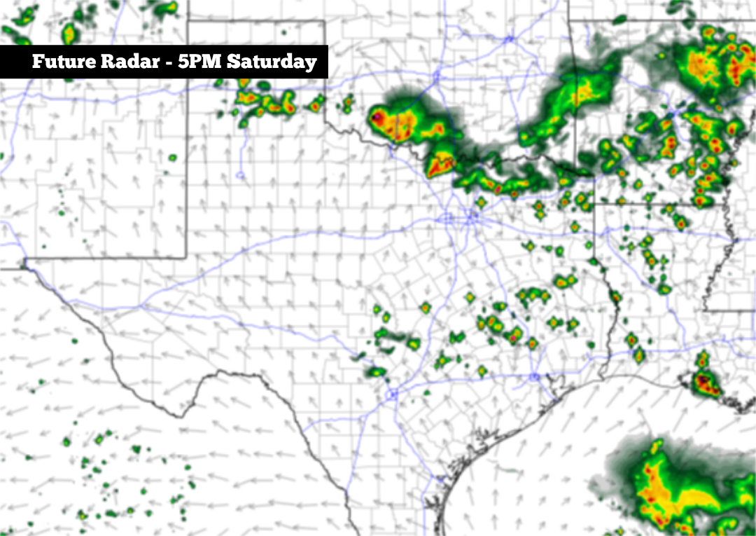
However, also worth watching will be a chance of a few heat-induced thunderstorms during the late afternoon and evening on Saturday. While it may sound counter-intuitive, the high heat results in rising motion in the atmosphere, and when combined with a weak front moving in from the north, a few thunderstorms will likely develop. Here’s how the day will play out.
High heat: The hottest temperatures of the day will be across North and Northwest Texas. There, highs are likely to reach between 106 and 110 degrees in cities such as Dallas, Denton, Sherman, Wichita Falls and Childress.
Here in South-Central Texas, temperatures will be a few degrees lower, but will still rise to dangerous levels. San Antonio will start the day near 80 degrees, but highs will quickly rise into the mid-90s by noon. Then by the late afternoon, highs are expected at around 103 degrees.
Humidity levels will continue to be very high as well, resulting in afternoon heat index values between 107 and 109 degrees. Plan to limit time outdoors during the middle of the day. However, if you have any outdoor plans, drink plenty of water and take frequent breaks indoors.
Thunderstorms develop: By the late afternoon, scattered showers and thunderstorms are expected to form across various portions of the state. Due to high pressure still over the region, storms will not be widespread, leaving many areas hot and dry.
The best chances of rain will be in North Texas, with a 20% to 30% chance of storms in Texoma, Northeast Texas, and the Dallas-Fort Worth metroplex. A few storms could even be severe and capable of damaging wind gusts.
A few storms may also form along the Interstate 35 corridor from Austin to San Antonio. However, rain chances will be quite low, near 10% across the area. Slightly higher rain chances — near 20% — are possible across parts of the Texas Hill Country.
Sunday could very well be the hottest day of the entire year in San Antonio. After a relatively mundane start with temperatures in the upper 70s at 8 a.m, extreme heat is expected to become widespread by the afternoon. High temperatures are expected near 104 degrees in the Alamo City — which would tie the daily record set in 2009.
From there, extreme heat will continue into much of the upcoming work week. Highs may drop by a degree or two, but San Antonio is still likely to top out at 101-103 degrees each day from Monday through Friday. Heat index values will also stay very hot, likely climbing to between 106 and 109 degrees.
Long-range forecasts also indicate that this heat is not going anywhere as we push toward the end of August and start of September. According to the Climate Prediction Center, there is almost an 80% chance of above-average temperatures from Aug. 29 to Sept. 4. Rain chances will also stay very low through the end of the month.