
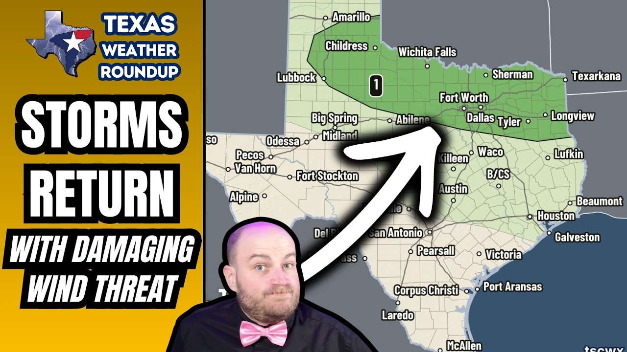
Isolated to widely scattered severe storms are possible this afternoon and evening across northern Texas, with damaging wind gusts of 60 to 70 mph the main threat. It’s your Texas Weather Roundup for Saturday, August 22, 2026.
WHERE THE STORMS SET UP
The risk covers the southeastern Texas Panhandle, West Central Texas, Northwest Texas, Texoma, the Ark-La-Tex, North Texas and into Northeast Texas.
That includes Lubbock and Childress, down Highway 287 from Wichita Falls to Fort Worth, out toward Mineral Wells, east of the DFW Metroplex, Tyler, Longview and Marshall, and up along I-30 to Texarkana and Sherman.
THE HAZARDS
Localized damaging wind gusts of 60 to 70 mph are possible with any thunderstorm that gets going this afternoon, thanks to the very hot atmosphere in place.
We could also see pocket-change-size hail, though hail sizes will be generally limited today because it’s so warm — not just at the surface, but aloft.
Any storm today can also produce dangerous cloud-to-ground lightning capable of sparking fires, and localized heavy rainfall. Most folks are not going to get a meaningful amount of rain out of this.
THE OUTFLOW BOUNDARY
An outflow boundary generated by overnight storms in Oklahoma is slowly sagging south. Behind it, temperatures may run a few degrees lower — but this is not a significant cool-down. If anything, humidity may actually be a bit higher north of the boundary.
Storm chances could continue into the overnight hours, especially across North Texas and Northeast Texas.
KEY MESSAGES
When thunder roars, get your keister indoors.
On area lakes, gusty outflow winds can produce sudden, erratic wind shifts. If you’re out on the water today, keep that in mind — the wind can change on you fast.
And if we have wildland fire incidents going, sudden outflow winds can significantly influence fire behavior.
FIRE DANGER
Today: Very High to locally Extreme across North Texas, Northeast Texas, East Texas and the Golden Triangle of far Southeast Texas. Moderate to High across the rest of the state.
Sunday: Very High to Extreme across the northern half of Texas, with Very High fire danger reaching into South Texas as well.
TEMPERATURES
111 this afternoon in Childress. 109 in Wichita Falls. 105 to 108 across DFW and west to Weatherford and Mineral Wells. 104 in Lubbock, 107 in Abilene. Triple digits galore statewide — a very hot day.
Tonight, lows mostly in the upper 70s to lower 80s, with 80s in the urban heat islands. A few 60s in the Davis Mountains and the higher terrain of the northwestern Texas Panhandle.
Sunday is just as hot. Triple digits galore again. Very hot weather continues through the weekend and into next week.
We’ll be keeping an eye out for storms and wildfire issues today, and we may have storms again tomorrow.
CHAPTERS
0:00 Severe Storm Risk Returns Today
0:39 Where the Storms Set Up
1:11 70 MPH Winds & Small Hail
1:33 The Outflow Boundary & Safety
2:57 Fire Danger Today & Sunday
3:24 Temperatures: 111 in Childress
━━━━━━━━━━━━━━━━━━━━━━━━━━━━
🌩️ LIVE RADAR:
https://texasstormchasers.com/radar
📲 FREE Weather App:
https://texasweather.app/
🔗 Website, tornado alert phone calls, photo gallery, store & socials:
https://www.Linktr.ee/texasstormchasers
⭐ Join this channel for perks:
https://www.youtube.com/channel/UCoIfgmxArI