
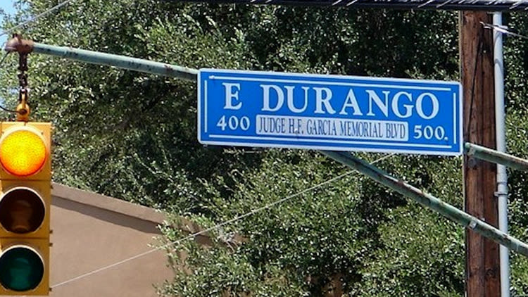
Durango Boulevard started as a numbered street, nearly became La Parra, absorbed portions of other roadways and survived an attempt to rename it for HemisFair.
Now, 15 years after the city replaced Durango with César E. Chávez Boulevard, the historic name is returning.
San Antonio City Council voted unanimously Aug. 20 to restore the Durango Boulevard name. The decision revives a piece of San Antonio history dating to the late 1800s.
Research compiled by Maria Watson Pfeiffer and Beth Standifird for The Conservation Society of San Antonio, along with a city Historic and Design Review Commission report, traces the roadway’s transformation across nearly 150 years.
From a number to a Mexican place name
Durango’s story begins in 1849, when City Council ordered a survey of city-owned land west of San Pedro Creek.
The survey, completed by Francois Giraud, divided the area into a grid. East-west streets received numerical names, including South Third, South Fourth and South Fifth streets. North-south streets were given directional names.
An 1873 map shows South Fifth Street running between what is now South Pecos Street and Laredo Street. It stopped at Laredo because the land between there and San Pedro Creek had not yet been divided into connecting streets.
City Council adopted an ordinance in 1881 intended to eliminate the “uncertainty and confusion” caused by numbered street names appearing in different parts of San Antonio.
City records initially called for streets south of Presidio to receive Spanish names inspired by trees, shrubs and plants. Under that plan, South Fifth Street would have become La Parra, Spanish for grapevine.
But that is not what happened.
An 1881-82 city directory instead listed the streets with Mexican place names. South Third became Monterey, South Fourth became Matamoras and South Fifth became Durango.
Conservation Society researchers found no documentation explaining why the city abandoned the proposed plant names. However, city directories from that period emphasized San Antonio’s extensive trade with Mexico, which researchers said may have inspired the names ultimately selected.
Durango appeared as the street’s official name on a revised 1883 city map.
Durango grows with San Antonio
Durango began as a relatively short street west of San Pedro Creek, but it expanded as San Antonio grew.
An 1892 Sanborn Fire Insurance Map shows Durango extending across Laredo Street to San Pedro Creek. By 1904, it reached west to Northwest 19th Street. By 1912, it extended east to South Flores Street but still lacked a direct river crossing.
In 1917, the Missouri-Kansas-Texas Railroad, commonly known as the Katy, opened a depot at Durango and South Flores streets.
Built for more than $160,000, the Spanish Revival depot was modeled after Mission Concepción and promoted as one of the Southwest’s most distinctive train stations. It was demolished in 1968 to make way for an automobile convoy site.
Durango’s connection across the city began taking shape after the devastating 1921 flood. San Antonio altered portions of the river channel to remove bends that hindered the movement of floodwater and used the opportunity to plan a bridge connecting the city’s east and west sides.
Officials considered both Guilbeau and Martinez streets for the crossing before selecting Martinez. Funding was allocated through a 1928 bond election.
At the time, Martinez Street ran east of San Pedro Creek in alignment with Durango, extending between Garden Street, now St. Mary’s Street, and Mill Street, now South Alamo Street.
The boulevard built for HemisFair
Durango underwent its most significant transformation during preparations for HemisFair ’68.
A 1964 plan called for a major boulevard connecting Interstate 35 west of downtown with the proposed Interstate 37 to the east. The route would use the existing rights of way along Durango, Martinez and Victoria streets and form the southern boundary of the HemisFair grounds.
Martinez Street was widened and realigned. It was then connected with Durango west of the river and a new roadway paralleling Victoria Street east of South Alamo.
The project created a more continuous boulevard across downtown.
In 1967, HemisFair General Manager Frank Manupelli asked the city to rename the roadway between I-35 and I-37 as HemisFair Boulevard.
The Planning and Zoning Commission rejected the request, finding that Durango had “considerable historic connotation” and that HemisFair would last only six months.
Instead, the commission approved extending the Durango name from I-35 to Hackberry Street.
That same year, another proposal called for promoting Durango as the “Avenue of Heroes,” with the names of local heroes displayed along the roadway. A committee with representatives from the city, county, Chamber of Commerce and Conservation Society would have selected the honorees.
Maps promoting HemisFair in 1968 show Durango along the exposition’s southern boundary, although research indicates only the section bordering the fairgrounds was finished in time for the event.
The city continued improving the corridor after HemisFair. A new Durango bridge was completed in 1972 at a reported cost of $300,000.
A historic name returns
City Council renamed Durango Boulevard for labor leader César Chávez in 2011.
The city began reconsidering that decision in 2026 following reports of sexual abuse allegations against Chávez. A citywide survey and community listening sessions showed strong support for restoring the former name.
As part of the formal renaming process, city historic preservation staff reviewed Durango’s history and recommended approval, finding that the application met San Antonio’s street-renaming requirements.
The restored name applies to the corridor running from the Old Highway 90 area to South Hackberry Street through City Council Districts 1, 2, 5 and 6.
The change will affect 295 addresses and cost the city nearly $375,000, primarily for new signs. City-owned signs could be replaced within two months, while state highway signs may take six months to a year.
The vote restores a name that has appeared on San Antonio maps since the 1880s — and one city officials considered historically significant enough to protect nearly six decades ago.