
CORPUS CHRISTI, Texas — CORPUS CHRISTI, Texas – Happy Sunday Coastal Bend!
WHAT YOU NEED TO KNOW
Near record high temps throughout this weekAir temps over 100 degrees in many neighborhoodsTemps could slowly return to the mid/upper-90s by the end of the weekMajor heat risk in the forecast
The big weather picture
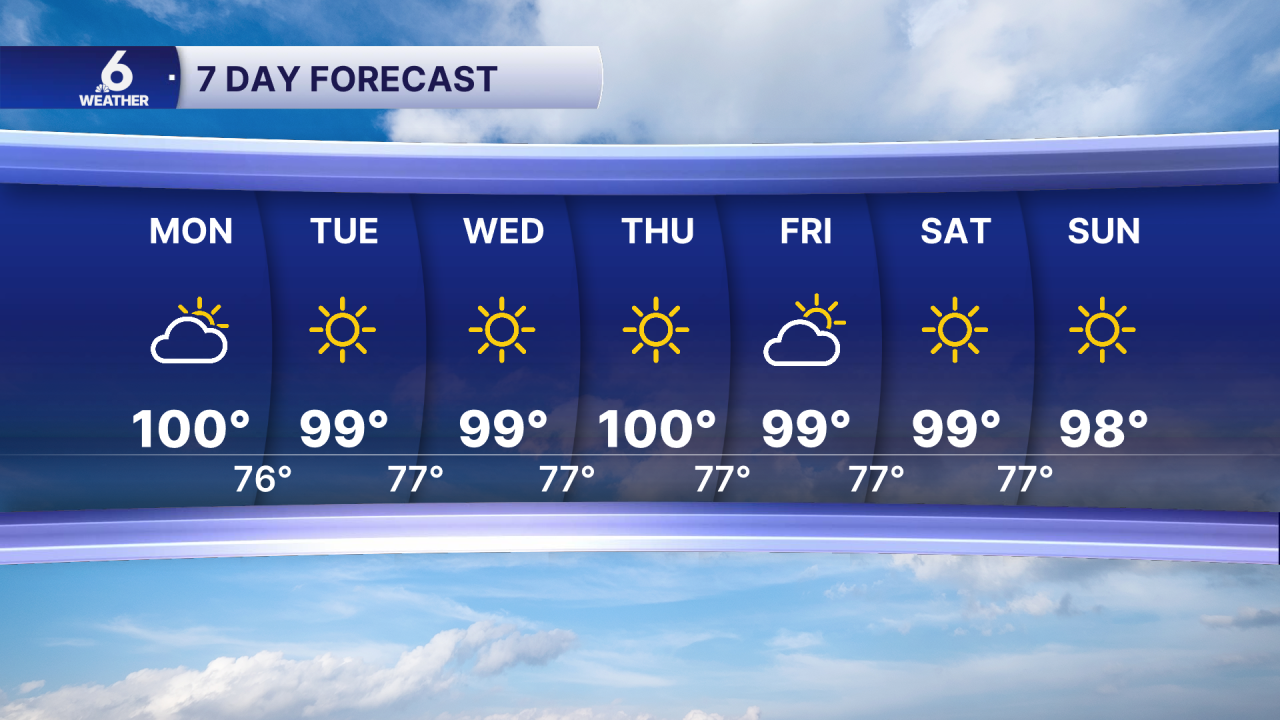
The cycle of hotter than normal August weather persists this week for the Coastal Bend. The “heat dome” of high pressure above us will sit in place over the next couple of days, reducing meaningful rain chances area wide. While there is a non-zero chance of seeing rain, its incredibly unlikely that we would see any downpours pop up. With less cloud cover overnight into Monday morning, lows will start cooler in the low to mid 70s.
Near record high temps
Yesterday, at CCIA, the previous record of 101 was broken, as a high temperature of 103 was observed. Monday. On Sunday we could break the record high of 102 degrees set back on this day in 2010. The same thing could happen on Monday; the current record high sits at 101 degrees.
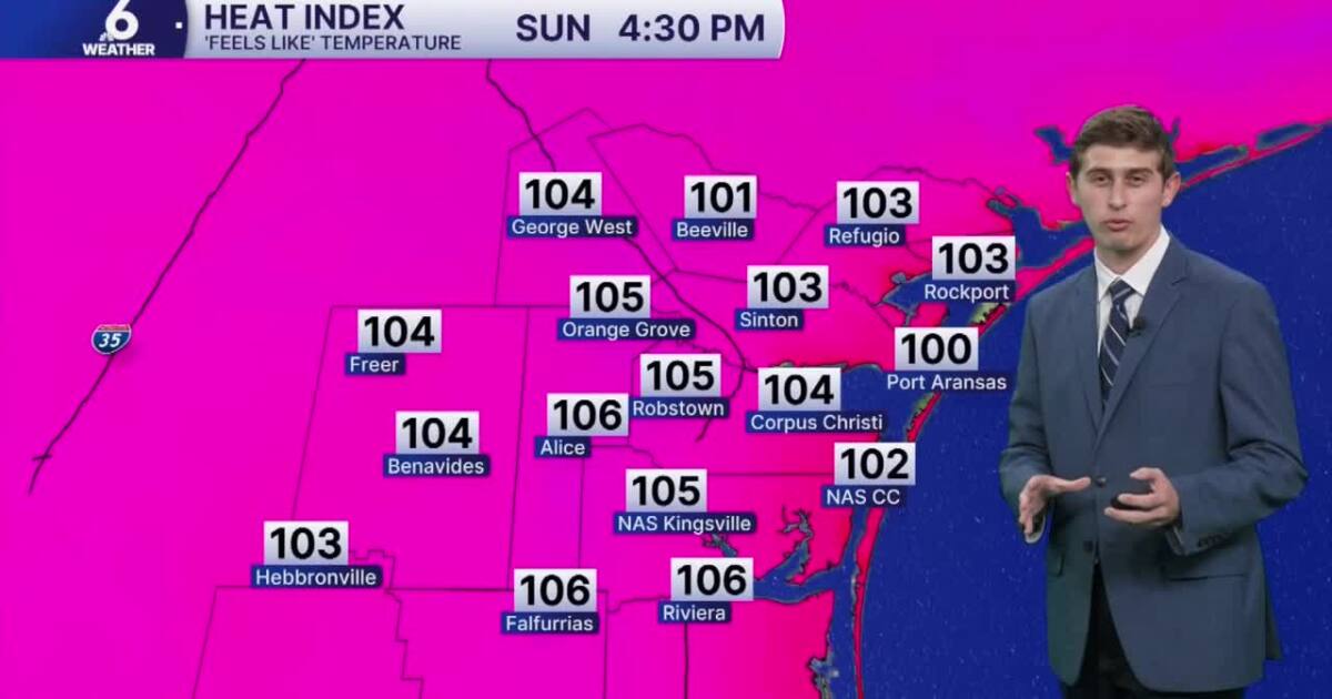
Please be sure to stay cool! A Heat Advisory has been issued for most of our Coastal Bend counties today until 8PM. We could see more of this during the week as ‘feels-like’ temps could come close to 110+ in some neighborhoods. Remember to practice heat safety by taking breaks in the air conditioning and staying hydrated. Look before you lock: don’t leave anyone or anything inside a hot vehicle! Check in on kids, pets, and the elderly as they are more prone to heat-related illness.
KRIS 6 Weather
In The Tropics
The Atlantic Basin is fairly quiet. We’re monitoring two areas with medium chances of development. Both areas of interest could become tropical depressions later this week. For now, no tropical troubles here in the Coastal Bend. 
Have a safe and fun weekend!