
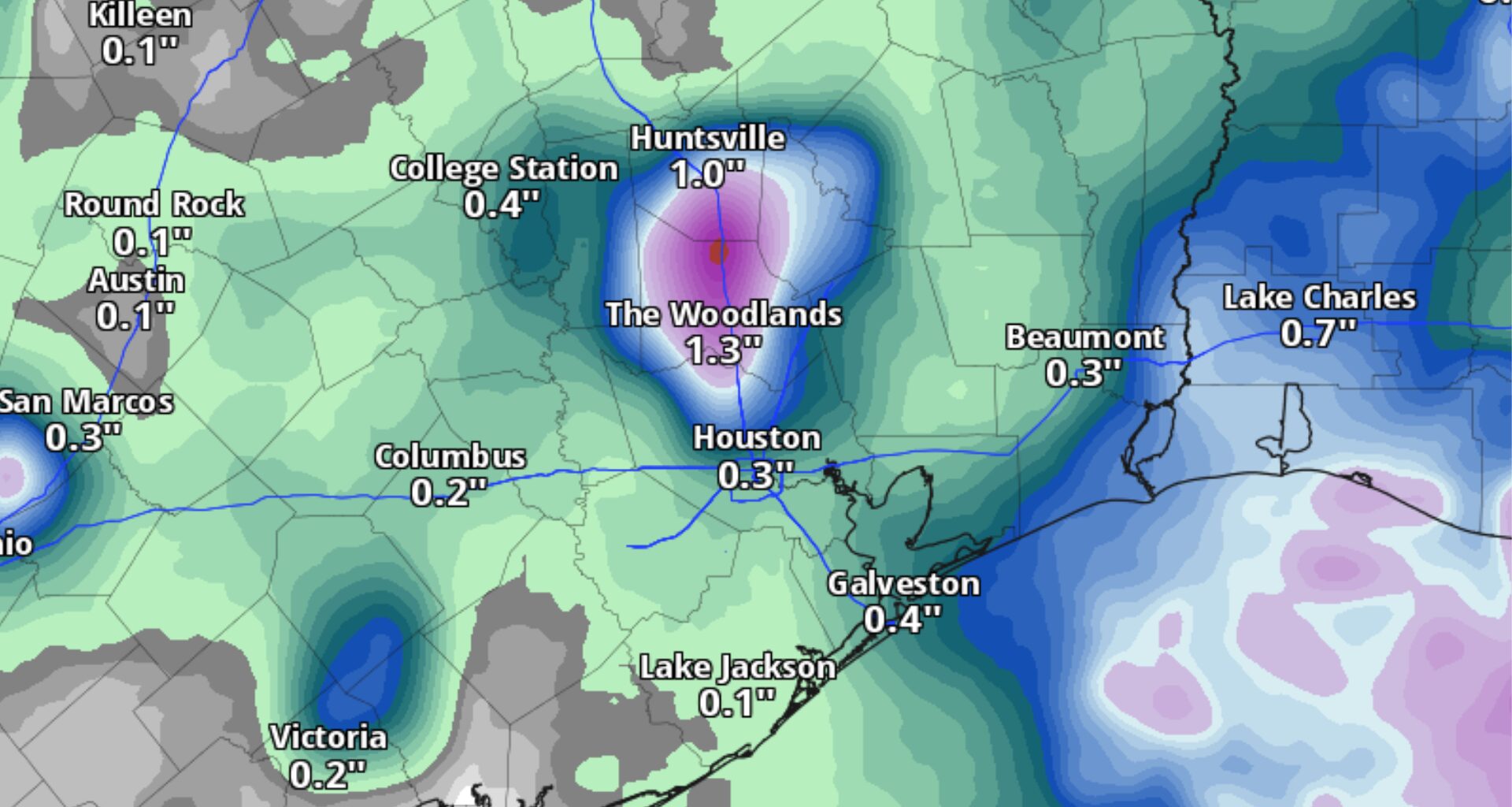
Houston’s unusually dry August could get interrupted Thursday morning by scattered downpours that may complicate the daily commute.
Houston has recorded less than a quarter-inch of rain so far this month, which is normally one of the city’s wettest. More frequent rain chances in the final days of August could help chip away at the rainfall deficit, but Thursday morning’s showers may create slick roads and slower travel.
Southeast Texas is in line for the first of several rounds of showers and thunderstorms beginning Thursday, as the heat dome behind the recent stretch of 100-degree days finally shifts west.
After more than two weeks without measurable rainfall in Houston, here’s when storms could slow down drivers:
6 to 10 a.m. Thursday: Models suggest storms will be isolated to widely scattered during this period across Southeast Texas. Rain chances are likely to be highest near and north of Interstate 10, which means slower travel for commuters coming into Houston from The Woodlands and Conroe, or for travelers headed to Bush Intercontinental Airport.
10 a.m. to 2 p.m. Thursday: Morning downpours should gradually push south of I-10 by noon, though spotty showers could redevelop during afternoon heating north of Houston.
2 p.m. to 6 p.m. Thursday: Showers and occasional storms will be hit-or-miss through the evening commute. It will be difficult to pinpoint where storms could slow the evening commute, even an hour or two in advance. If your neighborhood misses out on rain earlier in the day, the atmosphere may be able to deliver a briefly cooling downpour before the sun sets.
While morning and evening commutes could be affected by wet roads, the day certainly will have plenty of dry periods under partly cloudy skies.
Afternoon highs could still climb into the upper 90s to near 100 degrees across the Houston area, although clouds could keep some locations a few degrees cooler than expected. Humidity-driven heat index values could still climb to above 106 degrees, so the National Weather Service might issue a heat advisory Thursday if storm coverage is lower than expected.
Thursday’s showers and thunderstorms could continue into the night, especially along and south of Interstate 10. Most of the activity should shift offshore Friday, but isolated to scattered storms will remain possible over the weekend as a weak atmospheric disturbance moves westward across the northern Gulf of Mexico.
Severe thunderstorms are not expected during the next few days, although any storm that develops could become strong enough to produce gusty winds and locally heavy rainfall.
Temperatures should gradually ease through the weekend, but it will remain hot. Highs will generally be in the mid-90s, with more showers and thunderstorms offering only spotty relief.