
Cumulative rainfall totals in South and Central Texas through Thursday and into Friday will be low overall, but we could see pockets of moderate to heavy rainfall.
Pivotal
Central Texas could wake up Thursday to scattered showers and thunderstorms moving from north to south across the region as a frontal boundary slides into the area.

However, not everyone will see the morning rain, but the best chance will come during the afternoon and evening as daytime heating helps fuel additional showers and thunderstorms.
Article continues below this ad
What will the rain mean for Austin?
Could we be turning the page on the extreme heat and extended dry spell in Austin? This is the first time the Texas capital has had rain potential over multiple days in more than a month. While the rain may not be widespread or particularly heavy, the clouds and showers will help bring some relief from the heat over the next few days.
What would this rainy day look like?
“Any convection that does manage to develop will likely be high-based and would pose a gusty wind threat in any of the stronger cells,” meteorologists at the National Weather Service wrote in their forecast discussion for Central Texas on Wednesday.
Article continues below this ad
Rain chances on Thursday will be higher across Central Texas with a solid 30% to 40% chance.
National Weather Service
Currently, the rain chance is between 30% and 40%, which is the highest chance we’ve had since late July.
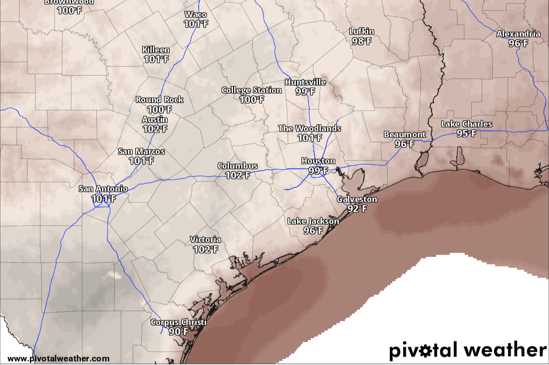
Temperatures will be slightly cooler Thursday, with highs ranging from 100 to 103 degrees thanks to increased cloudiness and the chance for rain. However, humidity will also be higher, which will push heat index values closer to 108 degrees. Because of the heat and excessive humidity, the National Weather Service has extended its heat advisory for the region to 7 p.m. Thursday.
Temperatures across Texas will be hotter than normal on Thursday but not nearly as oppressive as earlier this week.
Pivotal
What’s the forecast for Friday?
Small rain chances will continue into Friday, but overall coverage will decrease across Central Texas while increasing a bit across South Texas, particularly along the Interstate 10 corridor heading toward Houston.
Article continues below this ad
Temperatures will be cooler, with highs near 100 degrees, along with more sunshine and light south winds.
Hot and dry weather will build back in this weekend, but temperatures will be more manageable, with highs near 100 degrees each afternoon. The dry weather won’t stick around for long, though, as rain chances return next week.
A retrograding atmospheric disturbance is expected to move from east to west along the Gulf Coast, potentially creating a “ring of fire” setup and bringing new rain chances to parts of Southeast Texas.
Article continues below this ad
How to stay safe on wet roads
It’s been five weeks since Austin’s main weather station at Camp Mabry has recorded rain, so weeks of dry weather have allowed dust, dirt, oil and other buildup to accumulate on the roads, which will make them very slick when the rain arrives.
Here are some tips to help ensure your safety while driving in wet weather:
Article continues below this ad
Turn on your headlights and make sure your windshield wipers are in good working order.
Slow down, avoid braking hard, and do not turn sharply to avoid hydroplaning.
Do not use cruise control as the slippery roads can affect the system’s ability to maintain a constant vehicle speed.
Do not panic if you skid on the road, just take your foot off the accelerator and steer in the direction you want to go.
Taking these extra precautions can help ease the anxiety associated with driving in the rain and make it safer for everyone.