
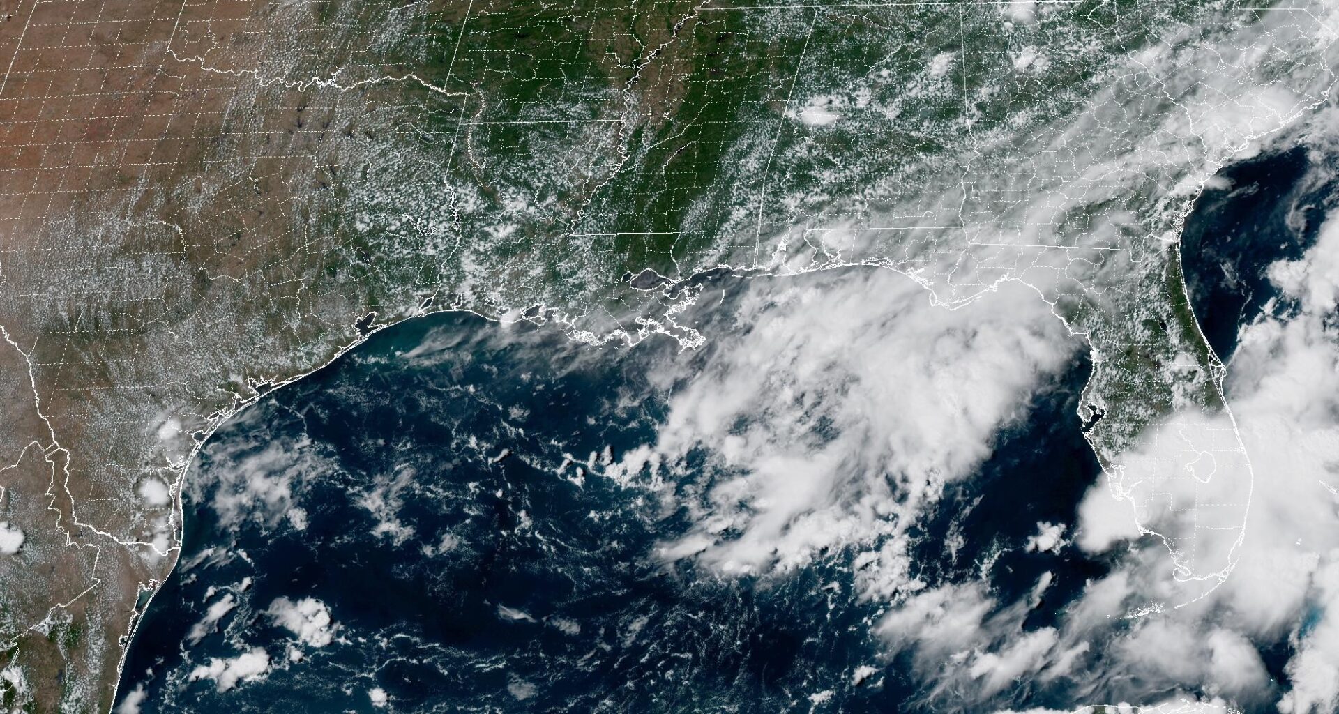
As we close out August and enter September this week, Houston weather might finally be influenced by something other than a heat dome of high atmospheric pressure. National Weather Service and National Hurricane Center forecasters are now watching a weak area of low air pressure in the northern Gulf of Mexico to see how it could shape regional weather.
“We are monitoring a disorganized cluster of showers/storms associated with a weak area of low pressure over the north-central Gulf,” the weather service said in a forecast bulletin Saturday. “The probability that this will slowly develop into anything is very low (10% over the next seven days), but we will continue to monitor as it gradually drifts westward.”
Forecasters added that, while it’s still too early to determine any specific weather hazards or issues for Southeast Texas, “the most likely scenario is increased moisture in the northwestern Gulf in the early to middle part of the work week, which would increase our chances for showers/storms.”
Houston on Sunday has a 20% chance of rain, mainly after 3 p.m., forecasters said. Otherwise the day will be sunny and hot, with peak daytime temperatures reaching 98 degrees. Humidity, though, will drive up the heat index and those temps could “feel” more like 104. South to southeast winds of 5 to 10 mph in the afternoon will continue to bring moisture-rich air from the Gulf Coast.
At night, rain chances ease down to only a slight 10% before 7 p.m. Under mostly clear skies, overnight temperatures should stay above a balmy 79 degrees amid warm southeast winds.
“The best chances for showers/storms this weekend will be along the sea breeze in the afternoon hours, so highest PoPs (probabilities of precipitation) will be generally along and south of I-10,” the weather service said in its forecast bulletin, “then moisture begins to increase going into the beginning of the work week.”
“We’ll see an ever so slightly downward trend in temperatures (by a couple of degrees) going into the early part of the work week as moisture begins to increase,” weather service meteorologist Cameron Batiste wrote in his forecast Saturday. “This increase in moisture likely comes courtesy of a disorganized cluster of showers that’s currently being monitored by the NHC (National Hurricane Center).”
Houston on Monday has a 20% chance of afternoon rain on an otherwise sunny day, with temperatures topping out at 97 degrees. More clouds are expected to roll in at night, when temperatures overnight into Tuesday morning bottom out around 79 degrees.
Then on Tuesday, Houston has a 40% chance of showers or storms after 1 p.m. under mostly sunny skies as temperatures climb to 95 degrees. Rain chances retreat to 20% after 1 a.m. Wednesday.
So what about that disturbance that hurricane forecasters are watching in the Gulf?
“Small spoiler: The probability it’ll develop into anything is very low and even if it tries to develop, it’d do so very slowly,” Batiste said. “Uncertainty still remains, but for now the highest rain chances associated with this will be generally east of I-45.”