
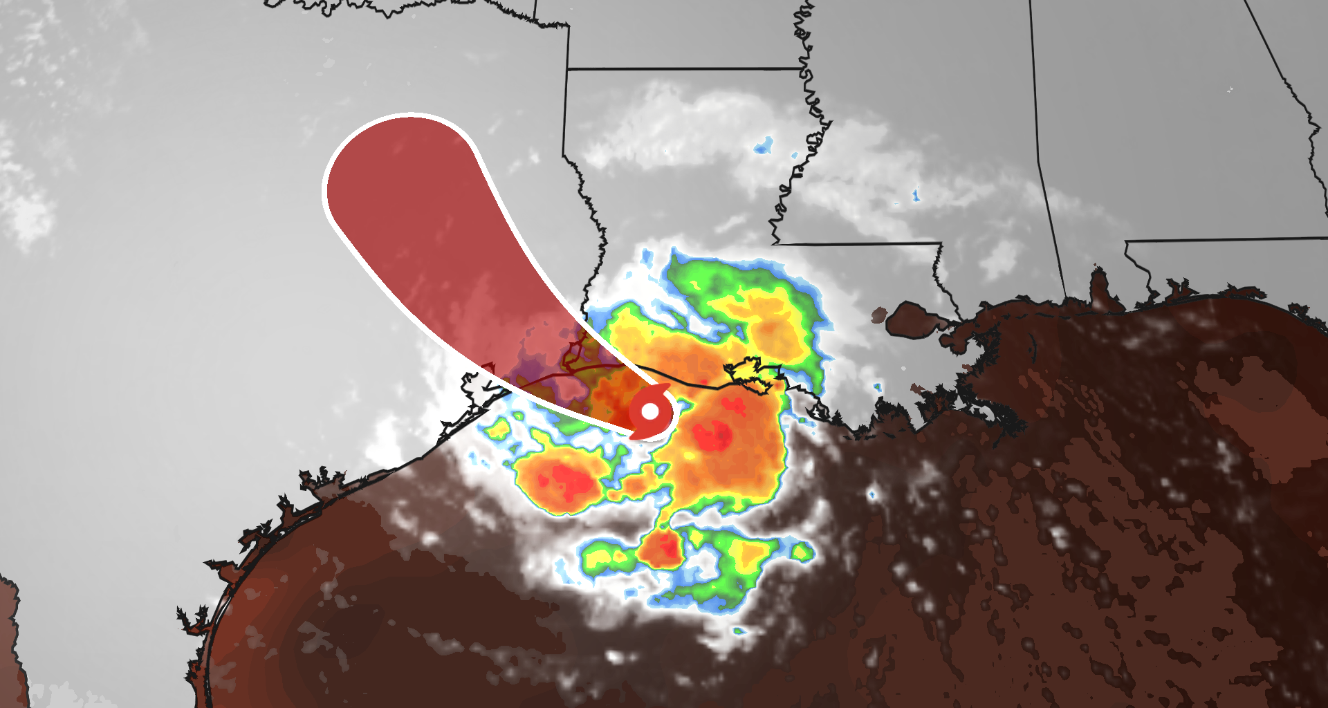
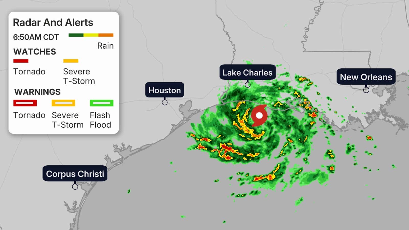
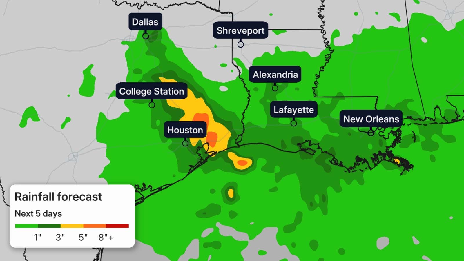
Tropical Storm Edouard has formed in the Gulf, and the National Hurricane Center warns of “significant strengthening before it reaches the Texas coast later tonight. Despite the storm being short-lived, it will wring out flooding rain in parts of eastern Texas and Louisiana, including the Houston metro area, and could potentially soak areas as far north as Dallas. Coastal areas could see as much as 3 to 5 feet of storm surge, and gusty winds are also possible.
Edouard could briefly become a hurricane near landfall.
Edouard became the fifth named storm of the 2026 Atlantic hurricane season Monday evening after being designated a tropical depression early Monday afternoon.

Weather in your inbox
By signing up you agree to the Terms & Privacy Policy. Unsubscribe at any time.
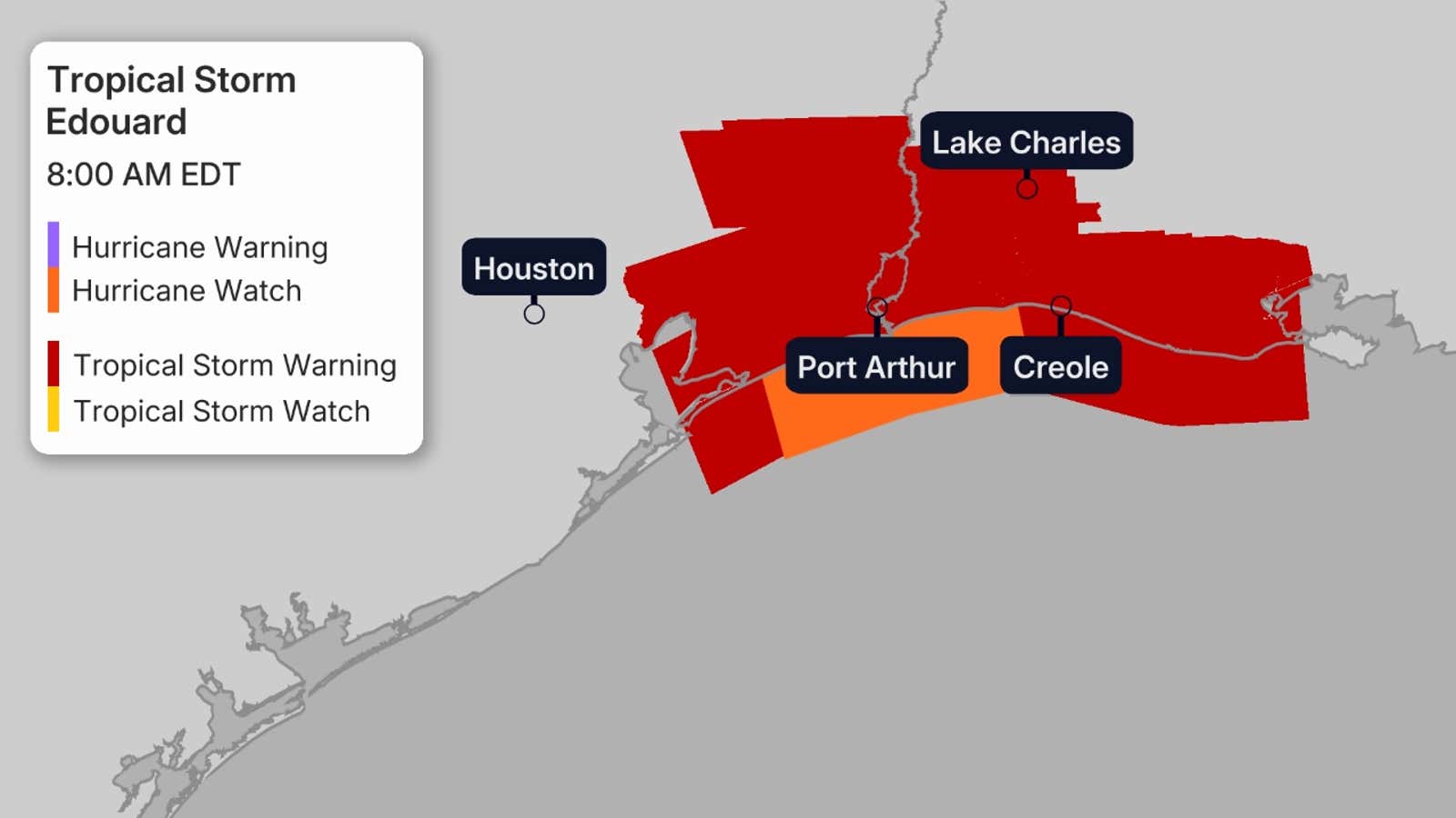
New: A hurricane watch has been issued for a portion of the Texas and Louisiana coast. The previous storm surge watch has been upgraded to a warning.
(MORE: What the tropical terms mean)
Watches and warnings
A hurricane watch has been issued from High Island, Texas, to Cameron, Louisiana, meaning winds of 74+ mph are possible on Tuesday.
Get More of Our News on Google
Set The Weather Company as a ‘Preferred Source’ to get quicker access to the news you value.

Tropical storm warnings have been issued from Port Bolivar, Texas, to the Vermilion/Iberia Parish Line in Louisiana, meaning winds of 40+ mph are expected today. This includes Chambers County and the Bolivar Peninsula.
A flood watch is in effect for southeast Texas, including Houston, through Wednesday morning. Flooding caused by heavy rainfall is possible in these areas.
A storm surge warning has been issued from High Island, Texas, to Cameron, Louisiana.
Latest information and forecast
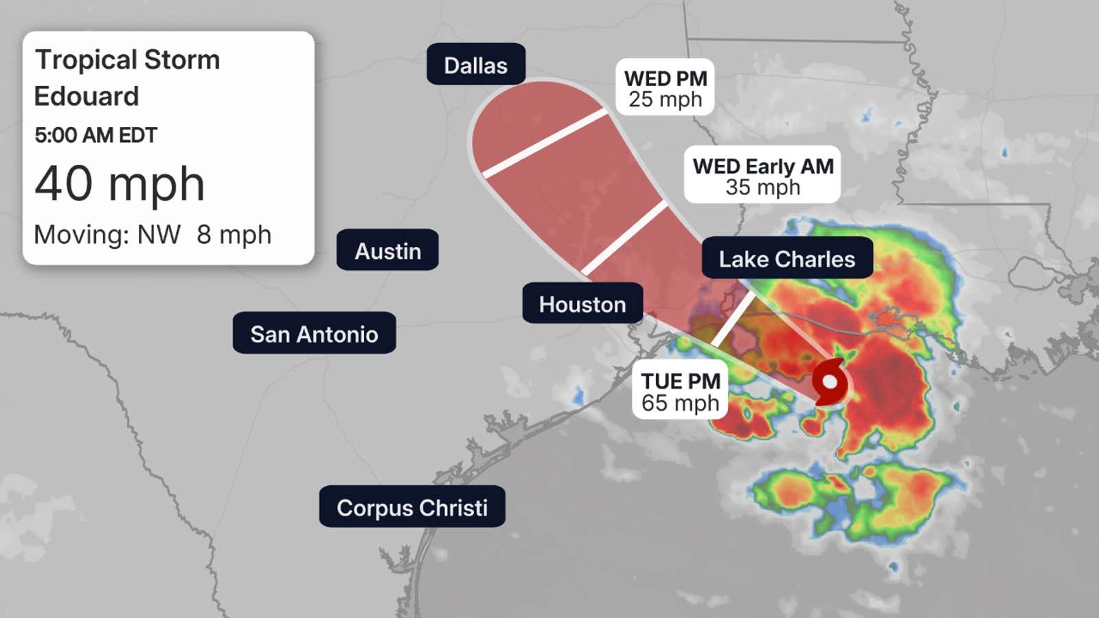
Tropical Storm Edouard is centered just over 50 miles south of the southwest Louisiana coast, moving west-northwest.
Fortunately, Edouard won’t spend much time over the warm Gulf, but is expected to move inland over eastern Texas sometime Tuesday afternoon or evening.
It’s then forecast to continue moving inland on Wednesday, then dissipate by early Thursday.
Wind shear is fairly light, and Gulf water temperatures are in the upper 80s, both favorable for additional development.
The small size of this system could allow it to strengthen more than currently forecast, but rainfall is expected to be the biggest impact.
Edouard could become a minimal hurricane near landfall for a short time.
 Impacts
Some tropical-storm-force gusts are expected in parts of the upper Texas and southwest Louisiana coasts near and for a few hours after its landfall Tuesday. These winds could arrive before the morning commute.
Wind gusts over 75 mph are possible within a few hours of landfall. Locally damaging winds are possible.
That said, the main threat from this system is heavy rainfall, both near the coast and to some extent inland, especially over eastern Texas.
Generally, 3-6 inches of rainfall is expected, but up to 9 inches are possible on the upper Texas Coast. Parts of southwest Louisiana could see up to 3 inches of rain.
Areas of locally heavy rain could persist with the remnant low Wednesday, perhaps even Thursday in eastern Texas.
While this area is in drought, these bands of heavy rain could lead to flash flooding, including in parts of the Houston metro area.
(MORE: Why impacts aren’t just at the coast)
A storm surge of up to 5 feet is also possible on the Texas and southwest Louisiana coastlines. For the latest forecast storm surge, click here.
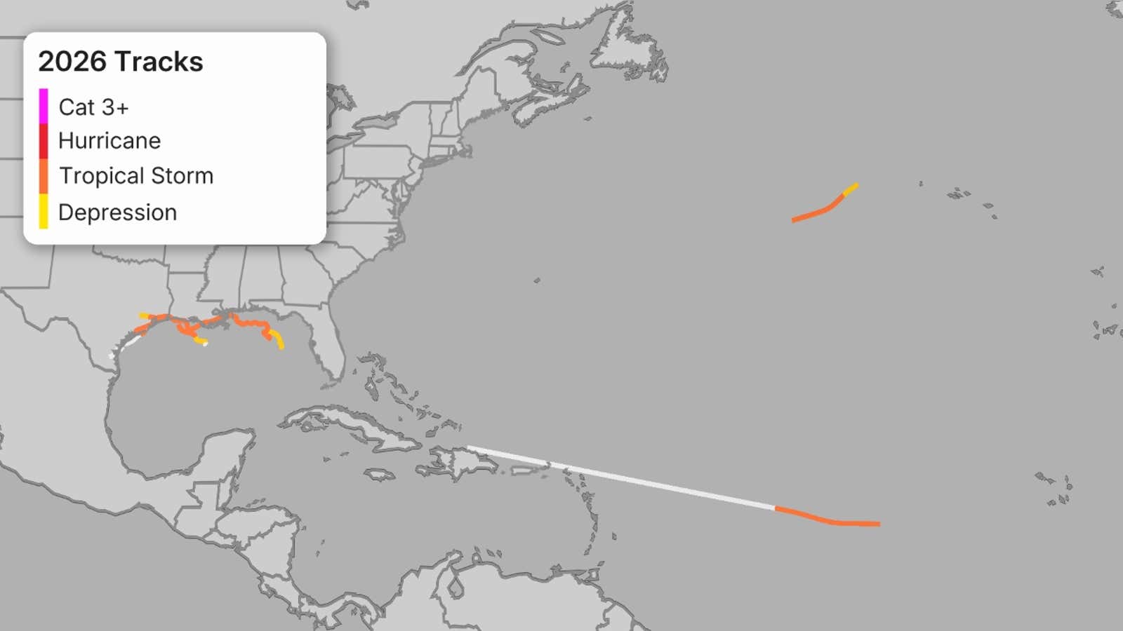
Third short-lived Gulf storm
Edouard became the third short-lived Gulf storm or hurricane of the 2026 Atlantic hurricane season.
Tropical Storm Arthur and its remnants soaked parts of the northern Gulf Coast in mid-June.
About a month later, Tropical Storm Bertha produced some strong wind gusts and coastal flooding, but was hammered by strong wind shear which kept its rainfall impacts relatively limited along the Gulf Coast.
(MORE: Record long wait for first Atlantic hurricane of season?)
It’s a reminder that while we expect a quieter hurricane season, you should have your hurricane safety plan ready to go and monitor forecasts throughout the season.
The Weather Company and Kalshi, a CFTC-regulated event-contract exchange, share data: we provide certain data Kalshi uses to resolve markets, and Kalshi provides market data featured in content like this article. Kalshi alone operates its event-contract exchange and is responsible for the contracts, trading, and settlement on its exchange. If you use our links to communicate with Kalshi and then open a Kalshi account or trade on Kalshi, we may earn a fee.
For Kalshi’s complete member agreement, click here.