
The Brief
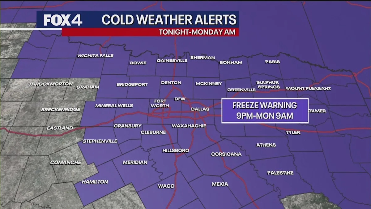
A Freeze Warning is in effect for North Texas, starting at 9 p.m. Sunday and lasting through 9 a.m. Monday.
Overnight lows will drop to or below freezing, with strong winds causing “feel like” temperatures to fall into the mid-20s.
Residents are urged to take immediate precautions to protect vulnerable plants and bring pets indoors.
DALLAS – A Freeze Warning is in effect for nearly all the North Texas viewing area beginning at 9 p.m. Sunday and lasting until 9 a.m. Monday, as the coldest air of the season so far sweeps into the region.
The National Weather Service upgraded Saturday’s Freeze Watch to a formal Warning due to the arrival of modified Arctic air.
While no precipitation is expected with the cold front, residents are urged to take immediate precautions.
Protect vulnerable plants.
Exercise caution and wear multiple layers when venturing out late tonight or early Monday morning.
Winds and Temperatures Plummet
Dig deeper
Strong northerly winds are a key factor in the sharp temperature drop. Sustained winds are expected to be between 15 and 25 mph, with gusts potentially reaching 30 to 35 mph later today, which will hasten the movement of cold air into the region.
Temperatures this morning started in the upper 40s and low 50s, but the cold front is limiting Sunday’s high to just shy of 60 degrees for most areas. The strong winds will make it feel even cooler throughout the afternoon.
Overnight lows are forecast to fall near or just below the freezing mark (32 degrees) in the immediate Metroplex, with outlying areas like Denton and Collin counties expected to dip into the upper 20s.
The intense wind is projected to continue through Monday sunrise, causing a significant wind chill. Most areas will experience “feel like” temperatures in the upper 20s and low 30s, with some spots feeling as cold as the mid-20s.
Brief Chill Precedes Warm-Up
What’s next
The cold spell will be brief. High pressure expanding from the west is expected to bring a shift to southerly flow by Tuesday, driving temperatures back up.
Highs are forecast to rebound into the mid to upper 70s and even the low 80s by late week and into the weekend.
The warming trend will precede a possible return of rain, with a low chance of showers and thunderstorms in the forecast for next weekend.
7-Day Forecast
The Source
Information in this article is from the FOX 4 Weather Team.