
 Chen Pan
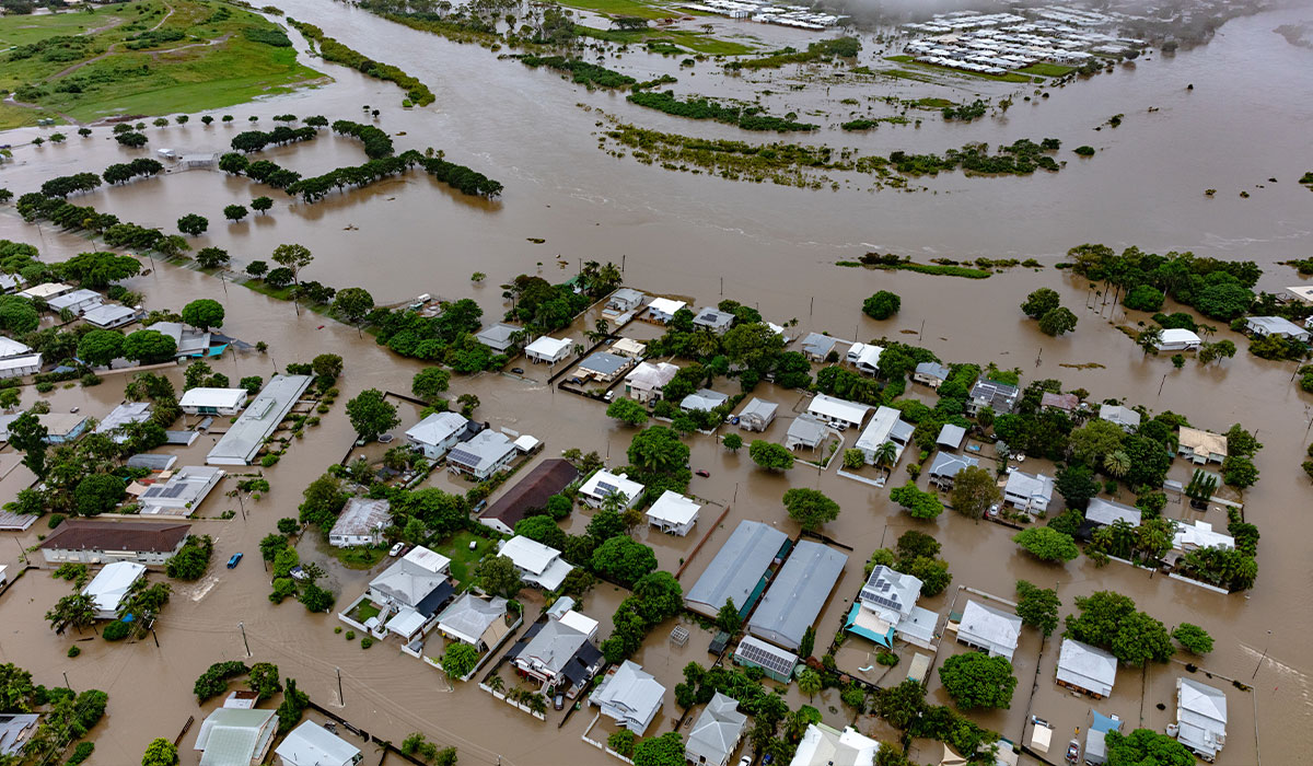
When sudden rainstorms roll across Texas, flooding can erupt in a matter of minutes. From coastal bends facing storm surges to low-water crossings in San Antonio, flood risks often spike block by block long before regional alerts sound. That means some people could have ankle-deep water in their yard by the time a flash flood warning notification sounds on their phone.
But a better monitoring system could get the word out more swiftly — and also more accurately. Researchers at The University of Texas at San Antonio have developed a self-sustaining, artificial intelligence-powered flood warning system designed to spot dangerous water accumulation at the street level.
Led by Chen Pan, PhD, assistant professor of electrical engineering in the Margie and Bill Klesse College of Engineering and Integrated Design, the team engineered a field-ready prototype that combines solar energy harvesting, multi-sensor environmental tracking, long-range wireless radios and on-device machine learning.
“In many rural areas or coastal communities, power infrastructure can fail right when severe weather strikes,” said Pan, who directs the RISE Lab at UT San Antonio. “Our system is an off-grid solution. It generates its own power, evaluates flood risk locally right on the device and sends timely warnings without needing external electricity or expensive network lines.”
The team includes Mimi Xie, assistant professor of computer science in the UT San Antonio College of AI, Cyber and Computing, as well as Texas A&M University-Corpus Christi collaborators Hua Zhang, professor of engineering, and Wenlu Wang, assistant professor of computer science.
The challenge of hyper-local flooding in Texas This project was funded in part by a Texas Coastal Management Program grant awarded by the National Oceanic and Atmospheric Administration (NOAA).
Texas holds a well-earned reputation for extreme flood events. While regional weather models and satellite imaging offer essential big-picture forecasts, they can miss hyper-local flash floods. A drainage channel behind a neighborhood, an isolated rural dip or a campus access road might submerge rapidly while surrounding areas remain dry.
Existing commercial flood-monitoring stations also come with drawbacks, from prohibitively high costs to reliance on grid power or frequent battery replacements, which leaves them vulnerable during multi-day storms or power outages.
Pan’s team set out to engineer an inexpensive, all-in-one alternative. The resulting prototype combines temperature, humidity, light and precipitation sensing, as well as four optical water-level sensors mounted at varying heights.
By analyzing multiple environmental factors simultaneously — an approach known as multi-modal sensing — the system achieves far greater reliability than traditional single-metric gauges.
Putting artificial intelligence directly on tiny computer chips
One of the system’s standout features is its exceptional computing power. Traditional Internet of Things (IoT) sensors simply collect raw data and transmit them to distant cloud servers for processing. If cell towers fail or internet connections drop during a storm, warning alerts stall.
Pan’s system sidesteps this roadblock by using TinyML — a branch of computer science that compresses machine learning algorithms so they can run directly on small, low-power microcontrollers. This on-device AI evaluates current and recent sensor data to predict localized, imminent flood risk without relying on a central server.
So far, the AI has performed well, achieving 98.82% validation accuracy in initial assessments post-training.
Off-grid power and long-range wireless communication
To keep operating through heavy storms and overcast days, the sensing node relies on a self-sustaining solar power system. An onboard power chip collects ambient light to charge a built-in battery and backup energy storage units, allowing the device to run indefinitely on a fraction of the energy used by a smartphone.
When the station detects rising water risks, it sends lightweight radio signals using LoRa (Long Range) wireless technology. These low-power signals can travel more than a half-mile through city streets and up to five miles in open areas without needing cell towers or power lines. The data arrives instantly at a local central hub, where emergency teams can monitor conditions from miles away.
Mapping flood paths for fast decision making
At the central monitoring site, custom server software aggregates data from multiple deployed nodes across a town or watershed. A second, larger AI model analyzes spatial and temporal patterns across the network to generate an interactive web dashboard with predictive maps.
“The user doesn’t need to decipher raw data,” Pan said. “The dashboard assesses risk levels and shows how flooding could spread across monitored locations, highlighting higher-risk zones so local officials can act quickly.”
This flood-path visualization supports emergency responders as they make crucial decisions, such as dispatching crews, closing dangerous roads or issuing targeted neighborhood warnings long before floodwaters peak.
From prototype to product
To keep the system affordable, Pan used commercially available, low-cost components. The total cost of parts for one prototype sensing station ranges from roughly $150 to $220.
Pan is currently pursuing patent protection for the hardware architecture. The team aims to refine the design into a sleeker, weatherized commercial product suitable for deployment by small coastal municipalities, homeowners’ associations, agricultural operations and industrial sites.
“Our ultimate goal is to get this technology deployed where it’s needed most,” Pan said. “Whether along the Gulf Coast, across rural Texas counties or in urban drainage basins, smart self-powered sensing can give communities the early awareness they need to stay safe.”
This project was funded in part by a Texas Coastal Management Program grant approved by the Texas Land Commissioner, providing financial assistance under the Coastal Zone Management Act of 1972, as amended, awarded by the National Oceanic and Atmospheric Administration (NOAA), Office for Coastal Management, pursuant to NOAA Award No. NA23NOS4190249.
The views expressed herein are those of the author(s) and do not necessarily reflect the views of NOAA, the U.S. Department of Commerce, or any of their subagencies.