
AUSTIN, Texas — We are a few weeks into meteorological fall, and decorations are already going up, with some even thinking about Christmas decorations already. Somebody needs to tell Mother Nature that she needs to chill out. Literally and figuratively.
As of mid-September, this is by far the hottest September on record, with an average temperature that is nearly a full 2 degrees warmer than the previous record hottest in 2019.
However, the second half of most Septembers tends to be a little on the cooler side. This might hopefully stabilize those heat reports from the first half of the month. The biggest problem – I don’t really see any way for us to cool down to near average before the month ends. Also, not only is this far beyond any September in history, it would be the third warmest JULY on record and fourth warmest AUGUST on record. We’re in uncharted territory here.
I’m sure if you’re clicking on this article, you’re hoping and praying that I’ve got some sort of good news to share along with the misery of Texas heat. It isn’t the greatest news ever, but there is some hope on the horizon.
ALSO| Four hospitalized after suspected mass overdose outside downtown Austin bar
For the majority of August and September, we have been underneath a massive heat dome – with temperatures reaching 107 degrees this year. Twice in a row! The rest of the time? In the triple digits, setting records along the way. As of September 16, 2026, since early August, we have broken or tied 6 records. We have also only had 5 total days that weren’t in the triple digits. This is also the longest streak of triple-digit days in the month of September in Austin’s history, currently at 10 days in a row. Another crazy stat: if we hadn’t occasionally broken out of the triple digits with the random “99” or “97”, we’d have had a streak of 47 days in a row, beginning in late July, which would be the longest such streak, ever.
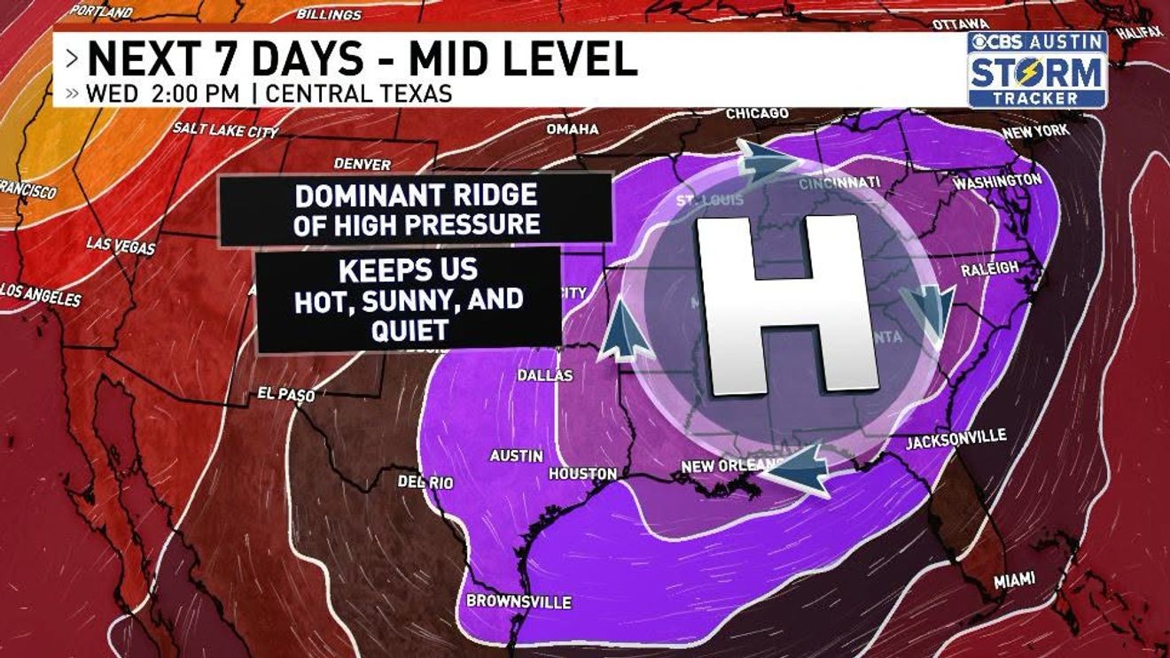
The rest of the time, we’ve been disgustingly above average every single day. And for the most part, dry as a bone – and the reason for it is extremely simple. We’ve had a ridge of high pressure, or a heat dome, directly overhead. High pressure compresses our air mass and clears the skies, letting more sunshine in, leading to pretty optimal conditions to see some scorching temperatures. A trough does the exact opposite. While a high-pressure system will limit upward movement, a trough encourages it, making showers and storms more likely. High pressure compresses the air, while a trough lowers the pressure, allowing air to rise freely into clouds and rain.
We’re now on a quest to find the next upper-level trough and maybe even an attached cold front near the surface. There was a chance of a cold front this weekend, but the likelihood of that is beginning to shift towards the less likely option. The upper-level ridge of high pressure is still looking pretty strong at least through this weekend and into next week, but according to some models, the overall strength of the high pressure looks to take a hit, but won’t be weak enough to get pushed out by an upper-level low just yet. Could a cold front arrive next weekend? Perhaps! But things are still a little up in the air now, and we could maybe see temps that are much less going-into-the-air-fryer and more like ahh-the-oven-door-is-open-but it’s-still-so-hot.