

It’s the first day of fall, and North Texas is off to a warm start for the season.
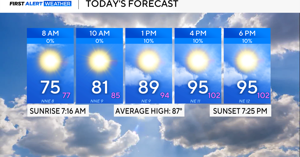
Highs will reach the low to mid-90s, feeling more like 100° by Tuesday afternoon. There is only a slim 10% chance of an isolated shower or rumble, mainly south of the Dallas-Fort Worth area, into Tuesday evening.

CBS News Texas
CBS News Texas
The streak of 67 days of no measurable rainfall at DFW Airport ended on Monday night. DFW received 0.01″ of rain, which ties the 2nd-longest streak on record.

CBS News Texas
There’s another 10% chance of showers or storms on Wednesday, mainly west and south of DFW; otherwise, it will be warm and above average through this weekend and into early next week.
Next Tuesday will be the best chance of widely scattered showers and storms as a front moves through North Texas. This will drop temperatures into the 80s on the final day of September, likely the only day this month with below-average temperatures.

CBS News Texas