
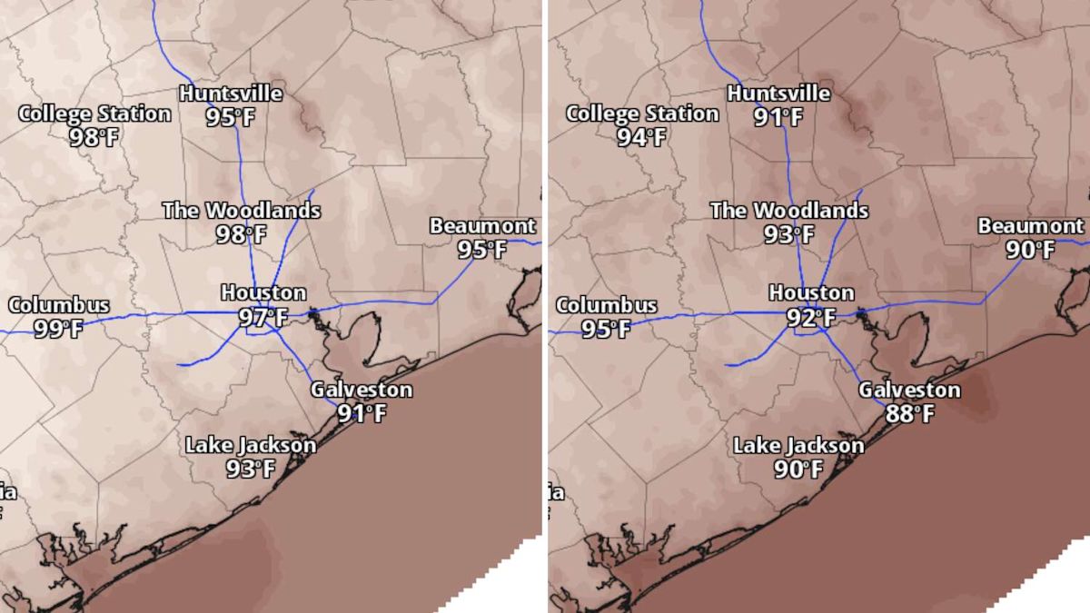
Houston’s heat will make a run at a daily record Wednesday before a weak cold front brings slightly drier air later this week.
The record high for Sept. 23 in Houston is 97 degrees, set in 2023. Afternoon temperatures could tie or break that record, with forecast highs at Houston’s Bush Intercontinental Airport likely to reach 97 or 98 degrees. Heat index values could climb above 100 degrees.
A weak front pushing south through the Houston metro area Wednesday will not bring fall temperatures, but it could briefly lower humidity and help set the stage for a wetter pattern next week.
Houston heat could approach Wednesday’s record
Wednesday will bring another hot afternoon across Southeast Texas.
Whether high temperatures tie or break the daily record Wednesday will depend partly on how much cloud cover and rainfall develop. At least a few showers and thunderstorms will be possible during the afternoon or early evening, especially near and south of Houston. Most neighborhoods farther north, even areas that saw spotty storms Tuesday near Conroe and the Piney Woods, are likely to remain dry.
FALL SHADOWS: Houston’s autumnal equinox won’t bring cooler weather. But look at the shadows.
The same front driving Wednesday’s storm chance will drift south of the region Thursday. A few morning downpours could develop early Thursday, mainly near and south of Matagorda Bay.
This will not be a strong cold front, so it will not bring a major drop in temperatures. The more noticeable change will be a brief decrease in humidity late Thursday and Friday, when heat index values should fall back into the 90s.
The drier air could also allow temperatures to drop a little more efficiently overnight. Some neighborhoods outside Houston’s urban heat island could briefly fall into the upper 60s late this week. Lows in most of Houston will likely only drop into the mid-70s, which would be about 5 degrees above normal for late September.
Rain chances could increase next week
The late-week front will not bring an early taste of fall, but it could help shift the overall weather pattern.
EL NIÑO & COLD FRONTS: When does fall arrive in Houston? Here’s what El Niño can – and can’t – tell us.
A ridge of high air pressure will remain strong over East Texas through Friday before weakening and shifting south this weekend. As the ridge breaks down, the atmosphere could become more favorable for a broader coverage of showers and thunderstorms next week.

Between Sept. 30 and Oct. 6, NOAA’s Climate Prediction Center expects above-normal temperatures across most of the contiguous United States. Darker shades of orange indicate higher confidence that temperatures there will be warmer than average. (NOAA’s Climate Prediction Center / Pivotal Weather)
The exact timing and daily rain chances remain unclear, but the pattern may become more active than it has been recently. This pattern shift, while far from locked into place, could lead to more widespread thunderstorm coverage across Southeast Texas.
For now, expect near-record heat Wednesday, limited rain chances Thursday and slightly lower humidity late this week – with a wetter, more active pattern potentially taking shape next week.
Subscribe
There’s more to Houston with the Chronicle. Subscribe today for just 25¢.
This article originally published at Houston heat could challenge a daily record Wednesday. What changes next?.