
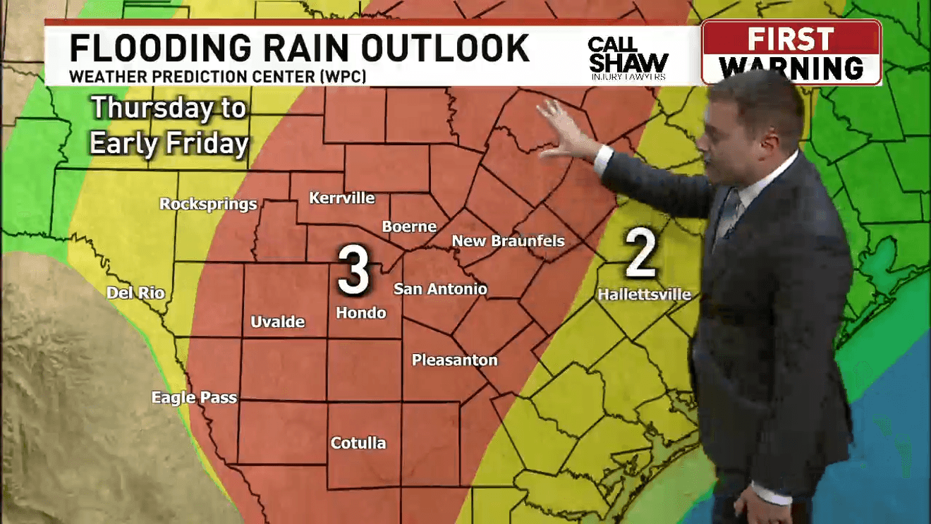
SAN ANTONIO – A Flood Watch goes into effect tonight for San Antonio and much of South Central Texas as forecasters prepare for several rounds of heavy rain that could bring several inches of rain and potentially dangerous flash flooding.
The Flood Watch begins at 7 p.m. and continues through 7 p.m. Friday.
Widespread rainfall totals of 2 to 5 inches are expected across the area, with isolated locations potentially receiving 6 to 8 inches. Flash flooding is expected to be the biggest weather threat, particularly around rivers, creeks, streams and low-water crossings.
Heaviest rain arrives overnight
Rain was already moving through portions of the western viewing area this morning, including areas around Edwards, Kinney, Uvalde, Maverick, Real and Zavala counties.
Some brief moderate to heavy showers were also developing around San Antonio and Bexar County. The more significant flooding threat begins later tonight.
CLICK HERE for our interactive radar
Heavy thunderstorms are expected to develop across western areas tonight before moving east and northeast overnight. The storms are expected to reach the San Antonio area overnight and continue into Thursday morning.
Another round of showers and thunderstorms is expected Thursday night into Friday morning.
Rain chances climb from about 30% Wednesday to 90% Thursday and Friday.
Some storms could turn severe
While flooding remains the primary concern, isolated strong to severe thunderstorms are also possible.
Today’s storms could produce frequent lightning, heavy rainfall and wind gusts topping 40 mph. Hail also cannot be ruled out.
On Thursday, San Antonio is under a Level 1 severe weather risk, with damaging wind and hail the primary concerns. The flash flood threat is more significant. Areas west of San Antonio face the greatest risk Wednesday before the higher flooding threat expands east toward the Interstate 35 corridor Thursday.
Drivers should avoid flooded roads and never attempt to cross a roadway covered by water, particularly at low-water crossings. Rain lingers into the weekend
The weather begins improving this weekend, although scattered showers could linger.
Rain chances fall to 50% Saturday and 40% Sunday, with drier conditions expected early next week.
The clouds and rain will also bring cooler temperatures. Highs are expected to fall to around 88 degrees Thursday and 81 Friday, with temperatures remaining in the low 80s into early next week.