
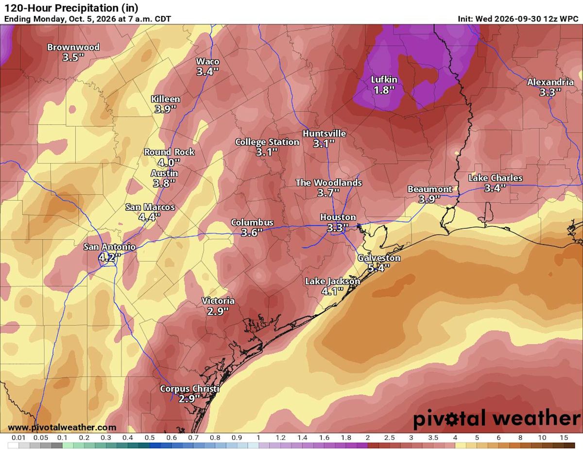
Houston faces two rounds of rainfall and a risk of flooding: The first will arrive late this week, possibly followed by second round along the coast over the weekend and into early next week.
The late-week threat is tied to a slow-moving front and remnant moisture from former Hurricane Polo, which dissipated over northwestern Mexico Tuesday night. A separate surge of tropical moisture from the Gulf of Mexico could bring more heavy rainfall to the coast. The timing and placement of those rains continues to be uncertain.
What’s changed in Houston’s rain forecast?
Since Tuesday, the potential axis of heaviest rainfall has shifted a bit east, bringing a higher threat to the Brazos Valley.
NOAA’s Weather Prediction Center has expanded its level 3 of 4 risk of excessive rainfall east to a line from roughly Bryan-College Station to La Grange, about 60 miles to the southwest. Flood watches may be issued for counties near and west of the Brazos River, the regional National Weather Service office for the Houston-Galveston area said Wednesday morning.
The window for the first round of rain has narrowed to late Thursday afternoon through Friday. The heaviest rainfall is still most likely to occur northwest of Houston, but its placement could shift. A change of a few miles could affect which communities see the strongest downpours.
Why could coastal rain continue next week?
After the late-week system moves through, a front may linger near the coast.
FLOOD TRACKER:
Know where flooding is occurring over the next seven days with the Chronicle’s interactive tracker.
A coastal disturbance and a deep surge of tropical moisture from the Gulf of Mexico could then bring another period of heavy rainfall, mainly along the coast, over the weekend and into early next week. Some of that rain could remain offshore, but the forecast this far out is not set in stone.
How much rain could Houston get?
Most of Southeast Texas is expected to receive an inch to 3 inches through the main late-week event, with higher amounts possible farther north and west and along the immediate coast. Over the next seven days, including possible tropical downpours into early next week, total rainfall could reach 4 to 6 inches along the coast and 2 to 4 inches near and north of Interstate 10.
Repeated storms could cause street flooding and quickly raise water levels in creeks and bayous, though they are not expected to exceed their banks. Flooding in isolated underpasses and low water crossings could be life-threatening. Never drive through flooded areas.
Subscribe
There’s more to Houston with the Chronicle. Subscribe today for just 25¢.
This article originally published at A shifting flood threat could bring two rounds of rain to Houston. Here’s a timeline of impacts..