
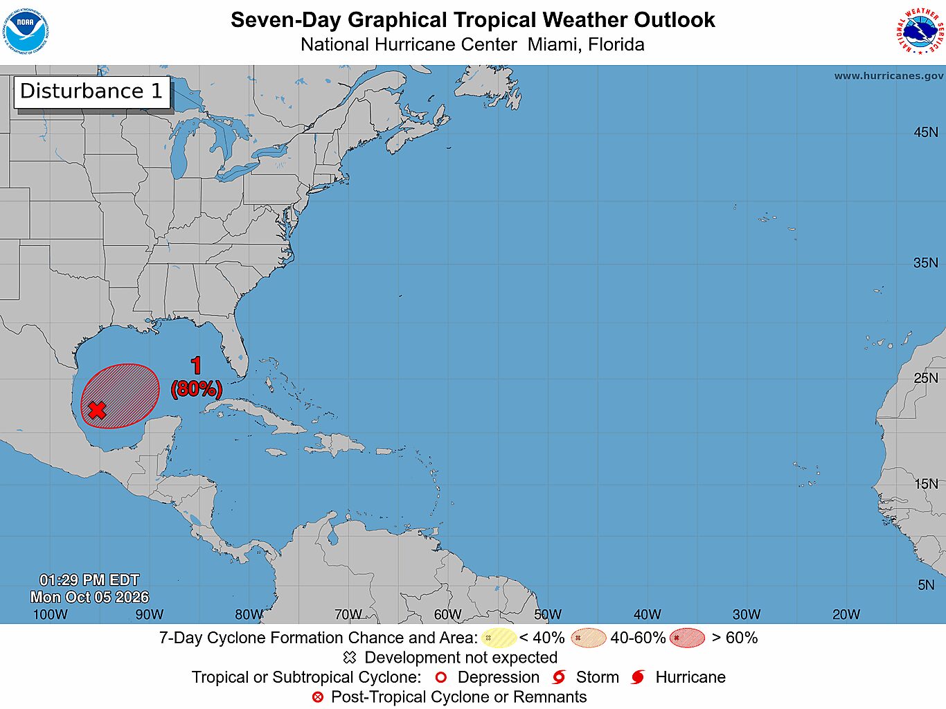
A broad area of low atmospheric pressure in the southwestern Gulf of Mexico is increasingly likely to develop into a tropical depression by midweek, but its eventual strength and path remain uncertain.
The National Hurricane Center gives the system a 60% chance of forming through Wednesday morning and an 80% chance over the next seven days. It is expected to drift east over the next few days before turning north.
The system does not yet have a well-defined tropical structure. Satellite imagery shows a broad, curved swath of clouds stretching across the southwestern Gulf and north along the coast, from Texas to Florida, while the rest of the Gulf remains mostly clear.
A tropical depression is expected to form by the middle of the week. The European ensemble spreads tracks from the western Gulf toward the upper Texas coast, Louisiana and Mississippi. The U.S. ensemble also shows a range, with many tracks turning north across the western Gulf toward Texas or Louisiana.
END OF THE SEASON: Hurricane season for Texas is effectively over as October begins. What changed?
There is a meaningful chance the system could become a tropical storm, which would be named Isaias. The name replaced Ike on the Atlantic storm list after Hurricane Ike devastated parts of Southeast Texas in 2008, making landfall as a Category 2 storm.
Few ensemble scenarios bring the system to hurricane strength. The Atlantic has yet to produce its first hurricane of the season, marking the latest such start since 1966. Although ensemble probabilities show a range of possible outcomes, they are not a guarantee of how strong the system will become.
As for the track, the outlook remains broad. The area of low pressure is expected to drift east before turning north, but that does not yet show where it could eventually go or whether it would reach the Texas coast. Its track and intensity may become clearer as the system organizes.
Over the next seven days, the deepest tropical moisture is expected to remain east of Houston, stretching across parts of Louisiana, Mississippi, Alabama and the Florida Panhandle.
That suggests the heaviest rainfall may stay away from Southeast Texas. However, the moisture plume could shift as the system develops and its track becomes clearer. For now, Houston’s connection to the system is a forecast to watch rather than a defined local threat.
The rain forecast shows some chance of tropical downpours near the upper Texas coast later this week. Even without a named storm, tropical moisture can contribute to heavy rainfall if it interacts with other weather features.
There isn’t enough detail yet to say how much rain Houston could receive or when it might arrive. The next few days should bring a better sense of whether the low pressure system organizes and how far west the heaviest rainfall may extend.