
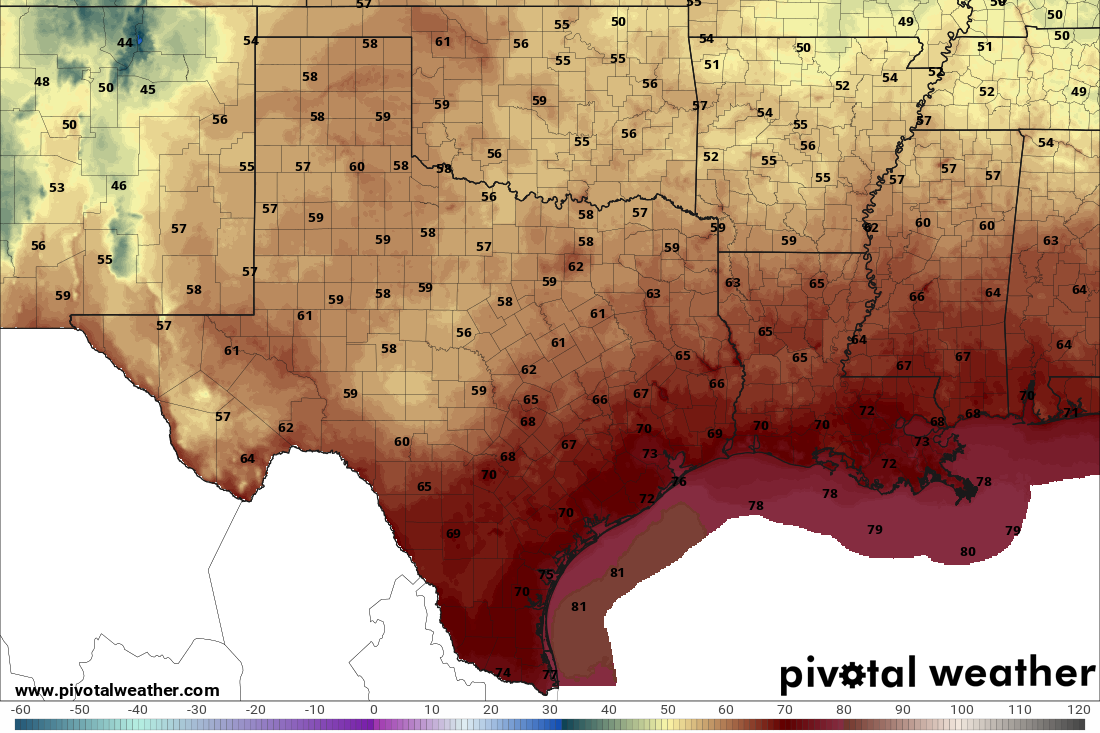
After a rainy weekend, we finally got that “ahhhh” moment we look forward to with our first fall cold front in Texas. And the good news? That cooler, more comfortable weather will stick around for the next few days.
Tuesday morning will begin with clear skies, and temperatures will be a little cooler than Monday morning, dipping into the middle and upper 60s for most of South Texas. North winds will be light, between 3 and 6 mph. Plenty of sunshine, low humidity and comfortable temperatures will stick around throughout the afternoon, with highs in the mid-80s.
Pleasant weather will continue until Wednesday. The morning will be the coolest of the week, and the coolest we’ve felt since May, with some morning lows dipping into the upper 50s in the Hill Country and the mid-60s along the Interstate 35 corridor.
If you’re a Texan who feels like summer is our default setting, you may even need a light jacket once those temperatures dip below 60 degrees.
While the dry air brought a refreshing air mass earlier in the week, moisture-related dew point temperatures will rise, indicating a more humid atmosphere later in the week. As more clouds roll in by Thursday, we will be watching two sources of low-end rain chances in Central Texas later this week.
One is an upper-level atmospheric disturbance moving into West Texas and through the Concho Valley, while the other is a tropical low pressure system in the Gulf of Mexico’s southern Bay of Campeche. As of Monday afternoon, that area of low pressure had an 80% chance of development in the coming week. Both weather systems will skirt our region, bringing only a limited 20% to 30% rain chance from Thursday through the weekend.
This won’t be anything like last week’s rain maker, so all outdoor plans should have zero weather issues through the weekend.
Think warm afternoons, cooler mornings, a few cold fronts and some rain. October typically brings more noticeable breaks from the Texas heat as cold fronts move through the state. Pacific storms can also send moisture into Texas, occasionally bringing widespread and heavy rainfall.
Rainfall averages 1 to 2 inches along the Rio Grande and 3 to 5 inches along the Interstate 35 corridor and east toward the Coastal Plains. In San Antonio, October is typically the third-wettest month of the year, with a monthly average of almost 4 inches of rainfall.
San Antonio temperatures typically start October with afternoon highs in the upper 80s before cooling into the upper 70s to near 80 by Halloween. Morning lows fall from the upper 60s early in the month into the 50s later in October, with a small chance of freezing temperatures in the Hill Country.
As we often see in Octobers with El Niño conditions, wetter weather is likely across South-Central Texas this October. The Climate Prediction Center is also projecting equal chances of warmer or cooler weather this October for most of the South Texas.