
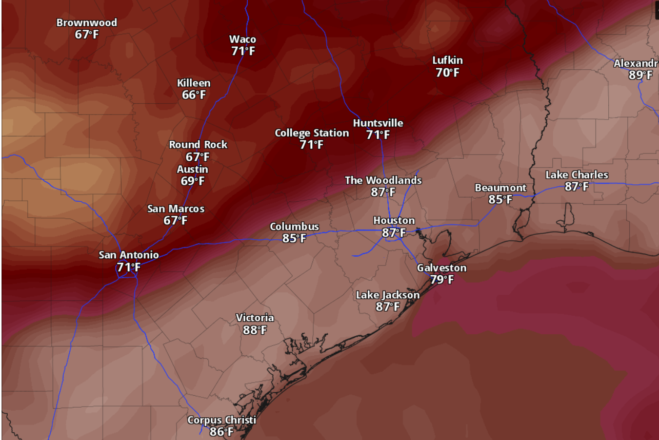
Austin temperatures will likely be in the lower 90s by 4 p.m. Sunday, according to the National Blend of Models, a composite weather forecast model.
National Blend of Models/Pivotal Weather
Expect more sunshine and more above-normal October heat Sunday in Austin, according to the National Weather Service. But forecasters added that a return of southerly winds off the Gulf Coast will lead to more humidity and higher heat index values as we head into the work week.

The next seven days also include the welcome reappearance of rain chances. Here’s what the weather service is looking at this week:
Article continues below this ad
What’s the Sunday forecast?
Austin on Sunday is shaping up to be sunny but breezy with robust south winds of 5 to 10 mph and gusts as strong as 25 mph. Daytime temperatures could climb to 93 degrees, which would be nearly 10 degrees warmer than normal for Oct. 11, according to weather service data. More clouds are expected to roll in Sunday night, when temps will bottom out around 73 degrees before sunrise Monday.
Hot weather has been the defining feature of the weekend, thanks to a ridge of high atmospheric pressure, but the return of southeasterly winds will also pull moisture-rich air from the Gulf of Mexico into Central Texas, and increase humidity levels in the coming days.
Article continues below this ad
“While this subtle change will not be highly noticeable over the weekend, it introduces a shifting trend for the days to follow,” the weather service said in a forecast bulletin Saturday. “These changes include a loss of mild overnight temperatures alongside an increase in daytime humidity, minimum temperatures, and heat indices.”
What’s Monday’s forecast?
“The early risers on Monday morning will wake up to higher humidity and warmer morning lows,” forecasters said in Saturday’s bulletin. “We will look to start the work week returning to those uncomfortable heat index days typical of September.”
Article continues below this ad
Austin on Monday has a 20% chance of afternoon rain on an otherwise partly sunny day. Like Sunday, temperatures should peak at 93 degrees amid persistent gusty southerly winds. Nighttime humidity will help keep temperatures above 76 degrees overnight until dawn Tuesday.
Tuesday in Austin, though, will be mostly sunny as temperatures climb to as high as 95 degrees. South winds continue to blow at 5 to 10 mph, with gusts as strong as 20 mph. Tuesday night temperatures, amid mostly clear skies, are expected to stay above a balmy 77 degrees.
Will Simon affect Texas at all?
While “strong Hurricane Simon in the eastern Pacific is forecast to crash into the rugged terrain of southern Mexico Sunday or Sunday night,” the weather service said, other weather features also are in play.
Article continues below this ad
An upper-level trough of low air pressure is moving into the western United States and will nudge the ridge of high pressure to the east, forecasters said. This will allow a cold front to approach South-Central Texas late next week.
The GFS weather model, sometimes referred to as the American model, shows a possible cold front moving through Texas by 1 p.m. Friday, with a 20-degree difference in temperatures on either side of the front.
GFS forecast model/Pivotal Weather
“Meanwhile, tropical moisture pooling over the western Gulf will wrap around the western periphery of the subtropical ridge, which continues to provide relentless heat over our region,” the weather service said.
As this weather pattern holds through Wednesday, Texas will have enough atmospheric moisture for daytime heating to trigger isolated showers along and east of the Interstate 35 corridor.
Article continues below this ad
“But it doesn’t appear to be getting any significant boost from the remnants of Simon,” forecasters added.
The GFS weather forecast model, sometimes called the American model, shows that the Austin area could receive as much as a half-inch of cumulative rainfall by 1 p.m. Friday.
GFS forecast model/Pivotal Weather
Weather pattern shift starts Wednesday
Austin on Wednesday should be partly sunny and breezy, with afternoon temps expected to hit 95 degrees again.
Article continues below this ad
“By late Wednesday, the (weather) pattern begins to shift as the upper ridge moves east,” the weather service said. “This finally introduces an opportunity to tap into a piece of Simon’s remnant moisture.”
So far, guidance from weather forecast models “only accounts for increasing rain chances over the Edwards Plateau starting Wednesday night,” forecasters said, adding that “frontal timing has also been highly inconsistent with this pattern change — but for now, it appears there will be at least some boost in rain chances Thursday through Friday, with a cold front arriving sometime during this period.”
For Austin, that translates into a slight 20% chance of rain Thursday and into Friday, according to the weather service.
Article continues below this ad