
LUBBOCK, Texas (KCBD) – If you’ve been nurturing a garden or keeping tender plants alive through early fall, Saturday morning may be a deadline for them. The first freeze of the season is likely for some of the KCBD/FOX34 area, and possible elsewhere in the area.
Today’s wind will become a chilly wind tonight, as colder air from the north follows the first strong cold front of autumn. These north winds will continue gusting up to around 30 to 35 mph.
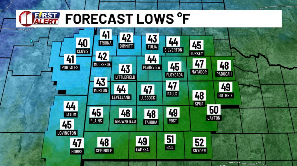 Chilly, but with a cold wind, Friday morning.(KCBD First Alert)
Temperatures will drop into the 40s across most of the viewing area, possibly even the upper 30s in the Friona, Dimmitt, and Muleshoe area.
The sky will be mostly cloudy tonight, but the heavy rain has ended.
Friday will be noticeably cooler. My forecast highs are only in the 50s. that’s as much as 20 degrees below average for mid-October.
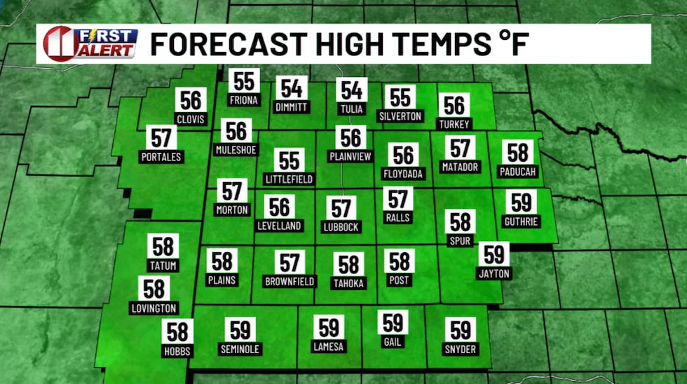 Temperatures will nearly 20 degrees below average Friday afternoon.(KCBD First Alert)
The northerly wind will continue well into Friday morning, then gradually ease through the afternoon. My expectation is the winds will become light before sunset.
Clouds will start clearing out late in the day. That and the winds becoming light are important. Those factors will contribute to a cold night and Saturday morning. Radiational cooling — basically, heat escaping from the ground into the atmosphere with nothing to trap it.
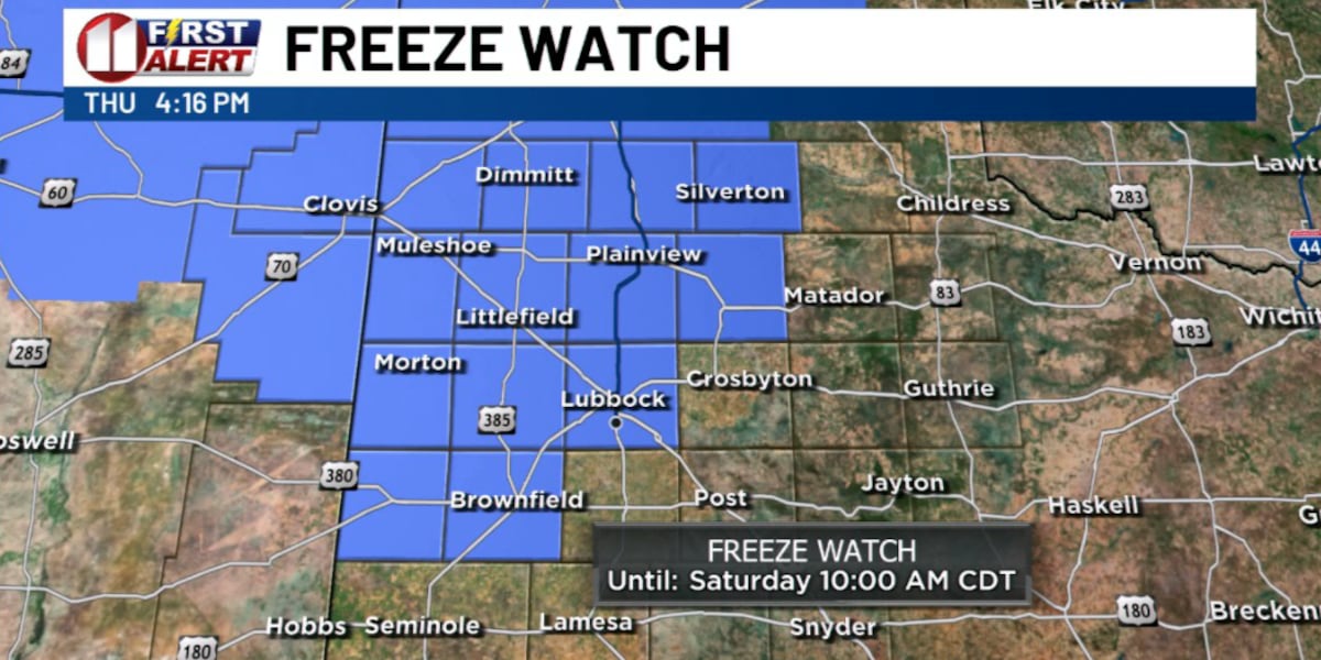
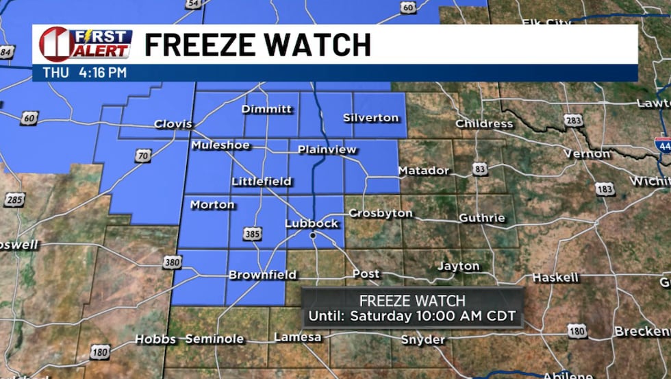 A FREEZE WATCH, highlighted by the blue shading, will be in effect Friday night into Saturday morning.(KCBD First Alert)
The National Weather Service has issued a Freeze Watch for areas on the Caprock for the period late Friday night through Saturday morning. The Watch, which sometime Friday may be escalated to a Freeze Warning, is highlighted on the map below. As you may note, it does include the city and county of Lubbock.
The far northwestern parts of our viewing area are likely to experience freezing temperatures. Currently, our forecast low for Lubbock is just above freezing. It’s a narrow margin. Slight variations in what is anticipated may result in a temperature not quite as cold, or just a little colder.
Keep an eye on our forecast for possible adjustments.
For those of you with cold-sensitive animals or vegetation that you want to protect, Friday is the time to prepare.
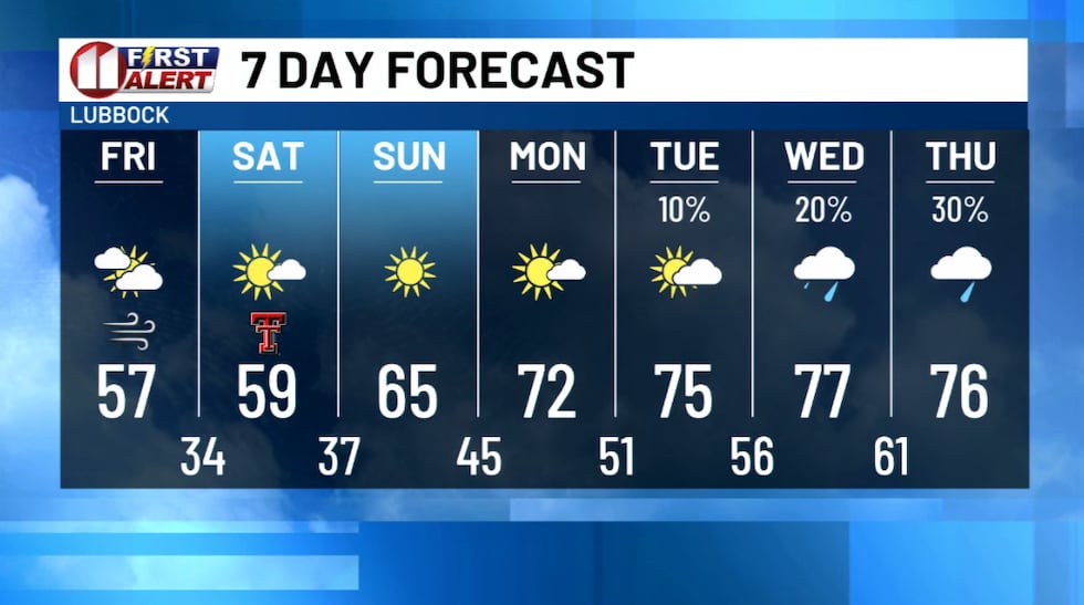 A notable drop in temperature may bring the first freeze of the season.(KCBD First Alert)
The dry and cooler pattern won’t last long. Early next week temperatures will begin to rebound. Highs will climb back into the 70s ahead of the next weather system.
For now, bundle up Friday night and Saturday morning. The first freeze of the season is possible. Just a reminder that fall is underway in West Texas.
 Stop by Yates’ new store on South Quaker to enter for your chance to win the $5,000 shopping credit!(KCBD First Alert)
On This Date
On this date in 1960, a rare late-morning tornado struck the Floydada airport destroying a small hangar and two aircraft. The storm moved southeast, producing 3.31 inches of rain in just 50 minutes. The roar from the tornado was heard as far as one mile away (though it is possible the roar was actually from copious amounts of hail falling, with drifts up to 14 inches).
(Source: National Weather Service, Lubbock)
Copyright 2026 KCBD. All rights reserved.