
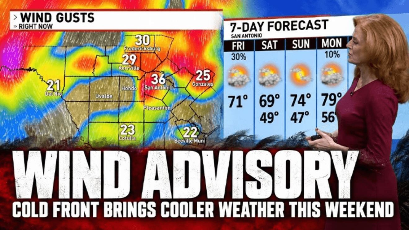
SAN ANTONIO – Strong winds are sweeping across San Antonio and the surrounding area Friday morning as a cold front brings a dramatic drop in temperatures, with wind gusts potentially reaching 50 mph before conditions improve heading into the weekend.
A wind advisory is in effect for the entire region until 7 p.m. today, with sustained northerly winds of 25 to 30 mph and occasional gusts exceeding 40 mph.
Some areas could see gusts approaching 50 mph, strong enough to blow around unsecured outdoor items and make driving difficult, especially for high-profile vehicles.
CLICK HERE for our interactive radar
Wind gusts had already reached 35 mph in New Braunfels early Friday morning, with gusts topping 30 mph at San Antonio International Airport and approaching 30 mph in Boerne and Kerrville.
Winds could exceed 40 mph in San Antonio by 10 a.m. and remain strong throughout the afternoon before gradually weakening tonight.
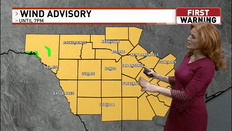
Strong winds are sweeping across San Antonio and the surrounding area Friday morning as a cold front brings a dramatic drop in temperatures, with wind gusts potentially reaching 50 mph before conditions improve heading into the weekend. (SBG San Antonio)
The gusty conditions come as a cold front pushes through South Texas, bringing a noticeable change from Thursday’s hot and humid weather.
Temperatures were already falling into the 60s this morning across much of Bexar County and the Hill Country, with readings near 60 degrees in Boerne and Kerrville.
Scattered showers were also moving through parts of the region, including western Kerr County, Val Verde County and northern Maverick County. Rain was expected to taper off from north to south by midmorning, with showers in eastern areas also coming to an end.
Clouds will stick around for much of Friday, although some sunshine could break through late in the afternoon. Temperatures will remain in the 60s for much of the day before reaching the lower 70s in San Antonio.
A chilly start to the weekend
The biggest change will be felt Saturday morning, when temperatures drop into the 40s and 50s across South Texas.
San Antonio is expected to wake up to temperatures around 51 degrees Saturday, while Hondo could dip to 49 degrees.
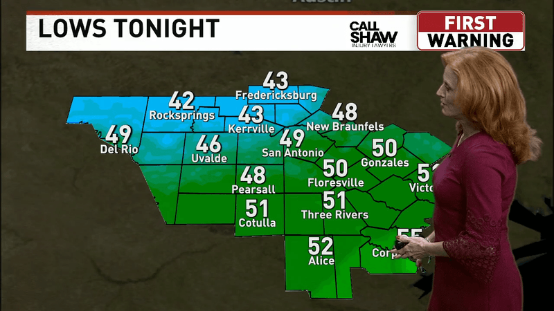
Strong winds are sweeping across San Antonio and the surrounding area Friday morning as a cold front brings a dramatic drop in temperatures, with wind gusts potentially reaching 50 mph before conditions improve heading into the weekend. (SBG San Antonio)
Residents heading outdoors early Saturday will want a jacket or sweater.
Saturday afternoon will bring a mix of sunshine and clouds, with a high near 69 degrees in San Antonio. The western zone will see highs around 68 degrees, while the Hill Country can expect a particularly chilly morning.
Sunday morning could be even colder.
With clearer skies overnight, temperatures will fall into the 40s across many communities, including upper 40s in San Antonio.
Despite the chilly start, Sunday afternoon is shaping up to be pleasant, with mostly sunny skies and a high near 74 degrees in San Antonio. Western communities can expect temperatures around 72 degrees.
Looking ahead to next week
The cooler weather will stick around through Monday morning, with San Antonio starting the day near 56 degrees before warming to around 79 degrees in the afternoon.
Temperatures will gradually climb back toward seasonal averages next week, reaching the mid-80s by Wednesday.
There is also a slight chance of rain Tuesday, although much of next week is expected to feature relatively comfortable fall weather.
For now, residents should secure loose outdoor decorations, patio furniture and other items that could be blown around by Friday’s strong winds.
Drivers of trucks, trailers and other high-profile vehicles should also use extra caution, particularly on open roads and highways where sudden crosswinds could make travel difficult.
CLICK HERE to send us your weather photos or video.