
The first significant cold front of fall blew through San Antonio on Friday, and it packed quite a punch. It brought a 20-degree drop in high temperatures to the region, as well as intense wind gusts exceeding 50 mph at times.
Saturday, the winds will finally be weakening, but San Antonio is likely to experience its chilliest day since early May. By late night, temps will fall quickly because of increasingly dry air and clearing skies across South-Central Texas. The chilly weather won’t last long, though, as a significant warming trend is likely during the upcoming week. Here’s what to expect.
Saturday’s forecast
A chilly start is anticipated across South-Central Texas on Saturday, as temperatures will sit close to 50 degrees across the San Antonio metro area between 5 a.m. and 8 a.m. The Hill Country will be several degrees colder, with lows likely at 43 to 46 degrees from Kerrville to Fredericksburg.
Breezy winds are expected throughout the morning, likely at sustained speeds of 15 to 20 mph. By the middle of the day, however, winds will lighten to around 10 mph, staying there through the afternoon and evening.
Temperatures will slowly rise, likely reaching the lower 60s by noon before topping out in the upper 60s by the late afternoon. This will be the coolest day San Antonio has had since May 1, when high temps rose to just 67 degrees.

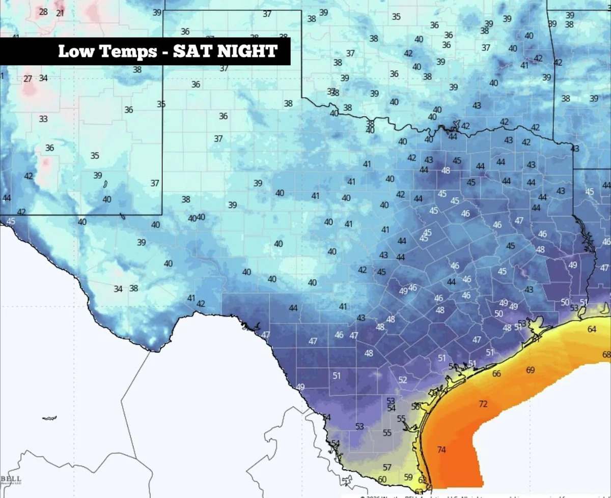
From left, the expected high temperatures Saturday afternoon, and the potential low temps Saturday night into Sunday morning. (WeatherBell)
Cold late Saturday: Temperatures will drop relatively quickly through the evening, likely falling back into the 50s shortly after 8 p.m. Overnight temperatures are expected to fall into the upper 40s for much of the metro area, although a few spots near downtown may bottom out in the lower 50s.
The coolest spots will be in the Hill Country, where temps will fall to between 40 and 42 degrees in Kerrville and Fredericksburg. A few isolated spots could briefly touch the upper 30s.
Warmer temps on the way
After the chilly start on Sunday, temps will start to warm up quickly with bright sunshine overhead. San Antonio will likely reach 60 degrees just after 10 a.m., before hitting a high temperature in the lower to mid-70s by the afternoon. Wind will be very light, coming in from the east at around 5 mph.
Temperatures will keep rising by a few more degrees each day this week. On Monday, San Antonio can expect highs in the mid- to upper 70s, rising into the lower 80s by Tuesday. Mornings will stay in the 50s through the first part of the week.
The warmest weather is expected from Wednesday onward, as temperatures are expected to rise back into the upper 80s, nearly 10 degrees above average for late October. Morning temps will also rise higher, but will stay comfortably in the 60s.
Rain chances will stay very low throughout the week, thanks to relatively low humidity values in place. According to long-range weather models, the next opportunity for widespread rain is not expected until at least the week of Oct. 25-29.
Subscribe
There’s more to San Antonio with the Express-News. Subscribe today for just 25¢.
This article originally published at South Texas temperatures to reach the 40s. Here’s how long the chilly weather will last..