
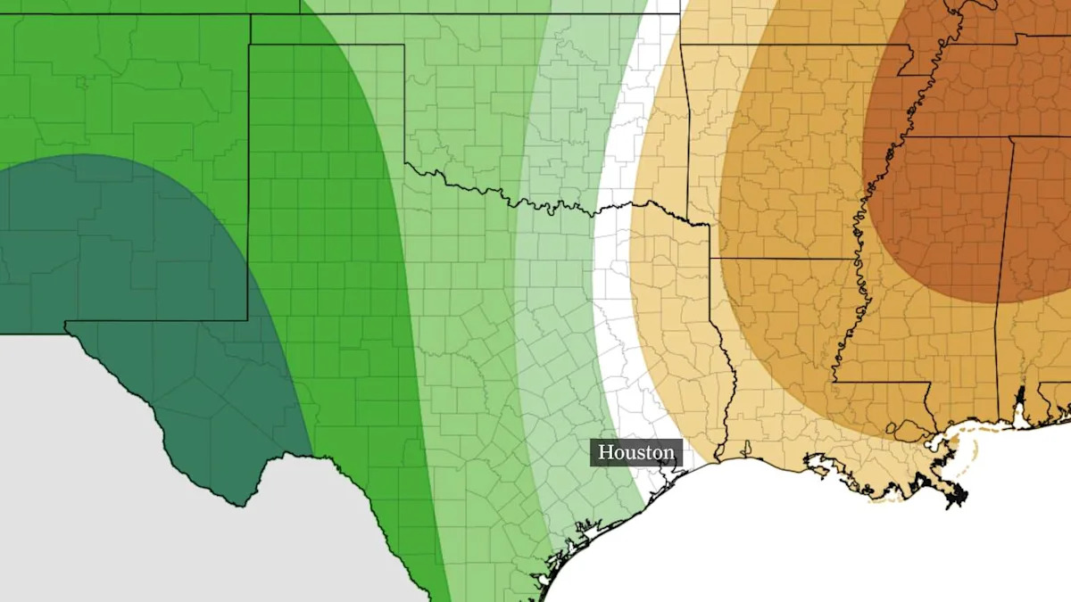
The Houston area’s best chance of rain this week arrives Tuesday as a coastal atmospheric disturbance could bring a few showers toward the shoreline.
However, most of the rain is expected to stay over the water, with only a slim chance of reaching the coast. The rest of the week looks dry, leaving little relief for soils as drought deepens across Southeast Texas.
Tuesday brings a few coastal showers
HEAT TRACKER: Is Texas weather getting more extreme? Find out with the Houston Chronicle’s interactive tracker.
Forecast models suggest a few spotty showers will approach the Texas shoreline Tuesday afternoon, especially near Matagorda Bay. Some of these may even work as far inland as Victoria or Columbus by Tuesday evening before drying up. Rain chances remain at only 10% to 20%, with higher chances offshore.

A snapshot from future weather radar modeling shows scattered showers Tuesday evening, mainly offshore of the Texas Gulf Coast. Rain chances Tuesday will be found mainly along the immediate coast south of Houston. (Pivotal Weather)
A few light showers could linger near the coast into early Wednesday before fading during the afternoon. For the rest of us, this week’s rain chances are virtually nonexistent.
Dry weather, warmer temperatures through the weekend
After Tuesday, high air pressure will help keep skies mostly dry and winds light across Southeast Texas.
Temperatures will climb into the mid- to upper 80s by Thursday and stay there through the weekend. Morning temperatures will generally land in the lower to mid-60s across the Houston metro area, with temps closer to 70 degrees near the coast.
How much rain would soak Southeast Texas?
Drought has deepened across the region, with nearly all of Southeast Texas now experiencing at least moderate drought, the lowest level of dryness as measured by the U.S. Drought Monitor.

Data from the U.S. Drought Monitor’s Oct. 13 map show about 97% of the region in drought or pre-drought conditions. Nearly 80% is in moderate drought, while about 19% is in severe drought, the next highest level. A week earlier, about 66% of the region was in drought or pre-drought conditions, and none of the region was in severe drought.
WINTER IS COMING: Super El Niño winter is coming: Here’s which Texas cities will likely be most affected
The Keetch-Byram Drought Index, or KBDI, offers one way to gauge how dry the ground is by estimating how much rain it would take to saturate the soil. The index is measured in hundredths of an inch, so a value of 500 means roughly 5 inches of rain would be needed.

This map of Texas shows the Keetch-Byram Drought Index. The index estimates how much rain is needed to saturate dry soil. Values are shown in hundredths of an inch, so a reading of 500 indicates about 5 inches. Southeast Texas, would need 4 to 6 inches of rain to saturate soils. (Texas A&M AgriLife Research / Texas A&M Forest Service)
The Oct. 19 county-average map shows KBDI values of about 400 to 700 across much of Southeast Texas. Most Houston-area counties fall between 400 and 600, suggesting about 4 to 6 inches of rain would be needed to saturate soils. These are broad estimates, not rainfall forecasts. Soil conditions can vary within a county, and rain would need to soak into the ground to make a meaningful difference.
With no reliable signs of widespread wet weather across Southeast Texas over at least the next seven to 10 days, we are left with little prospect for the soaking rain the region needs.
Subscribe
There’s more to Houston with the Chronicle. Subscribe today for just 25¢.
This article originally published at Houston’s rain chances are slim this week. How much rain could ease the drought?.