
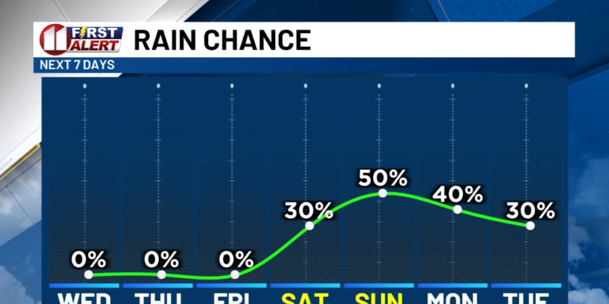
LUBBOCK, Texas (KCBD) – Lubbock and the South Plains are in for a pleasant run of weather through Friday. The pattern, however, shifts this weekend as a storm system moves in with rain chances and cooler temperatures.
Pleasant Ahead
The next few days are made for outdoor activity. Dry conditions and temperatures running a touch above average for late October highlight my forecast through Friday.
Evenings will continue to get cool by around sunset, and mornings will be quite cool.
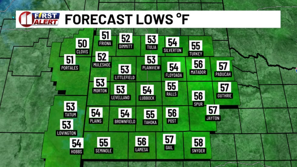 Quite cool early Wednesday, but it will be brief.(KCBD First Alert)
These cool downs won’t last, though, as temperatures will climb into the 60s my mid-morning and into the 70s by around the lunch hour.
Afternoon temperatures will peak in the 70s with the warmest spots peaking near or just above 80 degrees.
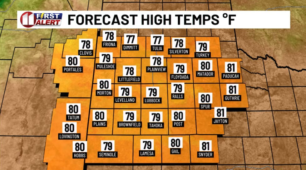 Slightly above average temperatures return Wednesday afternoon. Thursday too!(KCBD First Alert)
Pattern Shift
The storm system I mentioned yesterday is still anticipated to bring rain to the South Plains area. But it now looks like it will evolve more slowly than data yesterday indicated. Because of that, I’m adjusting the rain chances for Saturday, lowering them from what I mentioned yesterday, but the overall wet pattern remains in our forecast. I’m just delaying it a bit.
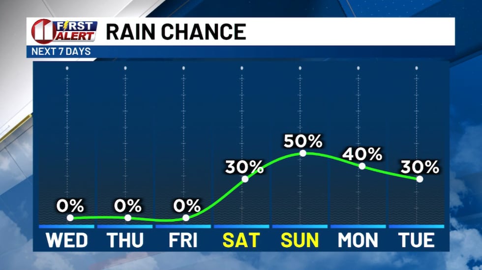 Rain chances increase this weekend.(KCBD First Alert)
Rain and a few thunderstorms may begin to affect our western areas, areas near the state line, Friday night into Saturday morning. Elsewhere, including Lubbock, Saturday is likely to start dry with rain chances gradually increasing through the day. The rain potential will continue to increase through Saturday night and into Sunday.
Sunday looks wetter, with showers likely along with a slight chance of thunderstorms. Some spots on the Caprock may see locally heavy rainfall, especially if storms train over the same spot.
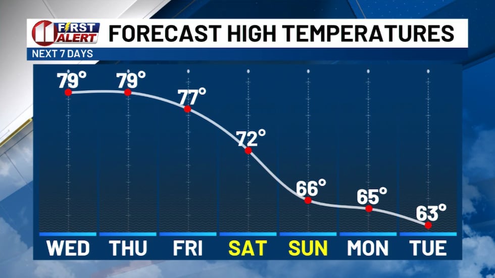 Warm and mild through the work week, then cooling with an increasing chance of rain this weekend.(KCBD First Alert)
As the clouds thicken and rain begins to fall, high temperatures will begin to cool. Well-below average high temperatures are likely Sunday into Tuesday. On the other end of the thermometer swing, the clouds and moisture will keep overnight lows above average for late October.
Looking Ahead
Currently, it appears the storm will be moving slow enough that the wet and cool pattern may continue into at least Tuesday.
Stay with us for updates as this system approaches. We’ll keep you posted on timing and rainfall amounts as we get closer to the weekend.
On This Date
On this date in 2011, a powerful cold front swept through the southern Texas Panhandle, South Plains, and Rolling Plains. Extreme pressure rises behind the front created a widespread high wind event. A haboob (a wall of wind-driven dust) was estimated to extend 250 miles. Visibility was reduced to as low as zero across much of the South Plains. Widespread damage was also observed with the most extensive damage in the Lubbock area. Power lines, trees and fences were blown over, with roof damage also reported. The Lubbock Preston Smith International Airport also sustained damage, including to the air traffic control tower and the airport fire station.
(Source: National Weather Service, Lubbock)
Copyright 2026 KCBD. All rights reserved.