
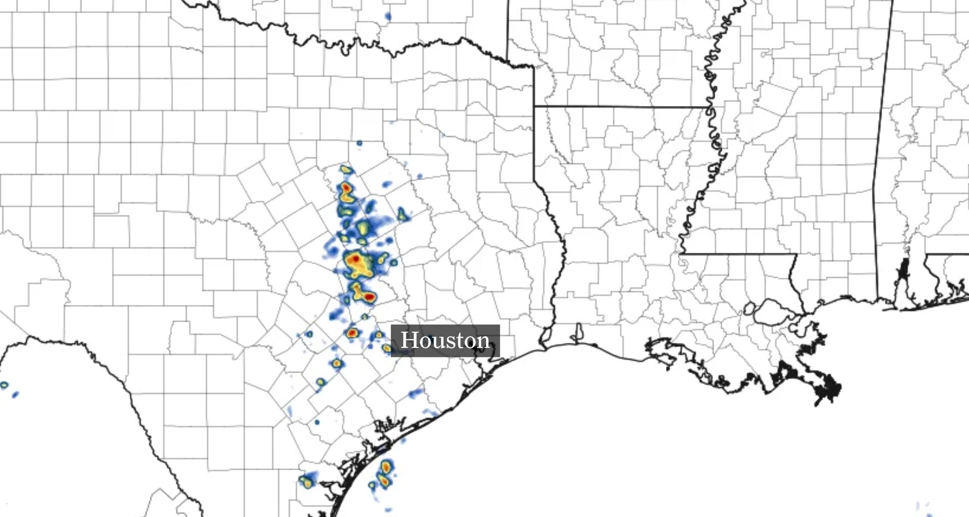
Scattered showers and thunderstorms could develop west of Houston by Wednesday afternoon.
Pivotal Weather
Houston’s late-week rain forecast is coming into focus, but scattered showers or storms could still complicate outdoor plans.
Wednesday could bring a few mainly light showers across Southeast Texas. After that, drier weather should keep most neighborhoods dry through Thursday, before rain chances return Friday. The exact details of the Halloween forecast, including when and where rain is most likely, are still difficult to pin down, even a few days out.
A shift in the winds high above Texas could help determine whether Halloween plans stay dry.
Article continues below this ad
Houston rain chances stay hit-or-miss through Friday
Wednesday provides the Houston area with only an isolated chance of a passing shower. Higher rain odds are expected south and west of the city, where rain chances could reach as high as 30% to 40%, from Brenham south to Victoria.
SCIENCE OF RAIN ODDS: Why does a 50% rain chance cause 100% confusion? Here’s what the percentages really mean.
Any rain that does develop should be mostly light, although a few heavier showers cannot be ruled out. Some of the heaviest downpours could even come with lightning through Wednesday afternoon.
Article continues below this ad
This image shows how weather radar could look Wednesday afternoon across Southeast Texas. The best chance for a few scattered thunderstorms will mainly be west of Interstate 45.
Pivotal Weather
A pocket of drier air arrives Thursday, helping to keep rain out of the forecast briefly. By Friday, a hit-or-miss shower will return to the forecast. Just about every corner of Southeast Texas has a 20% to 30% chance, unlike rain odds earlier in the week that favored communities south and west of Houston.
The risk of a passing shower creeps slightly higher by Halloween.
Houston could see showers for Halloween
Houston has a 20% to 40% chance of rain Saturday, with better odds west of Interstate 45, where more moisture is expected.
Article continues below this ad
A few showers or storms could affect outdoor plans, but the forecast does not point to a washout. The timing and location of any rain could still shift as Halloween gets closer. For now, showers are possible, especially west of Houston, but many neighborhoods may stay dry.
What does this mean for trick-or-treaters Saturday evening? For now, it looks like you’ll be able to maintain the spooky aesthetic of your costume without an umbrella to ruin it.
Stormy pattern possible as upper-level winds shift
The upper-level wind pattern that has helped steer storms across the desert Southwest in recent weeks is beginning to change. It has allowed weather systems to dip south and then turn north around a nearly stationary upper-level low.
Article continues below this ad
BLOCKING PATTERN: A stubborn ‘omega block’ is keeping Houston warm and dry. How long will it last?
The pattern is expected to become more zonal, with winds moving mainly from west to east. That can carry smaller weather disturbances across Texas and help bring a fewer chances for showers and storms.
After a lull late Saturday and Sunday, another round of rain and storms could develop along and ahead of a cold front early next week. The timing and details remain uncertain.