
With the exception of the two relatively strong cold fronts experienced over the past few weeks, Southeast Texas has been subjected to a very warm fall so far this year. Since Sept. 1, Houston’s average high temperature sits at 87.8 degrees, on track for the second-warmest fall in the city’s history.
Unfortunately, that average is going to stay relatively steady as we push into Sunday and early next week. High temperatures in Houston are expected to stay 15-20 degrees above average, potentially breaking a 77-year-old temperature record in the process.
Big changes are coming, though, as a strong storm system will move into Texas by the second half of the week. Here’s a breakdown of what you can expect moving forward.
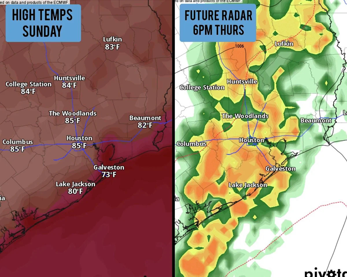
Sunday’s forecast
Expect a mild and humid morning, with low temperatures hovering in the mid-to-upper 60s under partly to mostly cloudy skies. Patchy dense fog will also be possible, mainly before 8:30 a.m. Skies will start to clear as we head into the late morning and afternoon, allowing temps to rise quickly.
Temperatures will already be in the mid-70s by 10 a.m., reaching the 80-degree mark between 11 a.m. and noon. Afternoon high temperatures are expected to top out at 85-86 degrees in the Houston metro area, potentially tying or breaking the daily record of 85 degrees, which was set in 1948.
A mild evening is also expected throughout the region. Houston won’t dip back into the 70s until after 6 p.m., and temps will hover in the 70s throughout the evening and late-night hours.
The rest of the week
Warm temps continue: Unseasonably high temperatures are expected to continue Monday and Tuesday, as high temperatures rise into the mid-80s while lows hover near 70 degrees each day.
High levels of Gulf moisture will also move into the region. While it won’t result in rain chances quite yet, you will notice an increase in humidity, daily morning fog, and partly cloudy skies throughout the day.
Heavy rain possible: A strong low-pressure system will move eastward from the Pacific, likely influencing Texas’ weather by Wednesday. Scattered showers and storms will develop across the state, but most of the activity at this point will stay north and west of Houston. Rain chances Wednesday will be just 30-40%.
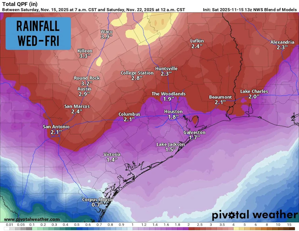
Shown are the potential rainfall totals from Wednesday through Friday, according to the National Blend of Models. (Pivotal Weather)
Thursday will bring higher storm chances, especially by the evening hours when a potential line of thunderstorms moves into the city from the west. Rain chances will rise to around 70%, with very heavy rain possible at times.
This line of storms will also have the potential to bring severe weather, including large hail and damaging winds. However, it’s too early to tell exactly where the strongest activity will set up, so be sure to stick with houstonchronicle.com/weather for daily updates.
Weather models are showing that the heaviest rain is likely to fall across Central and North Texas. Totals will likely be lower in Houston, but between 1-2 inches is still likely.
The line of storms will also be accompanied by a cold front. While it’s not an arctic front, it will send high temps back into the 70s by the weekend and into next week.
This article originally published at Record heat targets Houston Sunday, but major weather pattern shift is coming this week.