
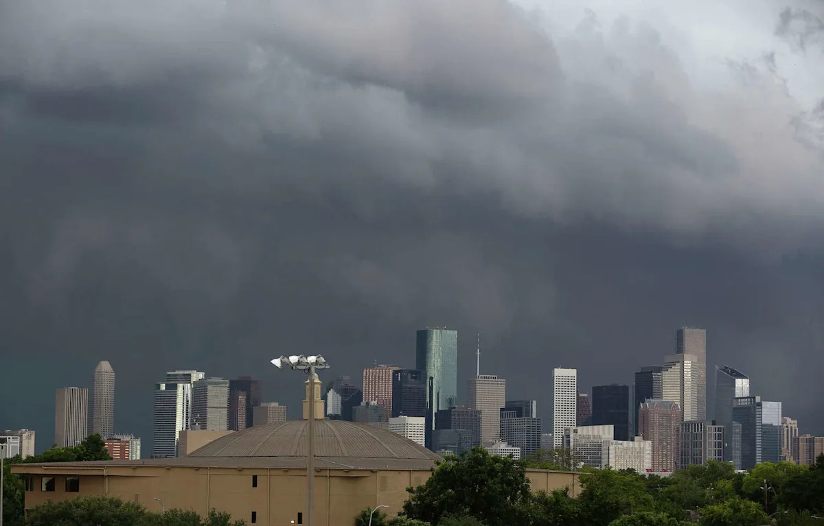
A cold front expected late Thursday could spark storms, downpours and gusty winds across the Houston region.
The National Weather Service – Houston/Galveston says a cold front is expected to move through Southeast Texas late Thursday, bringing the potential for showers, thunderstorms and locally heavy rainfall. In its latest update, forecasters said some storms could become strong enough to produce damaging wind gusts, though widespread severe weather isn’t expected.
The agency currently places much of the Houston area under a “marginal risk” of excessive rainfall, meaning a few localized flooding issues could develop if storms repeatedly move over the same areas. The exact timing and intensity of the front remain uncertain, but forecasters anticipate the strongest storms will likely arrive Thursday afternoon into the evening.
North Texas is bracing for the same system. The National Weather Service in Dallas/Fort Worth says widespread showers and storms will sweep through the region from Wednesday morning into early Friday. Heavy rainfall and localized flooding will be possible, with the most widespread storms expected on Thursday and Thursday night. Forecasters expect a broad 1–2 inches of rain across North Texas, with isolated totals topping 4 inches. A few storms may also grow strong to severe as the system deepens.
According to Space City Weather’s Eric Berger, moisture levels are building across the Gulf ahead of the front, setting up conditions for “noisy thunderstorms and locally heavy rain” as the boundary pushes through. The outlet notes that while the event doesn’t appear to be a washout, rainfall rates could be briefly intense, especially in the northern and western parts of the metro area.
The NWS’ extended forecast shows a 70 percent chance of showers and thunderstorms Thursday, with rain tapering off by Friday morning as cooler, drier air filters in. By the weekend, Houston should enjoy clearer skies and more comfortable temperatures, with highs in the 70s and overnight lows dipping into the 50s.
Forecasters urge residents to stay weather-aware as the front approaches, since small shifts in timing or strength could change when and where the heaviest rain falls.
More Weather
Rating | FEMA gives Harris County a perfect 100 for hurricane risk
Repeat | Houston storms knock out power again despite CenterPoint upgrades
Damage | What to know about the ‘monster’ tornado that ripped through Texas
Forecast | Texas faces higher risk of direct hurricane impact than past years
For the latest and best from Chron, sign up for our daily newsletter here.
This article originally published at Heavy rain and noisy storms set to blast Houston and north Texas.