
Tuesday started warm and muggy with temperatures in the lower 70s.
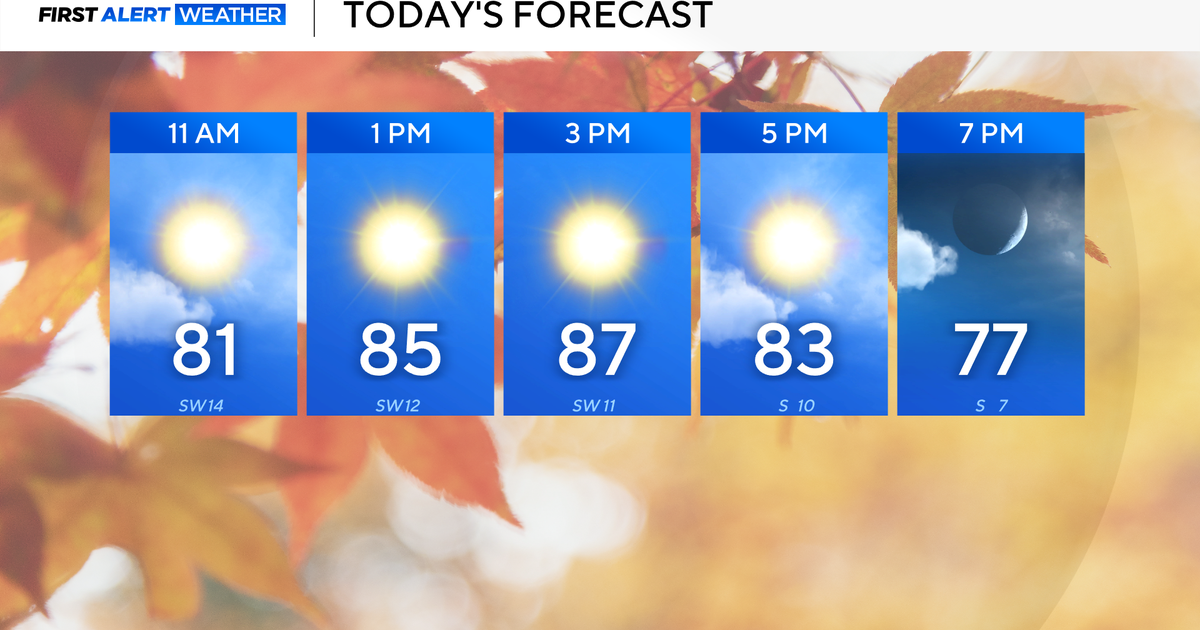
Highs will once again soar into the mid/upper 80s this afternoon, likely breaking the current record of 83 degrees. Southerly winds will be breezy and gusting to 25 mph throughout the day.

CBS News Texas
First Alert Weather Days have been issued for Wednesday and Thursday due to multiple rounds of heavy rain.
Flooding is the main concern as widespread rainfall totals of 1″-3″ are likely, with 4″+ possible in isolated areas.

CBS News Texas
Spotty showers are possible during the day tomorrow, but the first round of heavier rain doesn’t arrive until the evening hours, roughly around 8 p.m. in western counties.
The rain could impact both the morning and evening commutes on Thursday, before clearing out around sunrise Friday.
Please remember: Turn Around, Don’t Drown. Never try to drive through water-covered roadways. An isolated severe storm with gusty winds and hail is possible.
Temperatures are trending downwards heading into the weekend, with more rain expected Sunday evening into Monday.

CBS News Texas
More from CBS News