
Watch a livestream of the radar and weather cameras in the player above.
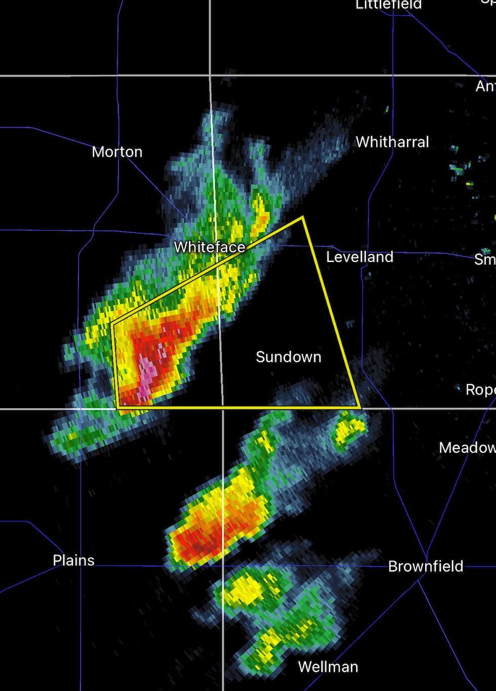
LUBBOCK, Texas (KCBD) – update 3:43 p.m. A severe warning in Hockley County will expire shortly. Scattered storms over Hockley and Terry counties are quickly moving NE, toward Lubbock. These storms are producing brief, heavy rain.
updated 3:13 p.m. Severe thunderstorm warning for parts of Cochran and Hockley counties until 3:45. The most intense part of this storm is capable of producing 1“ hail and 60mph gusts.
 Severe thunderstorm warning(KCBD)
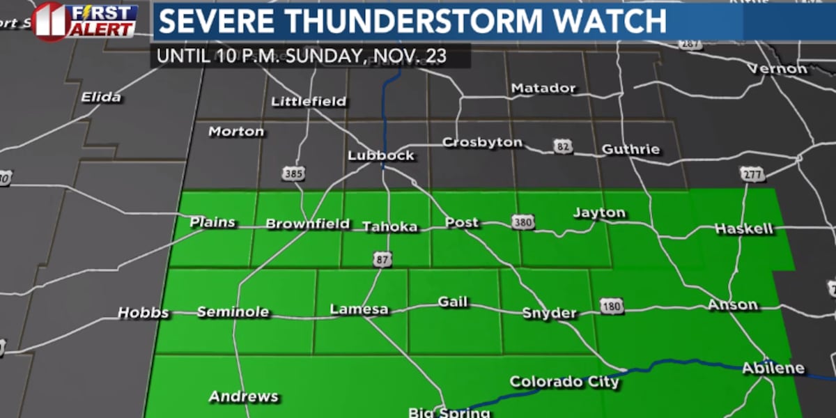
updated 2:32 p.m. – The Storm Prediction Center has issued a severe thunderstorm watch for the southern South Plains, including Plains, Brownfield, Tahoka, Post, Jayton, Seminole, Lamesa, Gail and Snyder. The watch goes until 10 p.m. shown in green below.
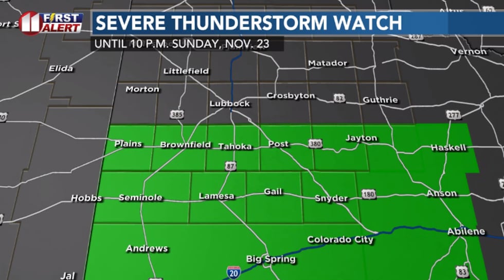 Severe thunderstorm watch in green until 10 p.m. CT Sunday, Nov. 23.(KCBD)
Around Lubbock and much of the South Plains, the rain and cloud cover has kept things cool, in the 50s. Farther south it’s in the 60s, even low 70s at Seminole and Andrews.
It’s more likely for storms to get stronger farther south, especially across the Permian Basin. But a few severe storms are possible in our area, which is why the watch was issued. Severe storms could have 1″ hail and 60mph gusts.
Area-wide, the chance for more rain and thunderstorms continues through this afternoon. In the watch area is where the potential for severe storms is a little bit higher.
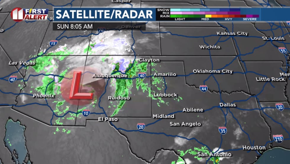
posted Sunday morning – Scattered showers and thunderstorms will continue moving across the area this morning into the afternoon.
There is an upper-level low over the Desert Southwest, which is providing the lift for the rain and thunderstorms ahead of it.
 Weather set-up Sunday morning(KCBD)
Individual showers and thunderstorms are moving quickly from SW to NE. When it’s not raining, it will stay cloudy and cool. High today in the upper 50s.
Instead of one-solid wall of rain, expect scattered clusters or individual cells. Coverage will be widespread enough that most people will get something, even if the rain comes in bursts.
Most will see around 0.10 to 0.25” of rain with heavier pockets off the Caprock.
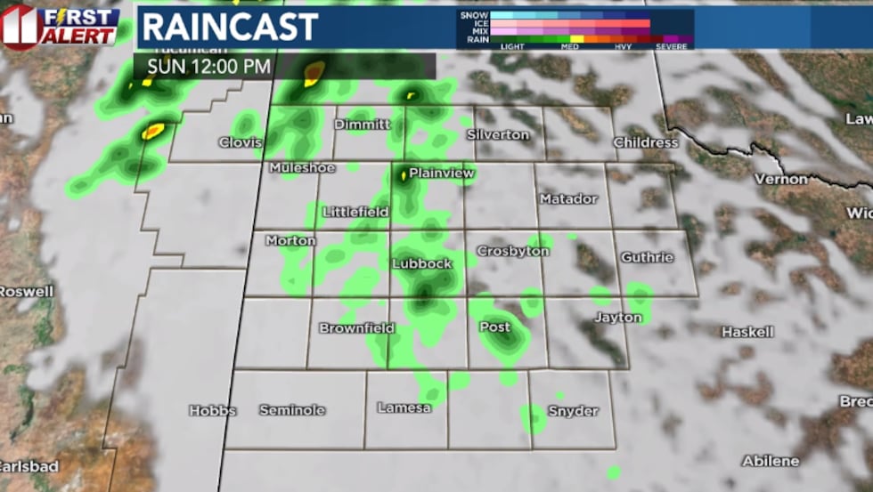 Computer model projection mid-day Sunday(KCBD)
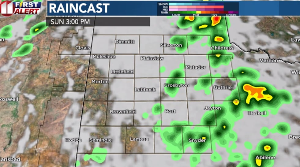 Computer model projection Sunday afternoon(KCBD)
The rain should be pushing east of the area this evening, though an isolated shower is possible through sunrise Monday.
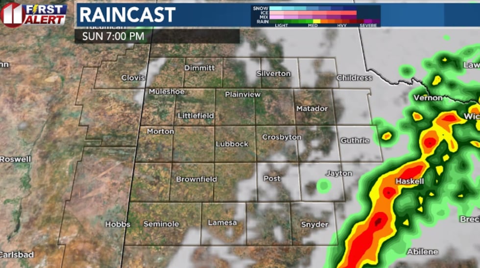 Computer model projection Sunday evening(KCBD)
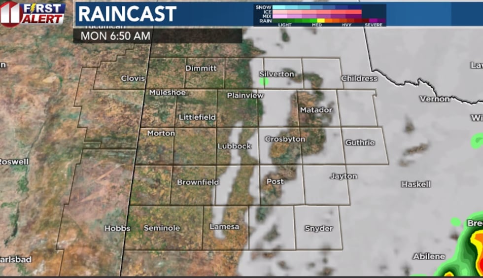 Computer model projection Monday morning(KCBD)
Severe potential
A few thunderstorms could become severe, with 1″ hail and 60mph gusts. The Storm Prediction Center mid-morning update shows a level 2 out of 5 risk over the southeastern part of our area, including Lamesa, Post and Jayton.
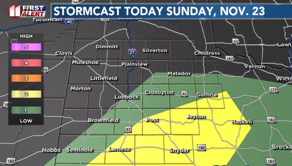 Storm Prediction Center severe outlook for Sunday(KCBD)
It’ll turn cooler again Wednesday, with the high in the 50s. Mid 60s with a good amount of sunshine on Thanksgiving.
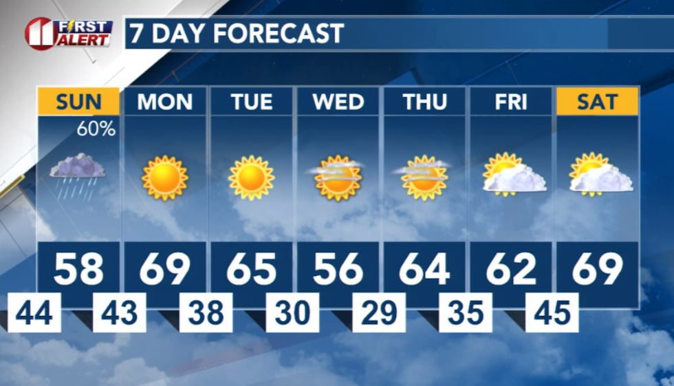 7 Day Forecast(KCBD)
Copyright 2025 KCBD. All rights reserved.