
The Brief
Cooler, drier weather is pausing the region Sunday before a renewed threat of severe storms and heavy rain arrives Monday.
Southeast Texas is under a Level 1 risk for both excessive rainfall and severe weather (strong winds/isolated hail) on Monday.
The weather is forecast to clear up significantly after Monday, providing favorable, cooler conditions for Thanksgiving holiday travel.
HOUSTON – Southeast Texas is enjoying a brief pause of cooler, drier weather Sunday before attention turns to a renewed threat of severe storms and heavy rain expected to arrive on Monday.
Monday storms possible
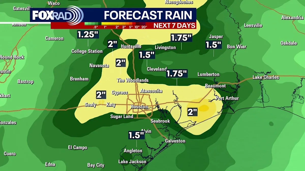
The weather shift follows recent rainfall that delivered isolated totals of 2 to 3 inches of “drought fighting” rain to parts of the region. Sunday is expected to be cooler and drier as a stalled front remains just off the coast, though an isolated shower cannot be ruled out.
Forecasters are watching Monday closely for returning thunderstorm potential as moisture streams in ahead of the next system.
The primary concerns are heavy rain and possible severe weather, especially Monday night through early Tuesday morning. All of Southeast Texas is currently under a Level 1 risk for excessive rainfall, which could lead to localized flash flooding.
Additionally, much of the area faces a Level 1 risk of severe weather, with that risk increasing to Level 2 further north. Strong winds and isolated small hail are the main threats being monitored.
Houston Thanksgiving Forecast
Looking ahead to the holiday week, the weather is expected to improve significantly after Monday’s potential disturbances, creating favorable conditions for travel and outdoor Thanksgiving plans.
Temperatures are set to drop, bringing a more seasonal feel to the area with lower humidity. Highs are expected to be in the 60s for Thanksgiving Day, with overnight lows falling into the 40s and 50s throughout the long holiday weekend.
7-Day Forecast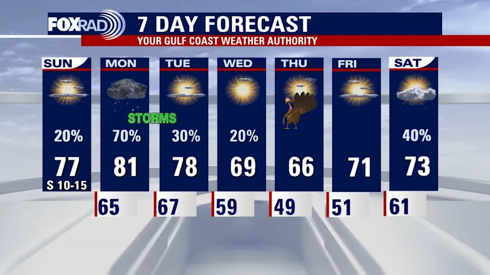
The Source
Information in this article is from the FOX 26 Houston Weather Team.