
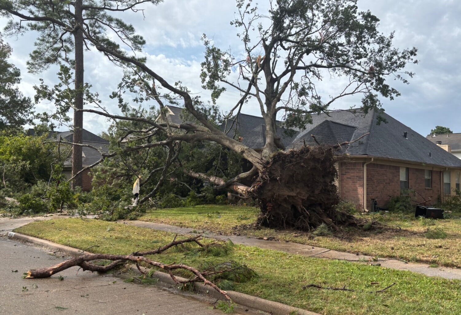
Photo courtesy of X user @emdal22
A tornado in the Houston area downed several trees in a neighborhood on Monday, Nov. 24, 2025.
A tornado touched down in northwest Houston on Monday afternoon as a line of thunderstorms moved through the region, according to the National Weather Service.
Cameron Self, a meteorologist with the weather service’s Houston and Galveston office, said preliminary information indicates a tornado was spotted in the Willowbrook area near the intersection of State Highway 249 and Grant Road.
“We do think there was a tornado,” Self told Houston Public Media shortly before 2 p.m. “We had a spotter site one pretty close to where we saw rotation in the radar, near 249 and Grant. There’s also evidence on radar that maybe there was a little bit of debris.”
Sign up for the Hello, Houston! daily newsletter to get local reports like this delivered directly to your inbox.
Tornado warnings were issued Monday afternoon for areas in northwestern Harris County and southwestern Montgomery County.
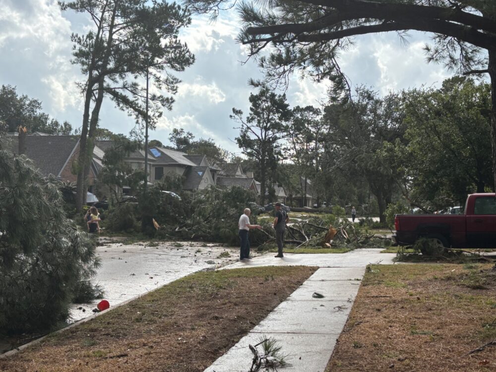
Houston-area residents and elected officials took to social media to share photos of storm damage, including fallen trees and damaged homes and rooftops. The online outage tracker for CenterPoint Energy, which supplies electricity to much of the Houston area, showed that more than 20,000 homes and businesses were without power at one point Monday afternoon.
“With reports of one tornado touchdown north of the Jersey Village area, we’re closely monitoring the weather as conditions continue to evolve,” Lena Dziechowski, CenterPoint’s lead meteorology specialist, said in a news release from the utility company. “An additional line of storms is expected late this evening with the potential for isolated strong wind gusts and lightning. Our teams are responding to each outage as safely and quickly as possible.”
Houston and much of Southeast Texas are under a tornado watch until 7 p.m. Monday. The tornado watch, which means conditions are favorable for the formation of tornadoes, applies to Harris, Fort Bend and Montgomery counties, along with 32 other counties in the region. Areas north of Interstate 10 are at the greatest risk for severe weather, according to Self.
“The primary concerns are going to be large hail, damaging wind gusts and even the potential for a few tornadoes,” Self said earlier Monday afternoon. “We’re watching the radar very closely.”
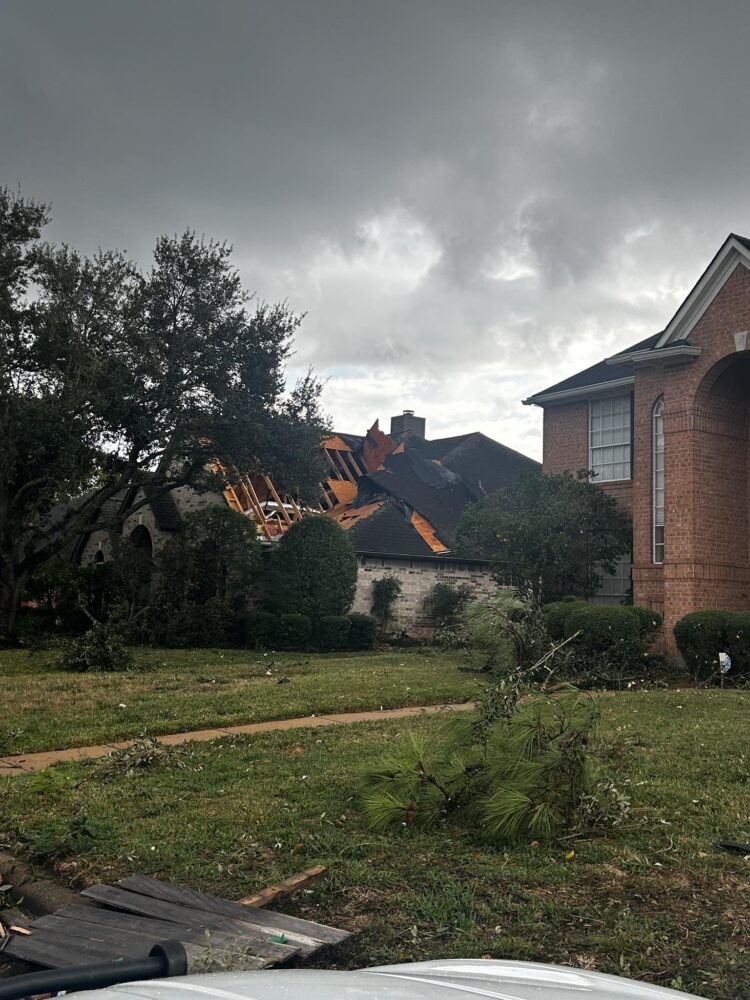
Harris County Precinct 4 Constable Mark Hermann via Facebook
A tornado damaged the roof of a home in the Spring area on Monday, Nov. 24, 2025.
More potential severe thunderstorms were in the forecast for late Monday night and early Tuesday, according to Self. There is an 80% chance of rain Monday night.
“I think rainfall totals generally are going to be manageable,” Self said. “We’ve had drought conditions, so the ground, the rivers, the bayous, they can handle quite a bit of rainfall. However, you could not rule out some localized flash flooding, particularly in a location that has poor drainage.”
The skies are expected to clear Tuesday, with sunshine in the forecast Tuesday through Friday. High temperatures on Wednesday and Thursday are expected to be in the 60s, according to the National Weather Service, which predicts lows in the 40s on those days.
“By tomorrow, this is out of here,” Self said of stormy weather. “As we approach the Thanksgiving holiday, it looks like we actually have some cooler weather coming down.”