
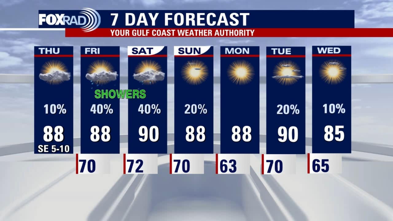
HOUSTON – There will be some small changes in the weather today with increasing clouds and a few possible drizzles. It will become slightly more humid as highs stay in the upper 80s.
Warm with subtle changes
Another unseasonably warm and mostly sunny day is ahead for Houston, with afternoon highs well above normal for mid-October. The extended stretch of warm afternoons shows little sign of breaking through next week.
Average highs for mid to late October are in the low 80s, but we’ll continue to rise into the upper 80s and even low 90s.
Elevated fire danger 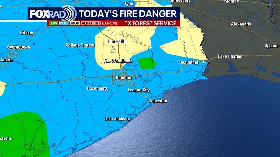
Dry vegetation and dry afternoon breezes have kept fire danger high, and burn bans remain active for much of Southeast Texas. The prolonged dry spell has pushed drought conditions deeper, with soils and grasslands extremely vulnerable to sparks.
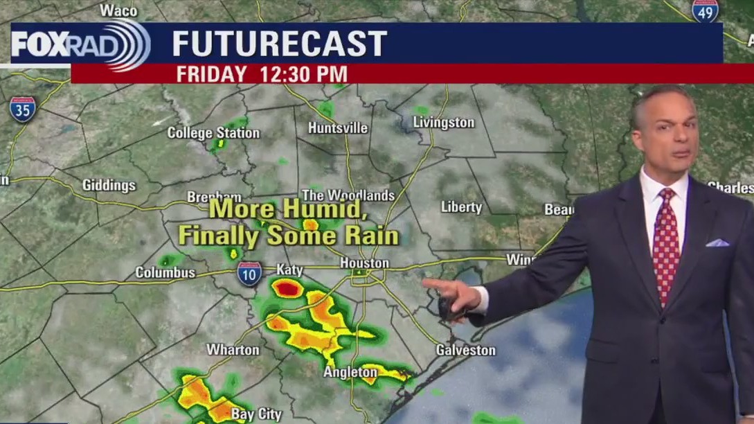
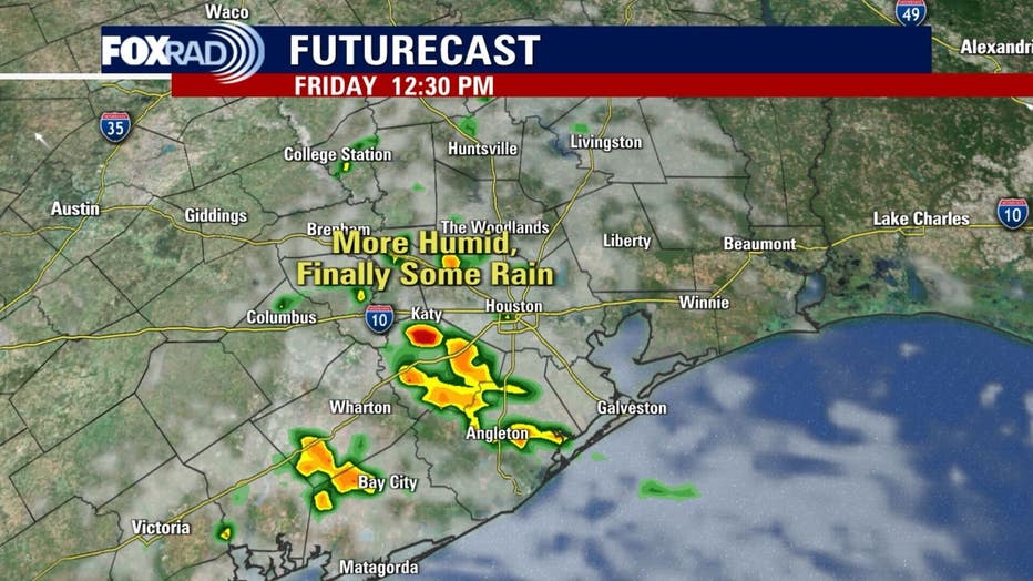
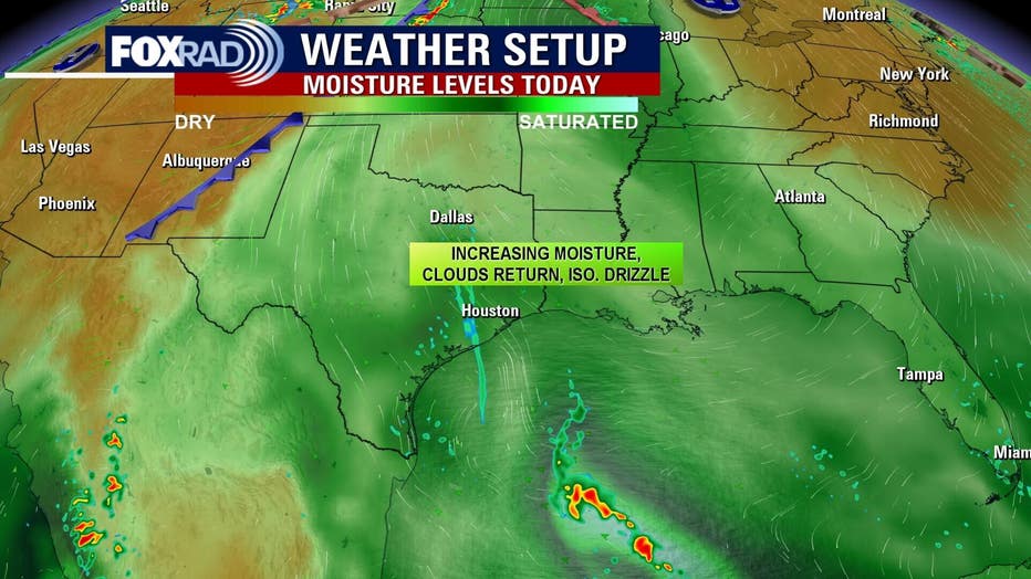 Moisture, rain on the way
Gulf breezes will return late today bringing a gradual rise in humidity. By Friday and Saturday, this added moisture will help trigger scattered showers and storms — offering the best chance in weeks for meaningful rainfall across the area.
Showers could briefly improve the wildfire risk, but it’s not going away any time soon.
The Source: Your Gulf Coast Weather Authority