
EL PASO, Texas (KTSM) — Happy Thanksgiving, Borderland! Hopefully you’ve been enjoying the warmer-than-average day. These weather conditions will continue into the weekend before a cold front pushes into the area, bringing cooler temperatures and very slight chances for precipitation.
Thursday night, the skies will be mostly cloudy with very calm winds from the northeast. The overnight low will be in the mid 40s.
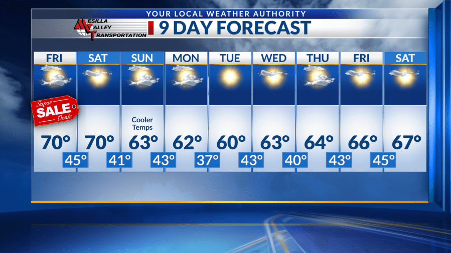
Friday and Saturday’s highs will be in the low 70s with some clouds throughout the afternoons. The air will remain dry with winds staying on the lighter side. Overnight lows will be in the low to mid 40s.
On Sunday, the region will see a weather shift as the result of a cold front pushing into the area. The system will bring additional moisture and cooler temperatures. However, chances to see any precipitation remain very low. The high temperature will be around 63 with the low in the low 40s.
Monday through Thursday, the high temperatures will continue to range below if not meeting the seasonal average in the low 60s. The lows will mostly be in the low 40s, and winds will continue to track on the light and calm end through both the days and nights.
Have a great rest of your holiday weekend!
Copyright 2025 Nexstar Media, Inc. All rights reserved. This material may not be published, broadcast, rewritten, or redistributed.
For the latest news, weather, sports, and streaming video, head to KTSM 9 News.