
LUBBOCK, Texas (KCBD) – Today and tomorrow will be dry, with plenty of sunshine both days, but wintry showers are possible later this week.
This morning was the coldest of the season to date. The lows, however, were not unusual for the time of year. Though about ten degrees below average for early December, they weren’t cold enough to set records. Lubbock’s December 2 record low is 13°, set on the date 110 years ago (1915) and tied on the date 40 years ago (1985).
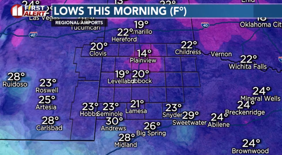 Tuesday morning saw the coldest temperatures of the season to date.(KCBD First Alert)
This afternoon will be warmer, relative to the past few days and seasonal averages. Lubbock’s December 2 average high is 58°.
The day will be sunny but it will become windy. Especially this afternoon. The southwesterly wind will increase to around 20 to 30 mph with gusts from 30 to 40 mph possible. There may be patchy blowing dust, mainly near open fields.
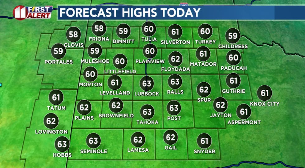 Temperatures rebound to about five degrees above average Tuesday afternoon.(KCBD First Alert)
Wind speeds will drop off late in the afternoon, nearing sunset. The southwest wind is likely to range from around 10 to 20 mph. Otherwise clear and not as cold tonight. Low temperatures will be near to just above the average for the time of year.
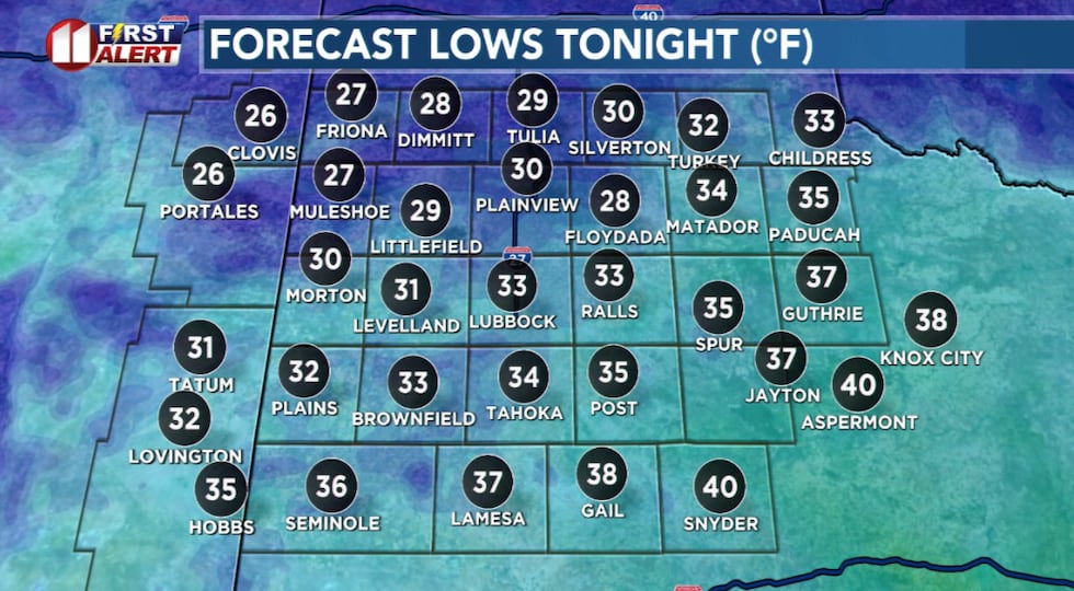 Not as cold tonight, with low temperatures slightly above average for the time of year.(KCBD First Alert)
The next cold front will sweep across the KCBD/FOX34 viewing area tomorrow. While the morning will be milder than recent mornings, the afternoon will be chilly. Wednesday high temperatures will only be in the 50s for most of the area. It is possible the northern viewing area may not quite make it to 50 degrees, and it’s possible the southern viewing area may peak above 60 degrees before the cooler air arrives there.
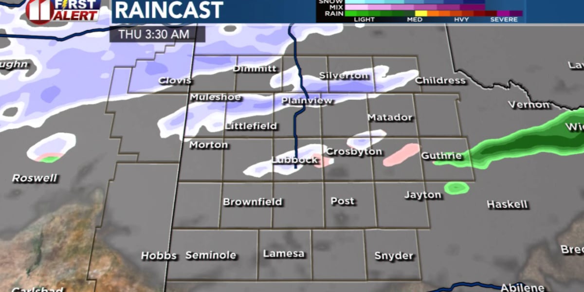
As the cold air settles in Wednesday night into Thursday morning, light wintry showers may develop. Based on today’s data, the precipitation may begin Wednesday night as light snow in the northwestern viewing area and as a light rain elsewhere.
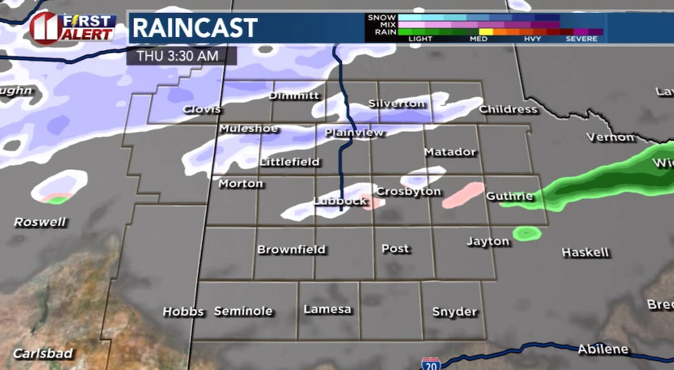 Light wintry showers are possible Wednesday night through Thursday morning.(KCBD First Alert)
Light snow showers, though favoring the northern viewing area, will be possible through Thursday morning. At this time, I still anticipate light amounts. Likely well under an inch in Lubbock, with perhaps around one to two inches over the northwestern viewing area.
Remain weather aware and keep up with our latest forecast.
ON THIS DATE
On this date in 2011 a weather system tracked over the South Plains, creating widespread freezing drizzle. Light ice accumulations began quickly after the onset of precipitation. One person died in a vehicle accident on Interstate 27 south of Hale Center in the early morning hours. Many accidents were reported in the area but no serious injuries were reported in Lubbock.
(National Weather Service Lubbock)
Copyright 2025 KCBD. All rights reserved.