

HOUSTON – Expect rounds of rain to impact the rest of your week in Southeast Texas.
Rain increases tonight, lingering until Friday
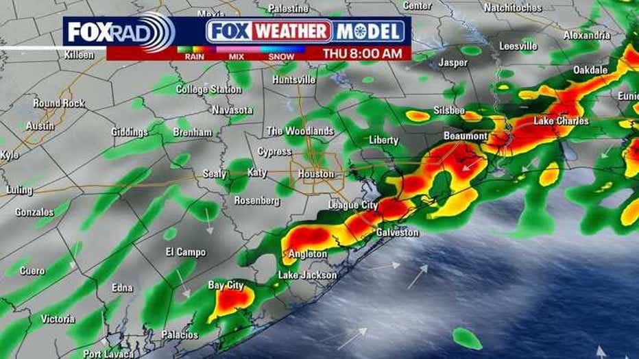
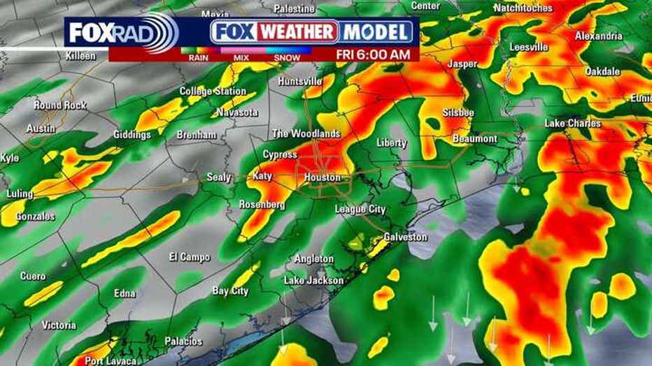
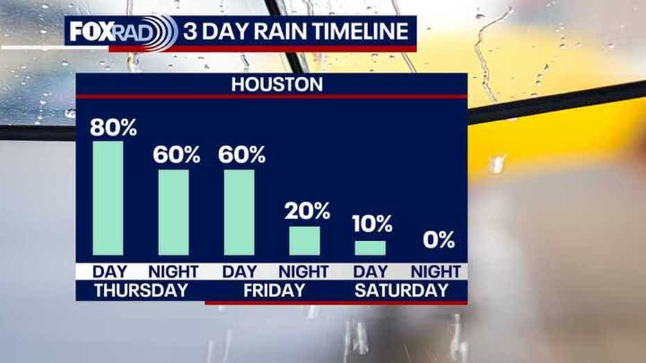
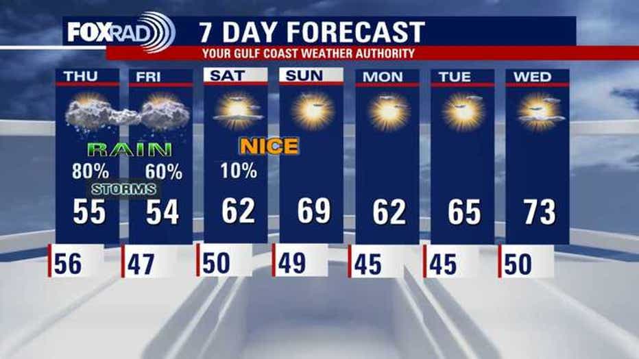
Rain becomes more likely late tonight into Thursday, continuing into Friday.
We are at a Level 1 risk of flash flooding for tonight into tomorrow.
A few strong storms are also possible over the next few days, especially south of I-10.
The main risk overnight would be hail and possibly some wind gusts near 40-50 mph.
Periods of steady rain, possibly heavy at times, could lead to ponding and slick streets for the Thursday morning commute. There is a chance for isolated street flooding, especially for areas near and south of I-10.
Showers are expected through at least early Friday, then we’ll have some welcome clearing.
 Looking forward to a nice weekend
By Saturday and Sunday, the skies should clear up.
Temperatures heat up some, especially on Sunday, and you’ll get a mix of sun and clouds.
Rain chances are low and humidity should be comfortable with highs in the 60s and even low 70s in some spots.
 Next week starts off pleasant with sunshine
Next week is looking awesome between Monday and Wednesday.
We’ll start off a little cool in the 40s Monday morning and climb to the low 60s Monday afternoon with lots of sunshine.
We’ll make it into the middle 60s Tuesday with bright skies.
By Wednesday, we get even warmer with temperatures rebounding to the 70s with still dry conditions.
Enjoy!
The Source: Your Gulf Coast Weather Authority