
The Brief
Harris County now added to long burn ban list
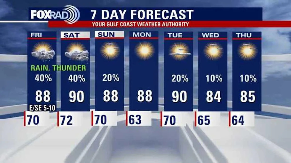
Humidity gradually increasing
Rain chances build Friday and Saturday
HOUSTON – The extended stretch of unseasonably warm afternoons shows little sign of breaking through early next week. Average highs for mid to late October are in the low 80s, but we’ll continue to rise into the upper 80s and even low 90s.
Elevated fire danger
Dry vegetation and dry afternoon breezes have kept fire danger high, and burn bans remain active for much of Southeast Texas.
Harris County is the latest county to be added to the burn ban list. So outdoor burning is not allowed.
More on Harris, Matagorda County burn ban
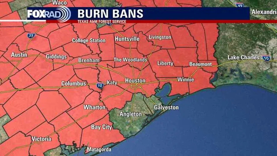
The prolonged dry spell has pushed drought conditions deeper, with soils and grasslands extremely vulnerable to sparks.
Moisture and rain on the way
Gulf breezes have returned bringing a gradual rise in humidity. By Friday and Saturday, this added moisture will help trigger scattered showers and storms — offering the best chance in weeks for meaningful rainfall across the area.
Showers could briefly improve the wildfire risk, but it’s not going away any time soon.
Tropical weather update
The National Hurricane Center is now monitoring a new tropical wave in the central Atlantic. This tropical wave is expected to continue moving west and eventually into the Caribbean sea. It has a low 20% chance of developing into a tropical system over the next 7 days in the Caribbean.
Tropical development is not expected in any other part of the Atlantic basin for now.
Keep in mind that hurricane season runs through the end of November, so stay alert.
The Source
Your Gulf Coast Weather Authority