
LUBBOCK, Texas (KCBD) – Following our chilly Sunday and Monday, temperatures will climb to above average today. Both low and highs will remain above average through the first days of Winter.
 MUCH warmer this afternoon!(KCBD First Alert)
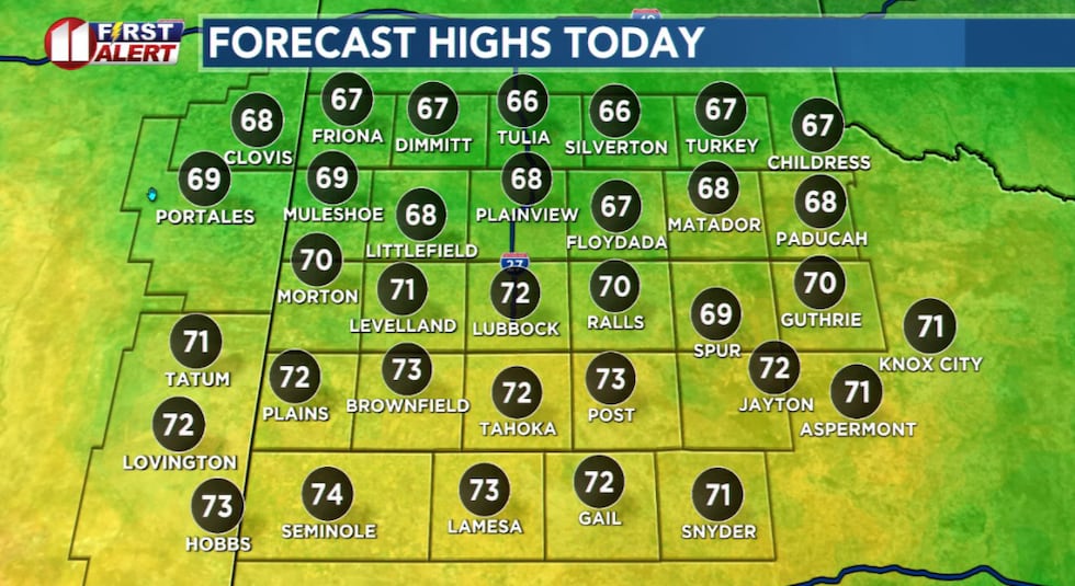
Sunshine and a westerly breeze will help push this afternoon’s temperatures to 15 or more degrees above mid-December averages.
 Seasonally mild temperatures return today and continue into next week.(KCBD First Alert)
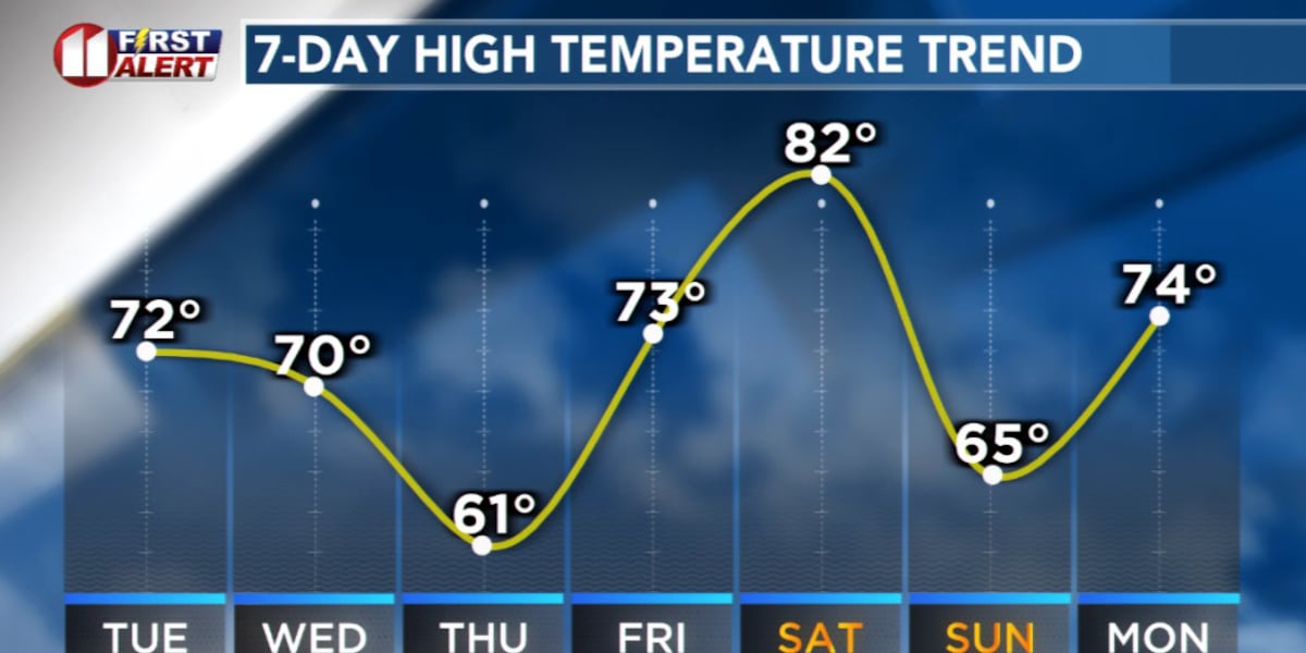
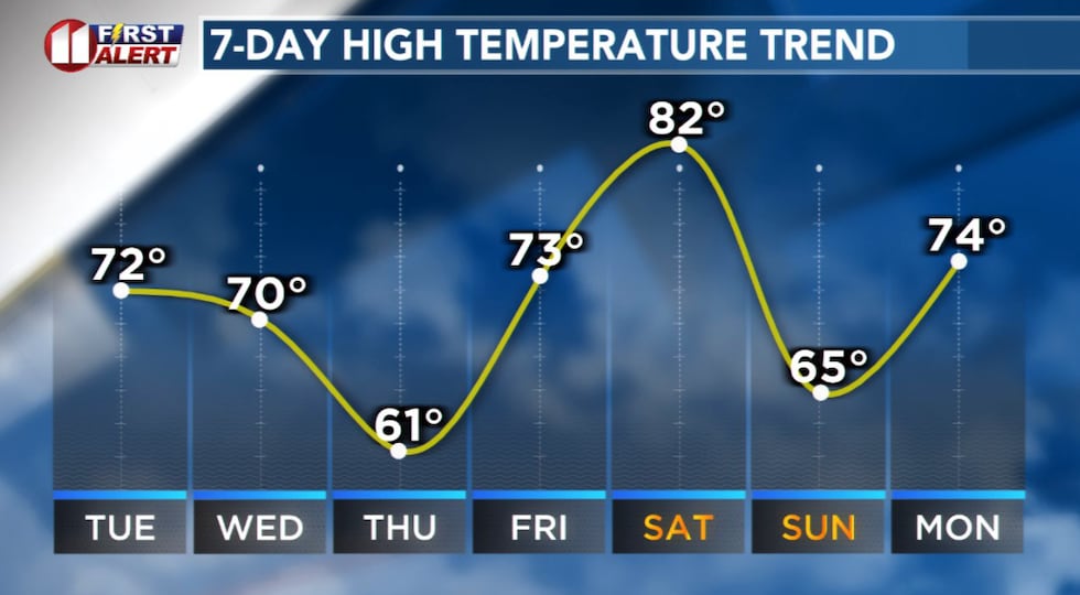
The remainder of the week we will see temperatures vary day to day but remain above average, a few clouds will come and go but skies will remain generally fair, and there is no hint of a drop of rain or flake of snow.
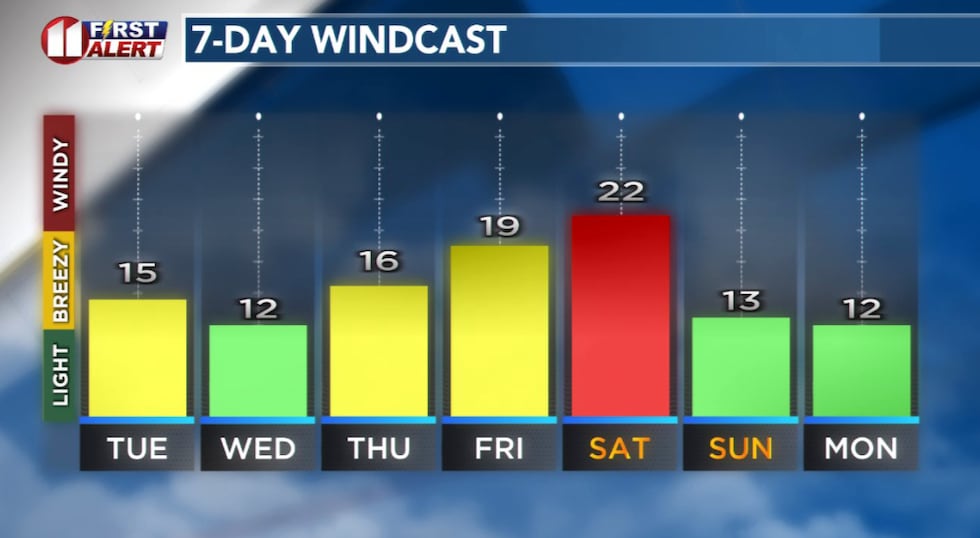 Forecast peak sustained winds are shown in this graph. Peak gusts will exceed the values shown here.(KCBD First Alert)
The warm and dry weather is consistent with the overall pattern dominating our area late this Autumn and early Winter. It’s a La Niña pattern. While La Niñas (and their counterpart, El Niños) vary from cycle to cycle, for our area it typically results in just these types of conditions. We can, and do, still have some days with below average temperatures and even showers. Overall, however, a La Niña period is drier and warmer than average.
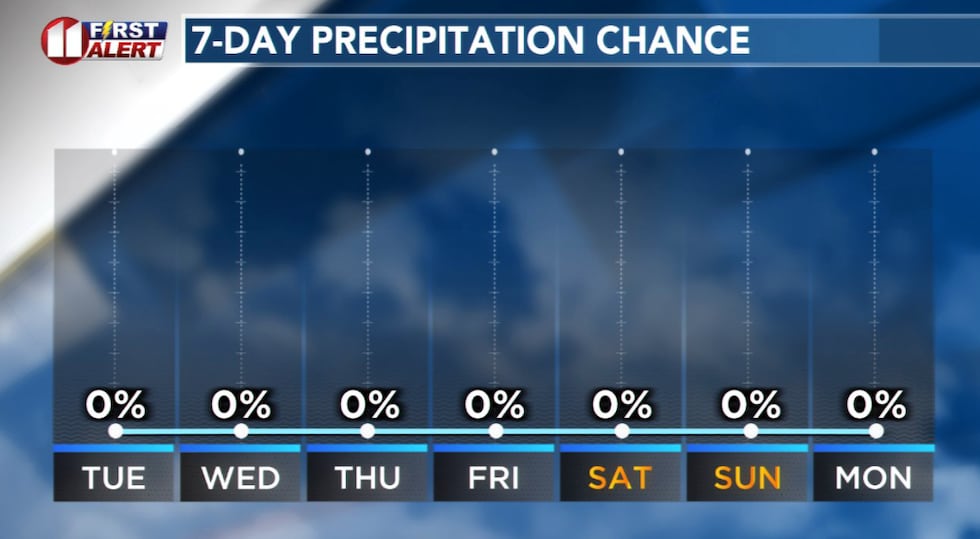 The same pattern keeping temperatures above average will keep our area dry into next week.(KCBD First Alert)
I expect more of the same next week, Christmas Week.
On This Date
On this date in 1977, an incredibly fierce dust storm enveloped all of the South Plains region. Blowing dust due to severe wind gusts in excess of 60 mph lowered visibility to a 1/2 mile or less for several hours straight. At the Lubbock airport the visibility fluctuated from 1/2 mile to as low as 1/8 mile for at least six continuous hours before finally improving after sunset. The next time Lubbock would record such a long-lasting dust storm would not happen for 35 years later, on December 19, 2012!
(National Weather Service Lubbock)
Copyright 2025 KCBD. All rights reserved.