
LUBBOCK, Texas (KCBD) – South Plains temperatures will be on a rollercoaster this weekend and next week. First, however, there is a chance of showers and thundershowers tonight.
This afternoon a sunny sky and a slight southwesterly breeze will contribute to highs around 12 to 14 degrees above average for mid-October. Lubbock’s average high for the date is 75°.
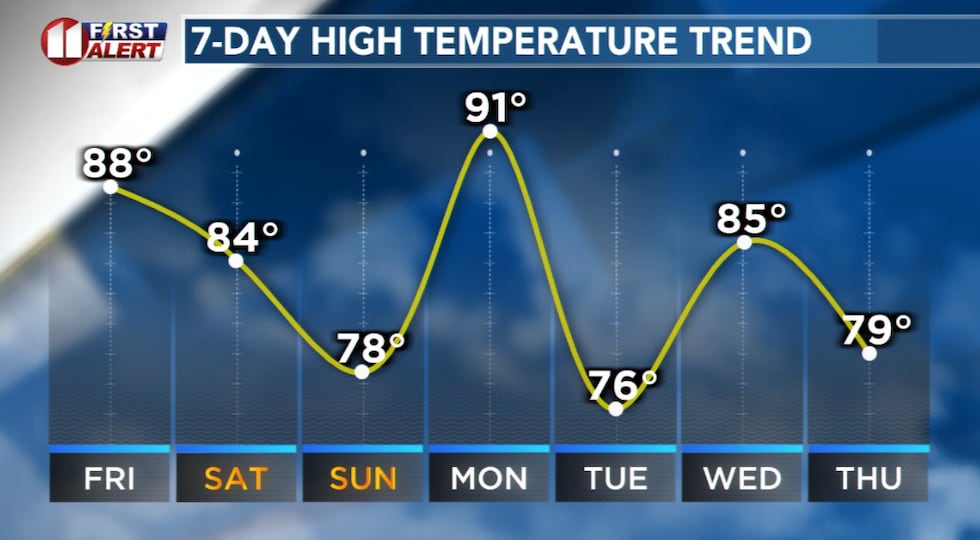 A series of cold fronts will move across the area, warming before and cooling after each front.(KCBD First Alert)
Mid- to late evening there is a slim chance a thunderstorm may clip the far southeastern viewing area. There’s a possibility then football games and other outdoor activity could be interrupted there, generally in the Snyder area.
A greater chance of rain begins around midnight.
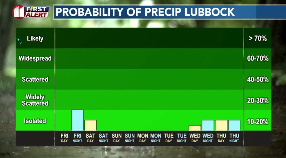 Scattered rain showers and a few thundershowers are likely in the area Friday night.(KCBD First Alert)
Scattered showers and a few thundershowers are likely overnight, first over the western and central viewing area. The rain will gradually shift eastward, though a chance of rain will linger over much of the central and eastern KCBD/FOX34 area until sunrise or so. Some rain may fall over the eastern viewing area through late morning Saturday.
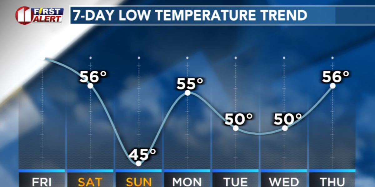
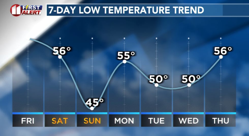 The chilliest air of the season so far will arrive Sunday morning.(KCBD First Alert)
A cold front will sweep south across West Texas late Saturday – Saturday night. Temperatures will tumble in dry air behind this front. Sunday morning will be our chilliest so far this Autumn. The temperature, however, will only drop to around the average low for the time of year.
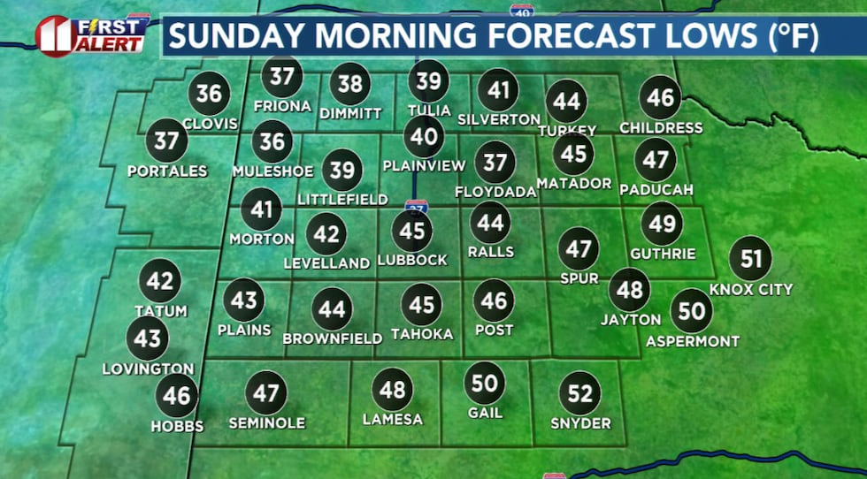 Sunday morning likely will be the chilliest here since early May. Watch for possible updates to the forecast.(KCBD First Alert)
But there’s more. The very chilly forecast low is only part of the story.
The cooler air will arrive on a brisk northerly wind. That will be cold if you are in that wind Sunday morning.
Copyright 2025 KCBD. All rights reserved.