
Friday will be breezy, warm and sunny in North Texas before a big change comes this weekend.
Temperatures started off milder Friday morning, with most of the region in the mid to upper 60s with mostly clear skies. Southerly winds will pick up throughout the day, gusting to 25 mph and helping to boost temperatures back into the upper 80s.
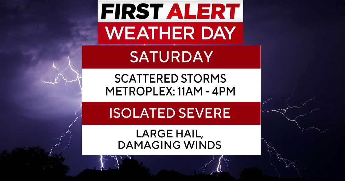
A cold front arrives Saturday bringing scattered rain and storms to North Texas.

Saturday is a First Alert Weather Day due to the threat of isolated strong to marginally severe storms.
It is the last weekend of the State Fair of Texas as well as the Bluebonnet Battle between TCU and Baylor in Fort Worth, so lots of people have outdoor plans.
Please remain weather aware on Saturday, as models are now showing scattered storms in the Metroplex between 11 a.m. and 4 p.m.

The Storm Prediction Center has shifted the severe threat further west to include the Metroplex. An isolated severe storm may produce quarter size hail and winds to 60 mph.
The threat for severe weather is even higher in East Texas.
The storms will clear out by Saturday evening with cooler and drier air moving in behind the cold front, bringing a taste of fall on Sunday with highs in the 70s and breezy northerly winds.
Monday morning will see temperatures drop into the 50s before warming back up to near 90 degrees.
