
A recent image of planet Earth taken from the NOAA GOES satellite has left internet users dismayed. The image shows unusual colors of the Earth. Or rather, colors that society wasn’t used to seeing. There is speculation as to whether this could be an optical effect of the image quality or, as many claim, a tragic case of global warming.
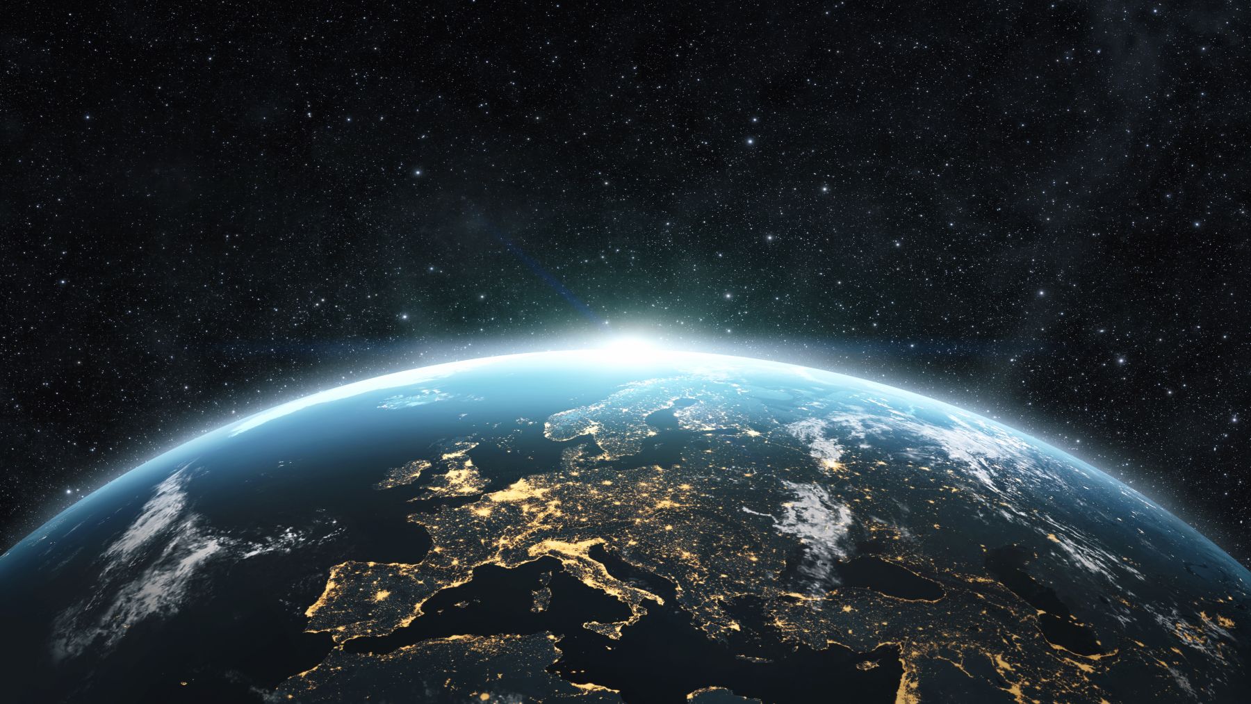
What has most caught the attention of internet users is the green, which represents vegetation, appears less vibrant and more muted
This photograph of Earth was captured on Saturday, June 21, 2025, at 11:50 a.m. (UTC) by the National Oceanic and Atmospheric Administration (NOAA) GOES satellite. What has most caught the attention of internet users is the blue tones that stand out strongly, while the green, which represents vegetation, appears less vibrant and more muted than in previous captures. Some users suggest that it could be an effect related to the technology used to capture the image.
GeoColor technology has unique features for this type of image: it identifies elements such as smoke, blowing dust, smog, and anything with a unique color property. Social media is full of opinions and doubts. Some believe the color shift could be due to the combination of visible and infrared light used in the photograph, as noted above.
GOES sent back a GeoColor frame of the entire planet every ten minutes
While others see this difference as an indication that green areas could be decreasing, pointing to potential problems such as deforestation or the impact of climate change. It’s really difficult to say, and only experts can give a thorough assessment of how the Earth appears from space.
Orbiting 35,786 km above the equator, GOES sent back a GeoColor frame of the entire planet every ten minutes, fusing infrared data with a static map of city lights so the view remains vivid long after sunset.
This image never ceases to intrigue. One way or another, people continue to wonder if it’s just a visual effect or if we’re witnessing a silent but significant transformation in the health of the planet. In any case, the satellite image is no longer dazzling. It can differentiate low-lying liquid water clouds from high-lying ice clouds at night using nighttime geolocation, a technology that uses city lights to georeference the light, helping to determine whether clouds (such as fog) are affecting populated areas.
Higher spatial resolution and faster coverage for more accurate forecasting and real-time mapping
There’s no denying the accuracy. The Geostationary Operational Environmental Satellite (GOES) R Series is “the nation’s most advanced fleet of geostationary weather satellites. The GOES-R Series significantly improves the detection and observation of environmental phenomena that directly affect public safety. These satellites provide advanced imagery “with higher spatial resolution and faster coverage for more accurate forecasting, real-time mapping of lightning activity, and improved monitoring of solar activity and space weather,” according to NOAA.
Facts are facts, global warming is causing practically irreparable damage to planet Earth
The conclusion we can draw is that this is an internet phenomenon, one of those that remain in the collective imagination, and almost no matter what the correct answer is, the curiosity to know the answer will remain. What is a fact is that, on the one hand, technology has evolved enormously, and the quality and precision of the satellite is undeniable. On the other hand, what is a fact is that global warming is causing practically irreparable damage to planet Earth. Perhaps this will help many people start taking the environmental problem seriously. A problem created by human beings. It can be seen in the high temperatures, the changing tides, the biodiversity, the seas, the rivers, the forests, the glaciers… Facts are facts.