
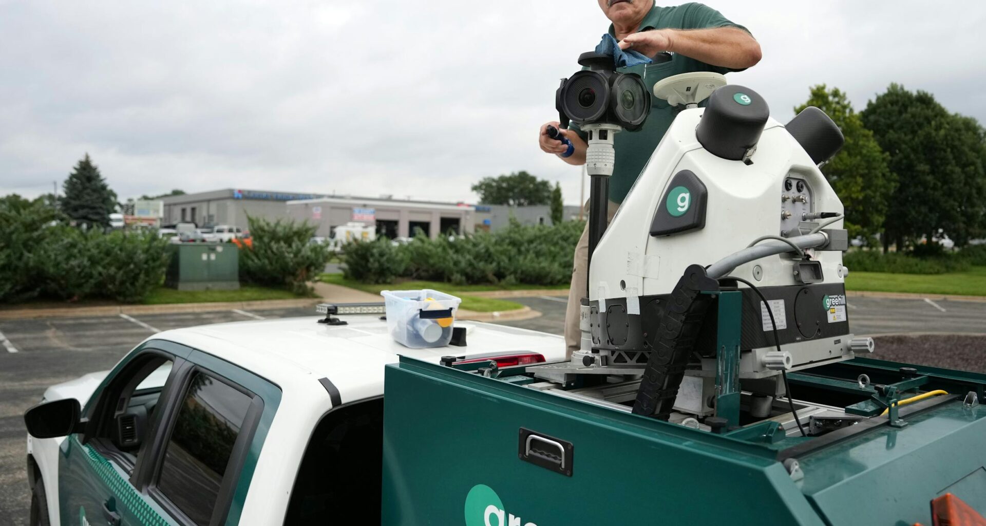
Eric Akers spends his days driving around cities in a truck with a machine on top snapping photos and sending out invisible pulses of light.
Occasionally, someone strikes a pose, mistaking him for the car that makes Google Maps. But Akers is creating something different: a “smart tree inventory” that logs the height, diameter, branch patterns and other data on trees along the roadside.
“It’s the creme de the creme” in new tree technology, said Plymouth City Forester Paul Buck, who has been working with Davey Resource Group and Greehill to create a database for the city. Plymouth and Bloomington are the first two cities in Minnesota to use the new tool.
“This inventory will give us the data to make decisions around urban forestry for many years to come,” said Dave Hanson, assistant director of parks and natural resources for the city of Bloomington.
Forestry crews would typically send teams out to walk local streets and paths in their communities and log various details on each tree they spot, a process that can be somewhat subjective, Buck said.
Eric Akers, a lead navigator with Greehill, runs a mobile lidar scanning system to create a “smart tree inventory” city planners can use to better manage urban trees. (Anthony Souffle/The Minnesota Star Tribune)
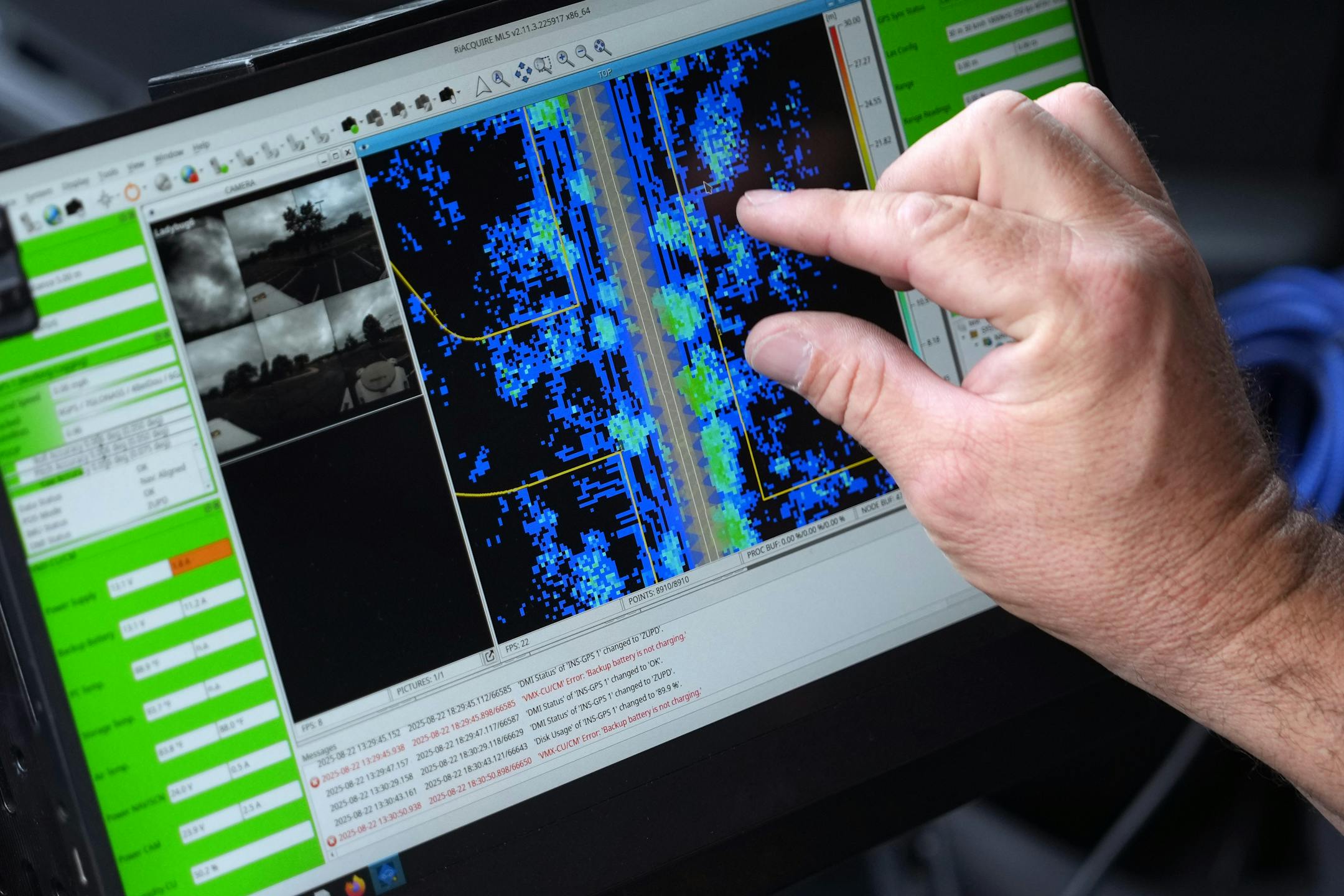
When creating a “smart tree inventory,” techs like Ackers drive around a city with lidar — light detection and ranging — tools that collect thousands of points of data that can be used to gauge the health of a tree.
“The short version of what lidar is, it uses a laser light that pulses out from a sensor and the laser is referred back to the same sensor,” said Jacob McMains, area manager for Davey Resource Group, which runs the technology. When that data comes back, a computer creates a 3D replica of the tree.