
![]()
ASHEVILLE, N.C. (WLOS) — Tropical Storm Imelda formed in the afternoon of Sunday, Sept. 28.
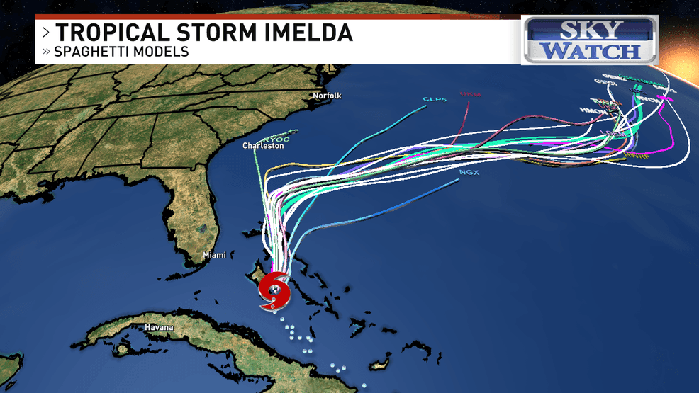
Tropical Storm Imelda is about 95 miles southwest of the Central Bahamas and drifting slowly northwestward. Tropical Storm watches and warnings are up for most of Florida’s east coast east of I-95.
LARGE LANDSLIDE SHUTS DOWN THE GATLINBURG BYPASS IN TENNESSEE INDEFINITELY
Tropical Storm Imelda is expected to stay well offshore. While it could bring some heavy rain to coastal areas of the Carolinas, the local impacts in western North Carolina will be minimal. Those impacts include scattered showers and thunderstorms for both WNC and the Upstate on Monday, Sept. 29, and Tuesday, Sept. 30.
INTERVIEW: GOV. JOSH STEIN SPEAKS ON FEMA, FUNDING, AND RECOVERY 1 YEAR AFTER HELENE
In addition, it will get breezy in the foothills and the Upstate with northeasterly winds gusting up to 25 mph, also on Monday and Tuesday.
Hurricane Humberto is now a major Category 5 hurricane on the Saffir-Simpson scale, but it will remain out over open water and is not a threat to the United States.
Click HERE to view a tropical tracker under “Tropical Weather” on News 13 or click HERE to keep track of Tropical Storm Imelda.