
NOAA satellites have witnessed some pretty extreme events, from massive wildfires and explosive volcanic eruptions to a 515-mile-long lightning flash. Along the way, the satellites have also tracked many record-breaking hurricanes, using a variety of instruments and data products to provide a comprehensive picture of these storms. NOAA satellites provide early warning that a storm is forming, monitor and track the movement of storms, and estimate storm intensity. They also aid emergency response to flooding from landfalling tropical systems. From measuring the most intense to the fastest developing hurricanes, NOAA satellites have provided critical information for forecasters to understand and predict these powerful storms and help communities prepare for their impact.
Most Intense Hurricane in the Western Hemisphere: Patricia (2015)
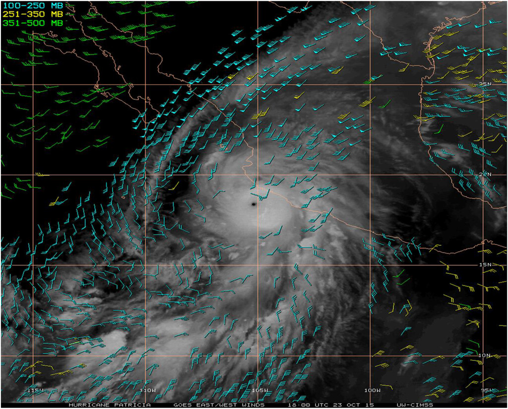
In October 2015, Hurricane Patricia became the most intense hurricane on record in the Western Hemisphere, breaking records for both maximum sustained winds and central pressure. On Oct. 20, a tropical depression formed in the eastern Pacific that became Tropical Storm Patricia later that day. Patricia strengthened into a hurricane on Oct. 21.
After a period of rapid intensification on Oct. 22, Patricia achieved Category 5 strength (maximum sustained winds of 157 mph or higher) on Oct. 23, and further intensified that day until it reached maximum sustained winds of 215 mph. Patricia’s lowest central pressure during maximum intensity was 872 millibars. Pressure is another way to measure the strength of a hurricane. Typically, the lower the pressure, the stronger the hurricane.
NOAA’s GOES-13 and GOES-15 satellites provided important information about Hurricane Patricia’s winds throughout the lifespan of the storm. Scientists use sequences of geostationary satellite images to track cloud features and water vapor. This information helps them estimate atmospheric motion and provide important information about winds at different levels in the atmosphere.