
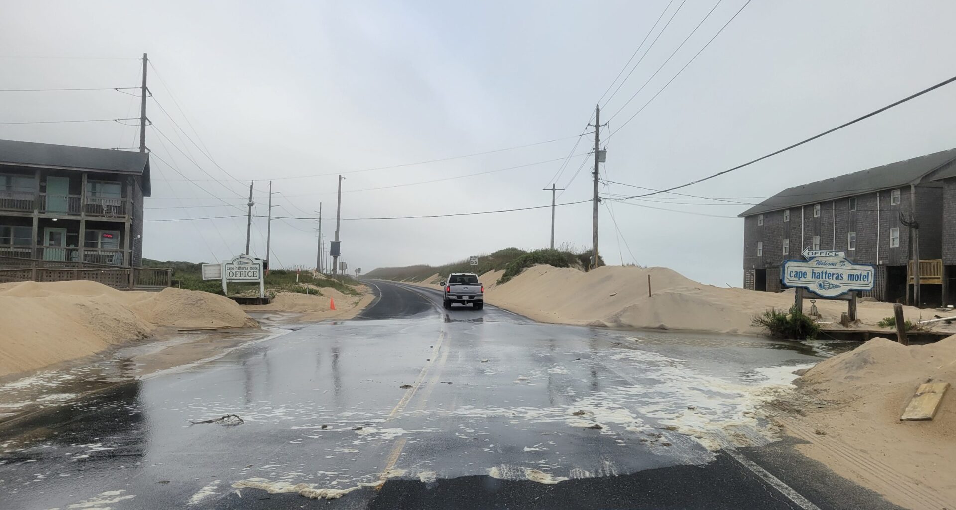
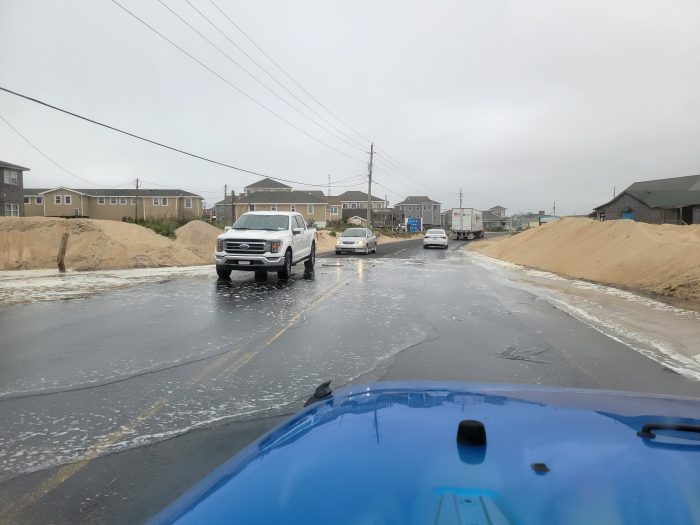
Ocean overwash was reported in northern Buxton and northern Hatteras Village on Tuesday morning, hours ahead of the approximate 2:15 p.m. high tide. N.C. Highway 12 remained open and passable on Hatteras and Ocracoke Islands as of 10 a.m. Tuesday, but flooding is expected to worsen as Hurricanes Humberto and Imelda pass offshore.
The long-duration coastal swell event is expected to bring hazardous marine and coastal conditions to the Outer Banks beginning Tuesday and continuing through much of the week, according to the National Weather Service (NWS) Newport/Morehead City office
The combination of persistent northeast winds, high surf, and increasing wave periods will create elevated flooding risks along soundside and oceanside locations, including vulnerable portions of NC Highway 12 on Hatteras and Ocracoke Islands.
Coastal Flood Warnings and Advisories in Effect
A Coastal Flood Warning has been issued from Tuesday morning through Friday afternoon, with Coastal Flood Advisories extending through Thursday for multiple inland and coastal waterways. Minor to moderate coastal flooding is expected, with 1–3 feet of inundation above ground level (AGL) possible in the most vulnerable locations
The strongest oceanside impacts are forecast for Ocracoke and Hatteras Islands, where overwash and roadway impacts are possible along stretches of NC-12 with weakened dune structures. Soundside flooding is also likely along the southern Pamlico Sound, as well as the Neuse, Bay, Pamlico, and Pungo Rivers, due to strong, persistent northeast winds.
Winds and Waves Building Midweek
Wave periods are forecast to peak between 14 and 16 seconds on Tuesday, with elevated wave energy persisting through at least Friday. Winds will strengthen along the Outer Banks midweek, with gusty northeast flow contributing to rough seas and higher surf heights
The NWS has issued a Wind Advisory for portions of the Outer Banks and Gale Warnings for some coastal waters.
Dangerous Rip Currents and Surf Hazards
The NWS warns that dangerous, life-threatening rip currents are expected all week, along with large breaking waves impacting beaches all along the Outer Banks.
 North Buxton at 9:30 a.m. Photo by Joy Crist
A list of local Outer Banks resources for information is below.
For alerts and notifications from Dare County on a customizable list of events or emergencies, (including hurricane evacuations and updates), visit https://www.darenc.gov/departments/emergency-management/emergency-alerts.
For rip current information and other beach hazards, sign up for text alerts from Dare County, ocean rescue agencies, and the National Weather Service by texting “OBXBeachConditions” to 77295.
For real-time flood maps that show water level rises throughout Hatteras and Ocracoke Islands, (as well as optional alerts), visit the NC Flood Inundation Mapping and Alert Network.
For information on the local forecast, visit weather.gov/mhx for general weather information, or the National Weather Service office in Newport/Morehead City’s Facebook page at https://www.facebook.com/NWSMoreheadCity/.
For up-to-date information on tropical conditions, follow the NWS at gov/mhx/tropical or visit the National Hurricane Center’s website. Just pay attention to all info, and not just the cone graphics.
For updates regarding road conditions, visit DriveNC.gov and follow the North Carolina Department of Transportation and NCDOT NC 12 on Facebook. The Dare County Sheriff’s Office also shares local road condition updates on its Facebook page.
To get notified of ferry delays or cancellations, sign up for text and/or email alerts via the N.C. Ferry System’s FINS system: www.ncdot.gov/fins.
For up-to-the-minute local information on hurricanes, as they happen, listen to Radio Hatteras at 101.5 (Avon through Hatteras) and 99.9 (Tri-villages), or visit them online at https://www.radiohatteras.org/.
For online news coverage on active storms, continue to check the Island Free Press.