Coastal flooding and hazardous ocean conditions are expected to peak on Wednesday afternoon and continue through Thursday as long-period swells from Hurricanes Humberto and Imelda continue to impact the Outer Banks.
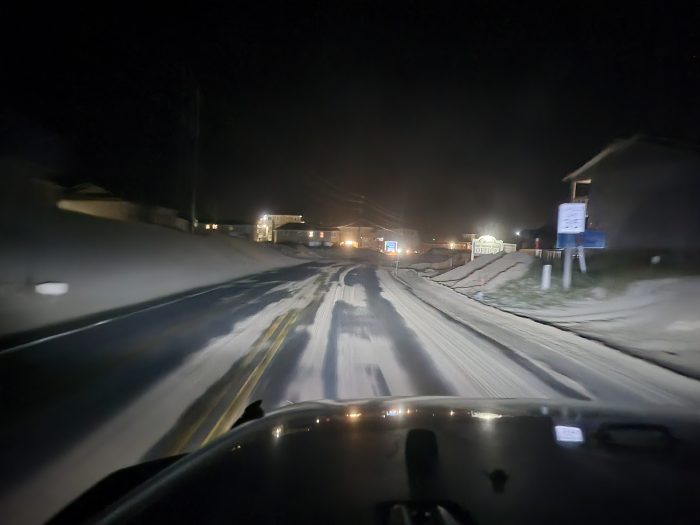
 N.C. Highway 12 on northern Ocracoke Island on Wednesday morning.
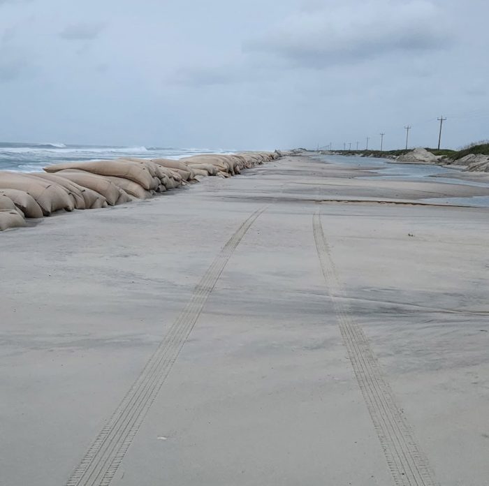
N.C. Highway 12 on Hatteras Island remained open and passable following Wednesday’s 2:30 a.m. high tide, with minimal additional overwash. Roughly six inches of standing water remains north of Hatteras Village, with sand on other stretches of the roadway.
“For now, travel on NC 12 on Hatteras Island should be avoided several hours before and after the upcoming high tides and please give way to the Road Pros as they work to keep NC 12 safe,” said Dare County Emergency Management Director Drew Pearson.
N.C. Highway 12 remains closed on northern Ocracoke Island, with Hatteras-Ocracoke ferry service suspended. The North Carolina Department of Transportation stated in a Tuesday update that the road will likely be closed until at least Thursday.
All Dare County Schools will have a remote learning day on Wednesday, October 1.
The National Weather Service Newport/Morehead City office reports that confidence remains high regarding a “long-duration and impactful swell event,” with the greatest flooding and overwash threats coinciding with the Wednesday afternoon high tide around 3:00 p.m.
 N.C. Highway 12 in Buxton at 5:00 a.m. Wednesday. Photo by Joy Crist.
Marine, land, and coastal hazard alerts remain in effect across the region, including a Coastal Flood Warning from Oregon Inlet to Cape Lookout through Friday afternoon, and Coastal Flood Advisories for areas north of Oregon Inlet and along the Neuse and Pamlico Rivers through Thursday
A Wind Advisory has also been expanded northward to include the Northern Outer Banks. Gale Warnings remain in place for most adjacent coastal waters.
Dangerous surf and life-threatening rip currents are expected to continue through the end of the week.
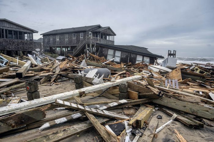
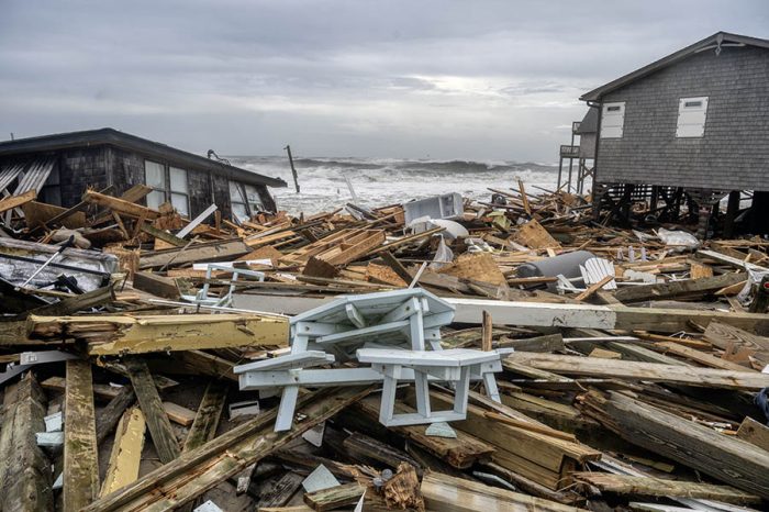
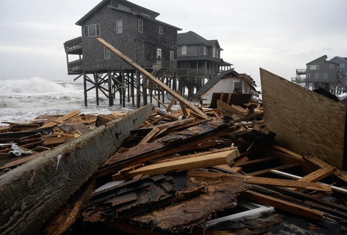
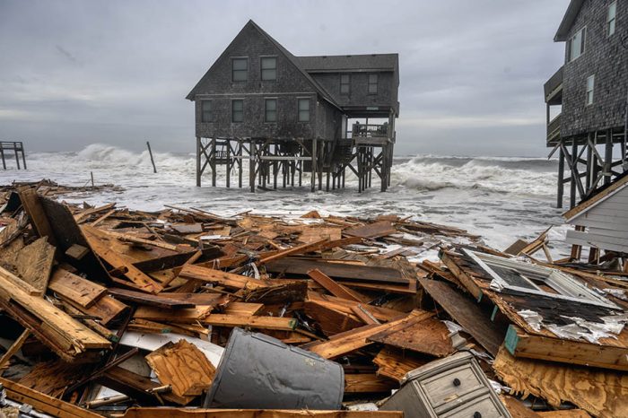
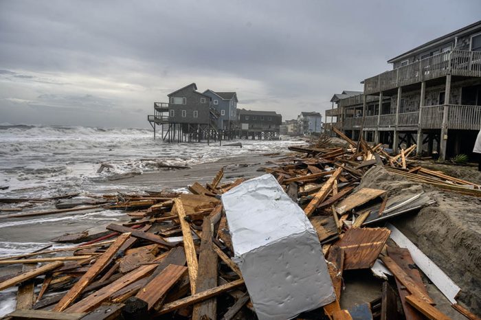
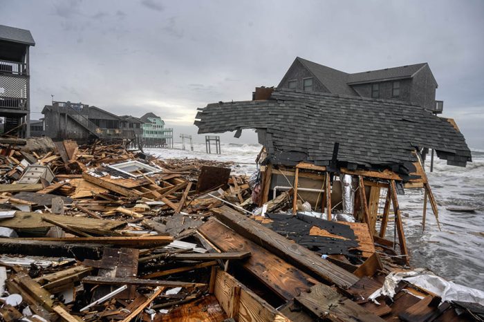
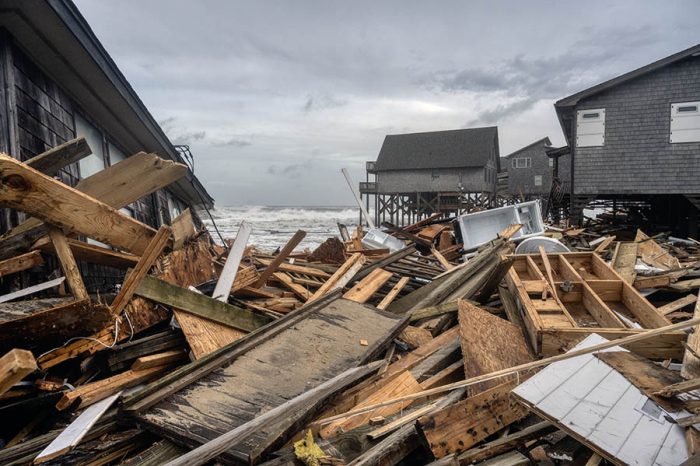
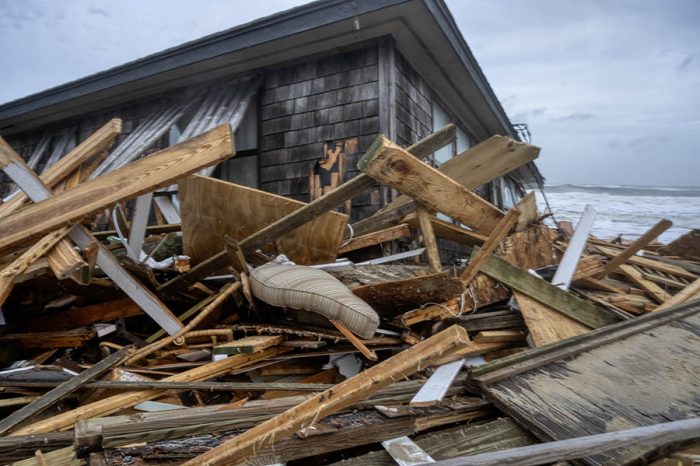
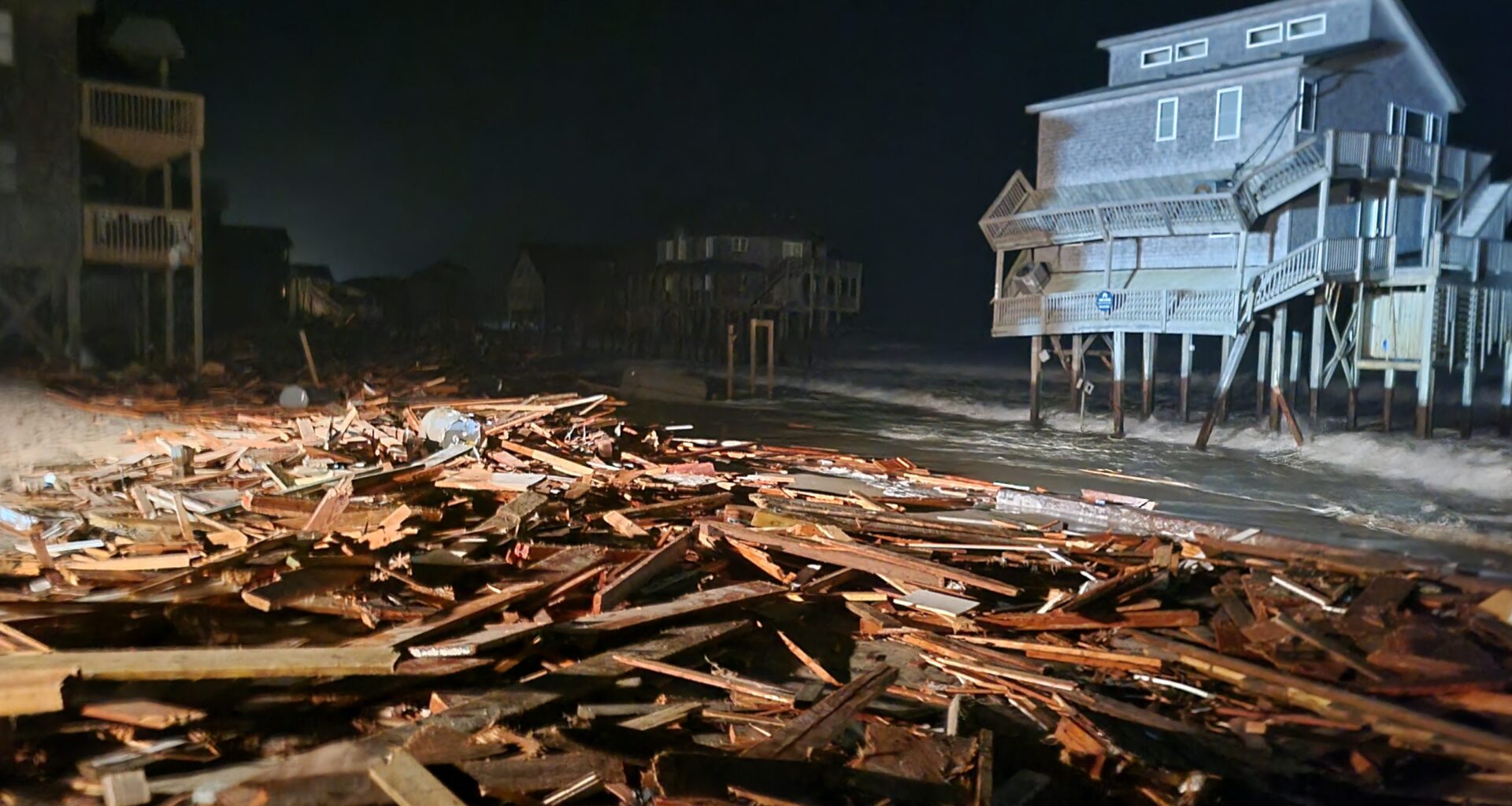
Five unoccupied homes collapsed in Buxton on Tuesday afternoon, and the beach is closed due to piles of dangerous debris and a sixth house reportedly fell at around 11 p.m. Tuesday night.
“The NPS has the beach area closed to keep people safe,” said Pearson. “Everyone should avoid the area due to truly hazardous conditions being generated as the debris moves with the ocean.”
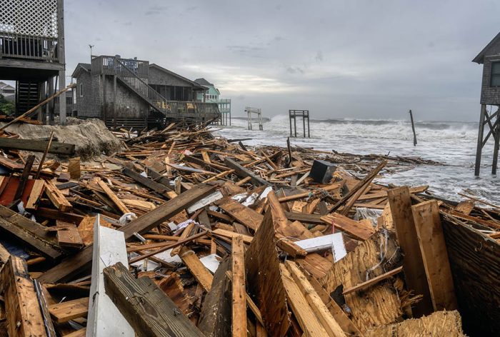 Buxton on Tuesday afternoon. Photo by Don Bowers.
The greatest risk for oceanside impacts remains along vulnerable stretches of N.C. Highway 12 on Hatteras and Ocracoke Islands, where moderate coastal flooding of 2–3 feet above ground level is possible during the peak tides
Soundside areas along the southern Pamlico Sound and connected rivers may also experience minor flooding due to persistent northeast winds. Minor soundside flooding was reported on Tuesday afternoon in Ocracoke Village.
For information on the local forecast, visit weather.gov/mhx for general weather information, or the National Weather Service office in Newport/Morehead City’s Facebook page at https://www.facebook.com/NWSMoreheadCity/.
Photos below of Buxton on Tuesday afternoon by Don Bowers