
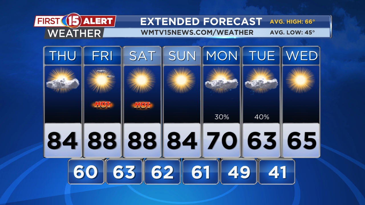
Skies clear tomorrowHeat surges Friday through SundayShowers are on the way next week
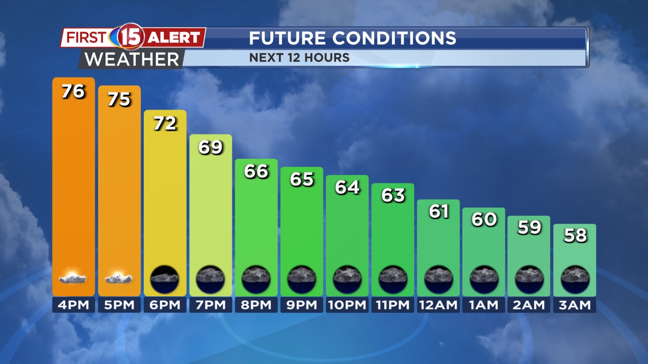
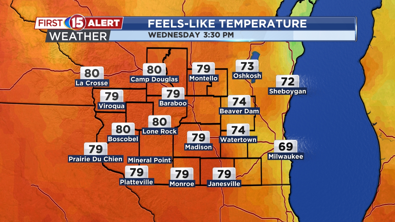
MADISON, Wis. (WMTV) – As we move through Wednesday evening across southern Wisconsin, high, thin clouds continue overhead. Temperatures are a touch cooler than earlier this week with a light east wind, but this is only temporary. Southerly flow returns Thursday, and with it comes a big warmup, sending highs back into the 80s for many inland areas.
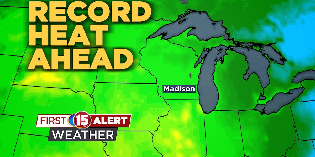
By Friday, the heat takes hold. A strong ridge of high pressure building over the Midwest will help pump in unusually warm air for this time of year. Highs are expected to climb into the mid to upper 80s both Friday and Saturday, with some spots edging close to 90. Records could be tied or broken. Here are a few of the records we’re expecting to break just on Friday
Madison Previous – 85° (2005) Expected – 88°
Baraboo Previous – 85° (1953) Expected – 89°
Lone Rock Previous – 87° (2005) Expected – 90°
The heat won’t be the only thing we’re tracking. With a storm system developing to our west, winds will pick up by Saturday afternoon. Southerly gusts between 15 and 25 mph are possible, which will combine with the dry stretch we’ve had to raise some concerns for fire weather. While humidity levels may stay just high enough to limit the risk, the warm temperatures will continue to dry out grasses and fall vegetation.
 What’s Coming Up…
Heading into Sunday, a cold front begins to move closer. This will be the trigger for our next chance of rain showers and possibly a thunderstorm, though at this point the odds are still on the lower side. There’s uncertainty in how much moisture will line up with the front, but the general trend favors at least some scattered activity Sunday into early Monday.
 Looking Ahead…
Even behind the front, temperatures don’t fall yet to the seasonal average. While the hottest air retreats, highs into early next week still look to stay above normal, in the 70s. Another system or two may bring chances for showers midweek, though that part of the forecast remains more uncertain this far out.
Click here to download the WMTV15 News app or our WMTV15 First Alert weather app.
Copyright 2022 WMTV. All rights reserved.