
Atmospheric rivers are changing. If you have never heard this term, they are giant vapor currents that transport much more water than the Amazon, but it is vapor, not liquid water. Now, scientists from the University of California in Santa Barbara have confirmed that these currents are shifting toward the poles, leaving areas that used to have regular rains with droughts, while others that barely received water are beginning to experience extreme storms. It was not expected in climate models and forces a rethink of how we manage water, agriculture and even cities. Think about it, these currents could bury large natural landscapes under several meters of snow or fill empty reservoirs in a matter of days.
What are these rivers in the sky
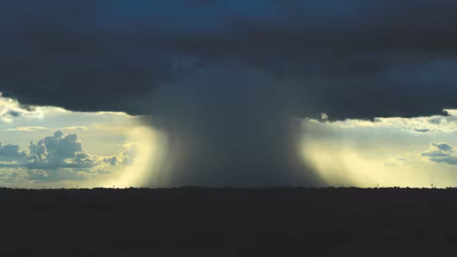
They are narrow bands of vapor that travel thousands of meters high, when they touch land, they slow down and that vapor turns into clouds that release rain or snow.
The most incredible thing is that, as we told you, they can accumulate meters of snow or liters of water, but also devastate entire neighborhoods and towns.
The unexpected shift
The team led by Zhe Li and Qinghua Ding discovered that in the last 40 years these rivers have shifted several degrees of latitude toward the poles, something like moving Los Angeles to the level of San Francisco. This has caused there to be places where there were no heavy rains or storms before and now there are.
The curious thing is that not everything is explained by global warming, as was thought, but they point to the Pacific Ocean as the main actor in this change of trajectory. What? Why the Pacific?
Rivers in the sky
The scientists reconstructed what the atmospheric conditions of the past were using data from the European Centre for Medium-Range Weather Forecasts (ERA5), with historical data since 1979 and thus managed to discover that, after 40 years of data, the rivers had shifted toward the poles.
What it means in real life
In regions that depend on three or four atmospheric rivers each winter to guarantee water, it is enough that they change route for long droughts and empty reservoirs to appear, on the other hand there are communities that had never seen such intense storms and now deal with floods, drainage systems that cannot cope and risk maps that no longer work.
Which regions will suffer more?
Those places that used to accumulate snow will now experience more rains, so the risk of flooding is much higher and the reserves for summer will be reduced (because the snow worked as a natural reservoir).
And on the opposite side, agricultural areas that depended on these rivers find themselves with dry fields and increasingly harsh drought.
Preparing for what is coming
Experts warn that current infrastructures are not ready for this change, and probably neither are we. A reservoir designed to store rains in January falls short if the storm arrives in February or if it is directly diverted to another region.
It is necessary to update water management plans, reinforce flood prevention and improve alert systems to anticipate extreme phenomena.
Atmospheric rivers are still there, only now they pass through other places. These changes are also altering the climate of the regions and much faster than expected. We have to be prepared to suffer stronger rains, longer droughts and sudden floods (with everything that, sadly, that entails), because it will be what we see from now on. The climate is turning around in front of us. What yesterday seemed like a rare phenomenon today is a clear sign that the planet needs us to review it again.