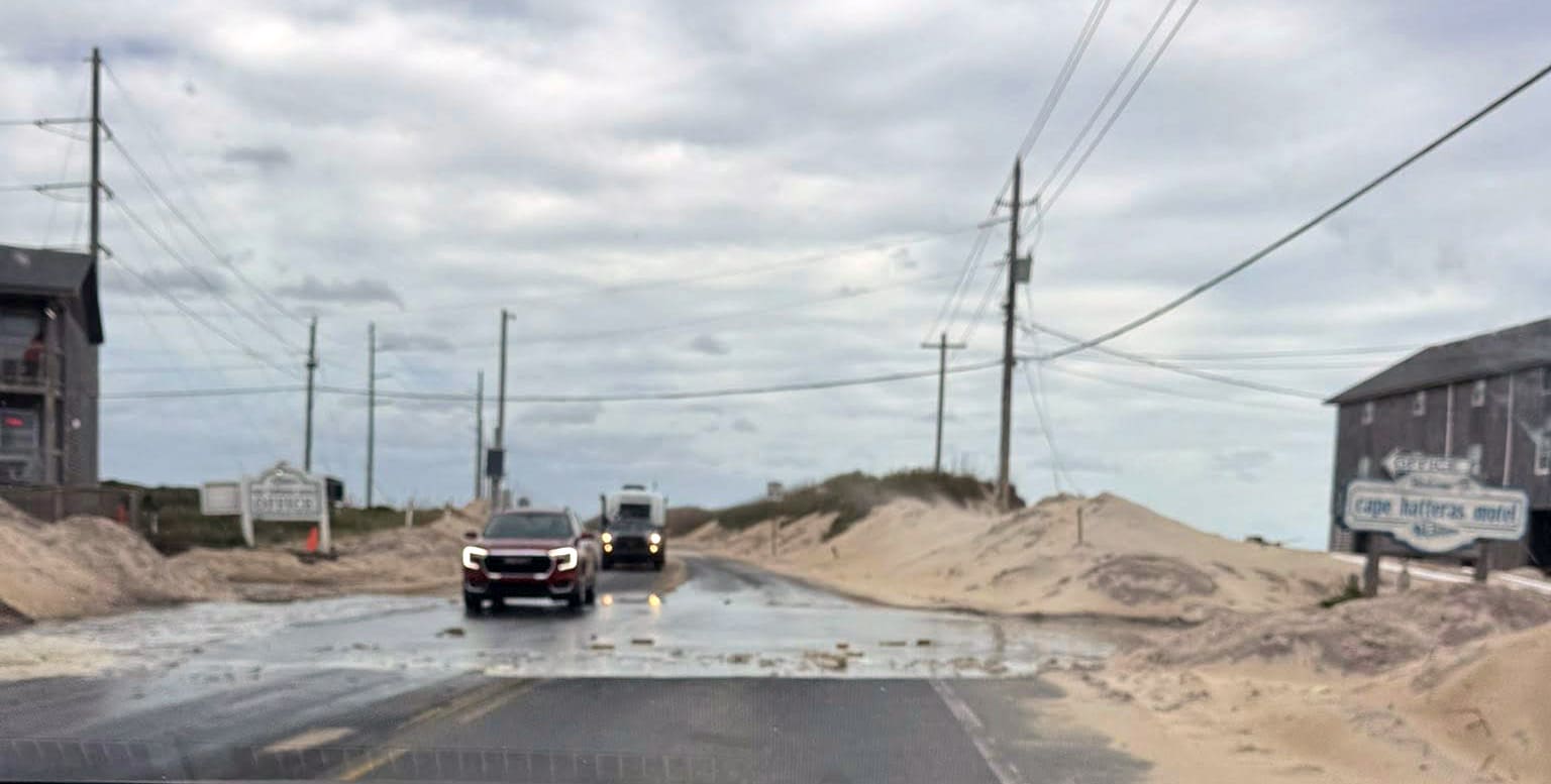
Ocean overwash was reported Thursday morning in Buxton and on northern Ocracoke Island, coinciding with the roughly 9:30 a.m. high tide, as a long-duration coastal flooding event begins to unfold across the Outer Banks.
N.C. Highway 12 remains open and passable as of 10 a.m. Thursday, and Hatteras-Ocracoke ferry service is running on its regular schedule, but standing saltwater may remain in these areas.
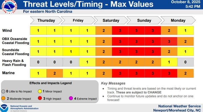
According to the National Weather Service Newport/Morehead City office, strong northeast winds behind a cold front and a developing coastal storm will persist through the weekend, bringing multiple rounds of coastal flooding, rough surf, and beach erosion on Hatteras and Ocracoke Islands. The flooding threat will likely worsen over the next several days, with additional overwash expected around the times of high tide.
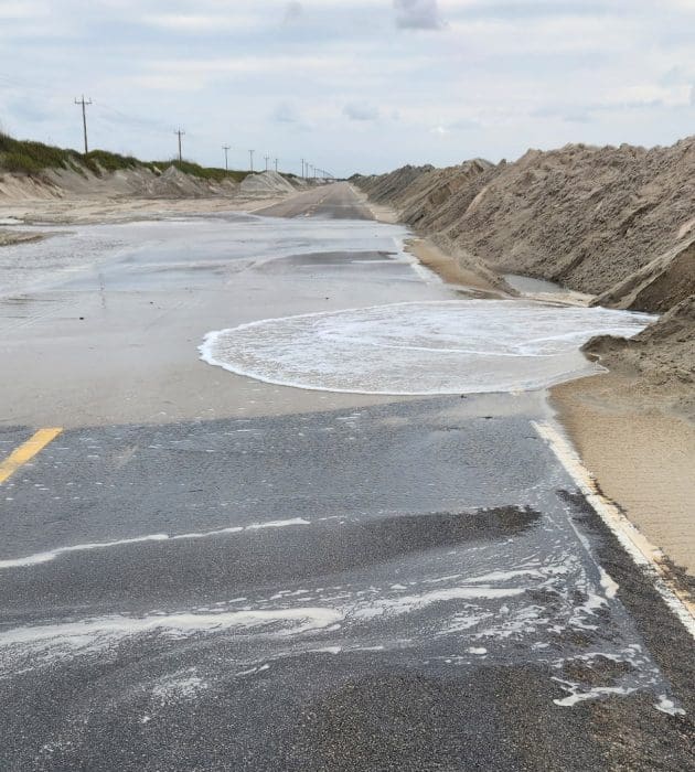 Northern Ocracoke Island at approximately 9:30 a.m. Thursday
High tide during the expected duration of this event, with the highest water levels anticipated during daytime tides, will occur around the following times:
Thursday: 9:30 a.m., 10 p.m.
Friday: 10:30 a.m., 11 p.m.
Saturday: 11 a.m.
Sunday: 12 a.m., 12:30 p.m.
Monday: 1 a.m., 1:30 p.m.
Forecasters expect 1 to 2 feet of water above ground level for much of the Outer Banks through Friday, increasing to 2 to 4 feet of inundation across Hatteras and Ocracoke Islands over the weekend.
Both ocean and soundside flooding are likely, particularly in low-lying oceanside areas lacking dune protection. Persistent northeast winds will drive wave run-up and dune erosion, and significant overwash is likely to affect portions of N.C. Highway 12, potentially making the road impassable at times
The National Weather Service Wednesday night briefing notes that while minor flooding is anticipated Thursday and Friday, the developing coastal storm over the weekend could bring moderate to locally major flooding depending on its eventual track and strength. King tides will further exacerbate impacts along the beaches, creeks, and soundside communities.
Heavy rain and areas of flash flooding are also possible this weekend as the developing coastal storm strengthens and moves slowly along the Carolina coast.
For more information on the local forecast, click here, or visit weather.gov/mhx for general weather information, or the National Weather Service office in Newport/Morehead City’s Facebook page at https://www.facebook.com/NWSMoreheadCity/.